
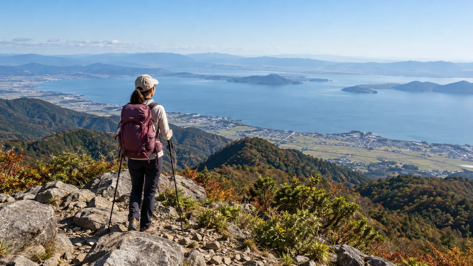
Shiga has day hikes that look down on Lake Biwa from summits or ridges. The part of the lake you see and the distance you need to walk vary by route.
The Hira Mountains on the west shore, the Konze Mountains to the south and the northern Suzuka range to the east differ in distance, footing and access. Choose a trail for your fitness and experience.
This guide describes representative areas and how to choose a day hike. Check current times, elevation change, closures and hut or facility hours with local authorities or operators.
Where to find mountains with Lake Biwa views
The Hira Mountains lie west of the lake, the Konze Mountains around Ōtsu and Rittō to the south, and the Suzuka range to the east. Hira and Konze have places overlooking the lake. On a clear day, it can also be seen from Mount Ryōzen on the eastern side.
Mount Buna is the highest in the Hira Mountains. Ridge views depend on where you stand and the weather. There are long climbs, and snow makes the range more demanding. Check bus operating days, parking and trail conditions.
The Konze Mountains are low hills spanning Ōtsu and Rittō, with distinctive rock formations and large boulders. Some trails are rocky and require careful footing. Some lookouts face the southern basin of Lake Biwa.
Mount Ryōzen in the northern Suzuka range has a gently rolling karst plateau where water has dissolved the limestone, with an open ridge. Routes on the Shiga side vary in difficulty. Poor weather makes navigation harder.
Three checks for choosing a first hike
1. Is the ascent within your ability?
Cumulative ascent is all the uphill sections added together. Compare total ascent, round-trip time and footing with a recent hike. For a first outing, choose a short route with an easy way to turn back.
Use topographic maps and route maps from local authorities or trail managers to check the climbs, descents and rocky sections. Low mountains can have steep climbs.
2. How will you get back to the bus or car?
In the Hira Mountains, some routes start on foot from JR Kosei Line stations and others require a bus. Check official timetables, such as Kojak Bus, for service days and return departures. If driving, check parking, road restrictions and crowds.
3. Are you equipped for autumn weather?
Mornings, evenings and ridges can be cold in autumn. Clouds, wind and rain change the conditions. Check Japan Meteorological Agency forecasts, warnings and advisories and local notices the day before and that morning.
Bring a rain jacket and trousers, warm layers, a map and compass or offline map, a headlamp, extra water and snacks, and first-aid supplies. Carry an emergency sheet for warmth even on a day hike.
Representative areas and their conditions
Hira Mountains: Mount Buna, Mount Hōrai and others
Mount Buna has routes from places including Indaniguchi and Bomura. Another option for views on Mount Hōrai is to ride the Biwako Valley ropeway up to the Mount Uchimi side, then walk or use the sightseeing lifts when open. The operator plans to close all facilities from 24 November 2026 until late December. Check your dates and the last departure.
Frost, ice and wet rock can make parts of Mount Buna slippery. Check junctions on a map. Choose a different route if you lack the equipment or skills for ice.
Konze Mountains: Mount Ryūō, Mount Keikan and others
Rittō City's guide lists routes from the Kamikiryū bus stop and Ichijōya car park. Around Mount Ryūō, Mount Keikan and Tengu Rock, check each route for rocks and steep slopes. When the rock is wet, choose another viewpoint rather than climbing onto it.
Mount Ryōzen on the Maibara side
The karst plateau on Mount Ryōzen has sinkholes. Leaving the trail in fog or snow is dangerous. Maibara City reports that Kuregahata Forest Road is closed beyond the Samegai Trout Farm, including to pedestrians. You cannot descend that way. The Kashiwabara trailhead is about 15 minutes on foot from JR Kashiwabara Station. Check current access, distance and ascent for your route, including options from Taga.
Planning for a view of Lake Biwa
Whether you can see the lake depends on clouds, fog, haze and the direction of the lookout. Check forecasts and local observations or webcams where available, alongside the weather chart.
Set a start time based on distance, cloud and wind forecasts, transport and sunset. Leave time for the descent and return transport. Consider turning back if visibility worsens.
Trailhead access and checks for the day before
Check the following before your outing.
- Japan Meteorological Agency forecast and local mountain information
- Trailhead access, including bus times and parking
- Hiking plan submission through Shiga Prefectural Police, Compass or another listed option
- Restrictions and closures from the local authority or park manager
- Phone charge and coverage, which can be weak in parts of Hira
- A change of clothes so you do not get chilled in sweaty clothing after the hike
A hiking plan can give searchers a lead in an emergency. Also tell family or another contact where you are going and when you expect to return.
Next steps
Use the map to choose one route for your fitness and experience. Check trailhead access and closures with the municipality or trail manager. You can also ask people who hike nearby in Nordwand's Base Camp.
References
- Japan Meteorological Agency forecasts and AMeDAS observations
- Geospatial Information Authority of Japan topographic maps
- Shiga Prefectural Police hiking plans and mountain incident information
- Shiga Prefecture natural park restrictions and information
- Yama to Kōgen hiking maps for Hira and the northern Suzuka range
References and sources
- Biwako Visitors Bureau: hiking guide to the Hira Mountains
- Biwako Valley: ropeway hours and closures
- Biwako Valley: sightseeing lifts
- Rittō City: Mount Konze hiking routes
- Maibara City: Mount Ryōzen trailheads and closures
- Maibara City: current forest road notices
- Shiga Prefectural Police: mountain information and online hiking plans
- Shiga Prefecture: safe hiking
- Japan Meteorological Agency: weather forecasts
- Geospatial Information Authority of Japan: GSI Maps
- National Astronomical Observatory of Japan: sunrise and sunset calculator