
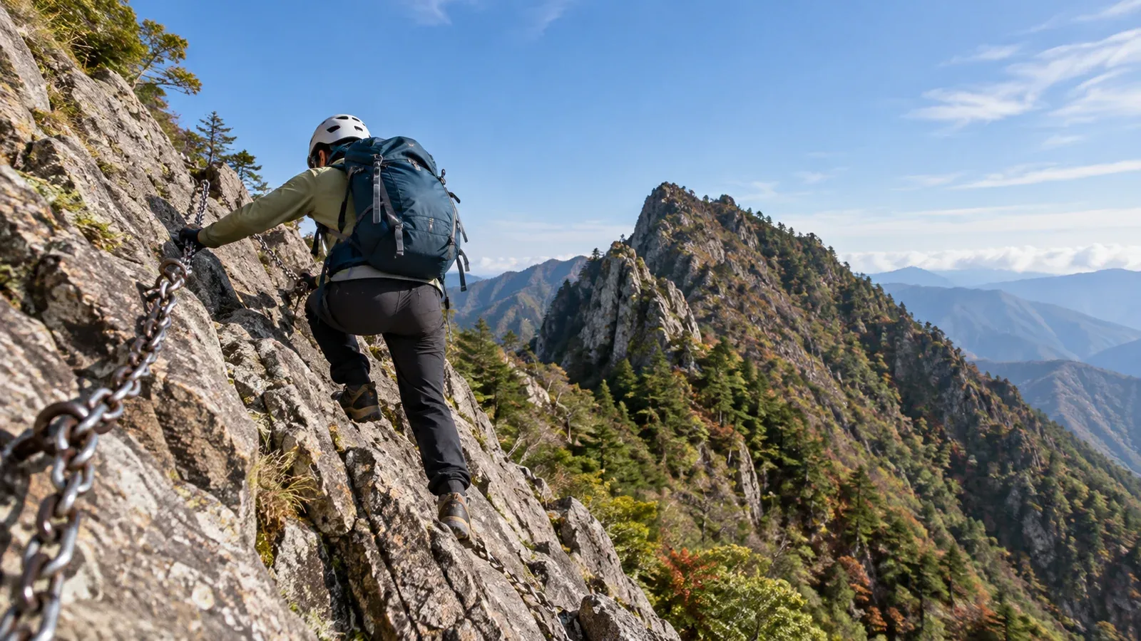
Mount Ishizuchi in Ehime and Mount Tsurugi in Tokushima offer different terrain. Ishizuchi’s Jōju route has four steep chain sections with bypasses. On Mount Tsurugi, the extension from the summit toward Jirōgyū is a separate ridge walk. Choose your route according to the terrain and conditions your group can manage.
This guide compares both mountains, focusing on how to read the route, assess the conditions and plan a descent. Check current notices from local authorities and operators for the date you plan to go.
Mount Ishizuchi’s four chain sections
The Jōju route reaches the Trial Chain and Chains One, Two and Three in that order. The Tsuchigoya route joins before Chain Two. The official route guide warns that the chain sections are on steep rock.
The Trial Chain has a 48 m ascent and a separate 19 m descent according to the Ishizuchi regional route guide. The name refers to the route feature. Look at the steep rock, the descent and the bypass junction before deciding to enter.
Chains One, Two and Three are listed at 33 m, 65 m and 68 m respectively. At each one, look at the footing and how you would complete the section. Wet or icy rock and congestion can make controlled movement much harder.
Fixed chains can assist movement. Keep secure holds and check where the next foot or hand will go before shifting weight. If you cannot move and descend in control, choose the bypass before stepping onto the rock.
All four chain sections have signed bypasses on the routes to Misen. Check their condition too. Snow and ice can affect the trails and stairs. The narrow rocky continuation from Misen to Tengudake is a separate section that the official guide describes as suitable for experienced hikers.
Mount Tsurugi in Tokushima: the ridge toward Jirōgyū
From Minokoshi, routes ascend via Nishijima to the summit area, where there are boardwalks. The Miyoshi hiking map shows the ridge extension to Jirōgyū as a separate part of the trip.
The route from Mount Tsurugi’s summit to Jirōgyū descends to the saddle and climbs again. Plan the full return, including the climb back if you are retracing the ridge. Consider how exposed sections will feel in strong wind.
The Miyoshi map shows separate paths and junctions in the summit area and around the Jirōgyū saddle. Use the signposted trail and check your position against the map, using a compass or offline navigation as appropriate.
Low cloud can hide the route and make it harder to judge the terrain. Decide whether to leave the summit area for the ridge using current visibility, wind and the forecast. If conditions deteriorate, stop where the footing is stable, confirm your position and assess whether it is safe to retrace a known route.
Choosing between the two mountains
Compare the steep chain sections and bypasses on Ishizuchi with the route finding, exposure and additional walking time on Tsurugi’s ridge. Decide which individual route matches the group.
Assessing Ishizuchi’s chain sections
Approach each chain as a separate decision. Plan to use the bypasses if you lack experience on similarly steep rock or cannot see how you would finish safely. Practise basic movement on lower-consequence terrain with experienced instruction.
Before entering a chain section, consider these three points.
- Secure contact: Check stable handholds and footholds and move deliberately.
- Weight and movement: Keep your feet on secure placements and use the chain to assist movement.
- Descent: Identify the descent in advance. If you cannot locate your next secure foothold or descend in control, choose a suitable bypass before committing.
Planning the ridge to Jirōgyū
Check the junctions, the climb back and the time needed for the full route. Carry a map that works offline and practise locating yourself on it. If poor visibility, strong wind or snow exceeds the group’s skills, shorten the outing.
Planning both mountains
Treat the two mountains as separate trips with different access and conditions. Neither itinerary is a prerequisite for the other. Confirm the dates and assess the group’s skills and equipment for each plan.
Equipment for rock and ridges
Bring equipment for the route and test it on stable ground. The conditions can differ between the trailhead, the summit and the return.
Gloves can protect your hands when using chains. Choose a fit that allows you to grip and feel holds, and consider warmth and wet conditions.
Footwear and soles should fit and be in good condition. Check wear and grip before leaving. Choose footwear appropriate to the route and conditions.
A mountaineering helmet protects against some impacts in rocky terrain. Fit it before entering steep rock or areas exposed to falling stones. Give other groups room and avoid dislodging stones.
Food and water should cover the full outing and delays. Eat and drink at a stable stop where you can keep both hands free when you resume.
When to turn back or take a bypass
Decide before entering a steep or exposed section. Choose a turnaround time that still leaves enough daylight for your descent.
On Ishizuchi, take the signposted bypass if there is doubt about your control, the chain is crowded or the rock is slippery. If neither the chain nor the bypass is suitable in the current conditions, turn back at a safe point.
On Tsurugi, avoid continuing onto the ridge in wind or visibility that prevents controlled walking or navigation. If you are already on it, stop at a stable spot and use the map to assess the safest available way back.
Tell the group what would trigger a change of plan before you depart. Reassess as conditions or the group’s pace change.
Before setting out
For Ishizuchi, check the ropeway or Tsuchigoya road, the trails and seasonal facilities. Ehime lists the Skyline winter closure from December 1 to March 31. For Tsurugi, check the Minokoshi access road, lift and huts. The operator lists lift service through November 30, subject to conditions, and seasonal bus schedules differ. Recheck the forecast and local notices on the morning of the hike.
Further reading
- Japan Meteorological Agency forecasts and advisories
- National Police Agency mountain incident statistics
- Ehime and Ishizuchi route and access information
- Tokushima and Miyoshi trail and access guidance
References and sources
- Japan Meteorological Agency · Warnings and advisories
- National Police Agency · Mountain incident statistics
- Ishizuchi regional council · Routes, chain lengths and bypasses
- Ishizuchi Shrine · Mountain route guide
- Saijō City · Winter access and trail information
- Ehime Prefecture · Ishizuchi Skyline road gates and winter closure
- Ishizuchi Ropeway · Operator notices
- Shikoku Regional Forest Office · Tsurugi and Jirōgyū
- Miyoshi tourism association · Mount Tsurugi hiking map
- Tokushima tourism website · Mount Tsurugi access and seasonal buses
- Mount Tsurugi sightseeing lift · Operator information