
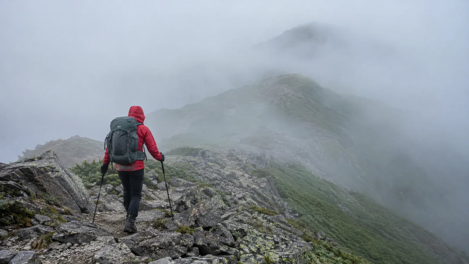
In Japanese hiking reports you may see gasutteta, “it was foggy”, or gasu de shikai ga zero, “the fog left us with no visibility”. It is not immediately obvious why hikers use the word gasu for fog.
Gasu is Japanese mountain slang for fog, mist or low cloud that obscures your view. The suspended droplets are the same kind that make up fog and cloud. The word is widely used among hikers. They say gasu ni makareru for getting enveloped in cloud near a ridge or summit and gasu ga deru for the fog rolling in.
Here is how the term is used, what low visibility does to a hike and how to decide what to do.
What gasu is and why it is common in the mountains
Fog and cloud both contain tiny water droplets floating in the air. Near the ground we call it fog. Above the ground we call it cloud. On a mountain slope, low cloud can pass over the trail, or moisture rising out of a valley can condense close to the ground. From the trail, it feels like being inside a cloud.
As elevation rises, temperatures tend to fall and water vapour can condense. Mountains also force moist air upwards, which can produce cloud quickly. Cloud may form before afternoon thunderclouds develop in summer, so a clear morning can still give way to fog after midday.
How fog affects a hike
The biggest change is loss of visibility. In thick fog you may see only a few metres ahead, which creates several problems at once.
Losing the trail
Paint marks, cairns and signs become hard to see. A ridge junction you could pick out on a clear day is easy to pass in the fog. The risk of taking the wrong direction increases where ridges meet or several traces cross.
Slower response to lightning or weather changes
With fog it is harder to see what the sky is doing. On a ridge you may notice an approaching thundercloud late, leaving less time to find shelter. Changes in wind and temperature can also be harder to gauge.
Getting cold
Clothing can pick up moisture in the fog. Combined with wind, this can cool you quickly. Even in summer, a foggy ridge can increase the risk of hypothermia.
How to decide what to do in fog
Whether to turn back, wait or continue depends on the situation. Use the points below to guide your decision.
Use visibility and terrain.
If you can see only a few metres and the trail is unclear, or you are close to a ridge junction, stop and reassess. Being able to locate yourself with a topographic map and compass gives you more options. If you have little navigation practice, avoid pushing on.
Consider the time and the forecast together.
In some ranges, fog often forms in the afternoon without heralding bad weather. A thunderstorm or strong-wind advisory changes the situation. Check information from the Japan Meteorological Agency and the local land manager, and weigh it against when the fog appeared.
Decide to turn back early.
Pressing on in the hope that it will clear uses up the energy and time you need to return. If you are new to hiking, consider turning back when the fog starts to thicken. The mountain will still be there on another day.
Equipment and habits for fog
Prepare by knowing how to use your basic equipment.
Map and compass. A phone map can help in fog, but batteries can run out and mistakes happen. Carry a paper topographic map and compass, and practise using them before the hike.
Warm and waterproof layers. Fog can leave you feeling cold. Keep your mid layer and rainwear within reach so you can put them on promptly.
Whistle. When visibility drops to almost nothing, companions can get separated. A whistle can carry farther than a shout in the wind. Agree on sound signals before a group outing.
Trip log and hiking notification. If fog causes you to lose the trail, a record of where you went can help rescuers. File your hiking notification before leaving, with the route and expected finish time.
What forecasts can tell you
You may discover mountain fog only when you get there, but some signs are available before leaving.
Alongside Japan Meteorological Agency forecasts and advisories, use a mountain forecast to check expected wind, temperature and precipitation near the ridge. Moist, light-wind afternoons can favour fog rising from valleys. Conditions can also change rapidly around a frontal passage. Follow the weather charts in the days before the hike.
Make the final decision after checking the weather that day. Check the local authority, a mountain hut or a trailhead noticeboard for current conditions.
What to do next
Once you know what gasu means and what it can do to visibility, practise topographic-map reading and compass use. Locating yourself in fog is one of the first safety skills worth learning. In Nordwand’s Base Camp and topic-based communities, you can ask experienced hikers about navigation and planning.
References
- Japan Meteorological Agency: mountain weather and forecasts
- National Police Agency and prefectural police: mountain incident statistics
- Geospatial Information Authority of Japan: reading topographic maps