
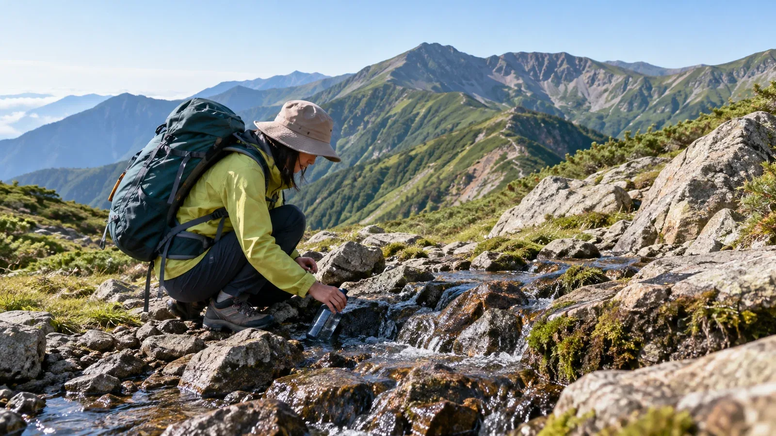
Where you can refill water matters as much as distance and elevation change when planning a multi-day hike. A source marked on a map may be dry when you get there. Since carrying water for the whole trip adds considerable weight, find out in advance where you can reliably refill.
The flow at a given source varies by season and year, and its manager may restrict access. Check both whether you can collect water and whether it is safe to drink. Here's where to look for information before leaving and how to use it in your itinerary.
What a water symbol on a map tells you
On a paper or digital hiking map, a water symbol indicates a possible refill point. It cannot tell you how much water is flowing now or whether it's drinkable.
Symbols and update schedules vary by publisher and edition. Check the legend and update date, including on topographic maps from the Geospatial Information Authority of Japan. A symbol for a stream or body of water doesn't guarantee drinking water.
Water sources shown on hiking maps tend to fall into three groups.
- Permanent taps and piped water: A hut or other operator manages the tap or pipes. They are convenient when running, but can be shut off by drought, freezing, or seasonal closures.
- Springs and streams: Flow depends on terrain and rainfall. These sources can dry up in a summer drought or during a dry autumn.
- Snowmelt: Water flows from remaining snow and disappears when the snow is gone. Availability varies by location and year.
Identifying the type of source before leaving makes it less likely that you'll arrive and find no water.
Reliable sources of information and where to find them
Ask hut staff or the operator
Hut staff or other people who manage water along the route may know about recent conditions that maps and guidebooks don't show. Ask about flow, hours, access for people who aren't staying overnight, and whether the water is safe to drink.
Give the exact section and date. For example, ask whether there are any usable water sources between a particular pass and a particular hut. Look for phone numbers or email addresses on the hut, tourist association, or local authority's hiking website.
In national and quasi-national parks, the Ministry of the Environment or prefectural park authorities sometimes publish hiking updates that include water sources. Check the relevant park office's website before leaving.
Updates from mountaineering clubs and local groups
On long trails, such as major ridge routes or more remote traverses, local clubs and trail maintenance volunteers sometimes document and share water conditions. Look at the websites or social media accounts of clubs that know the area.
How to read hike reports
Other hikers' reports can help you find recent information on water. Keep the following in mind as you read.
- Date of the report: Prefer recent observations to reports from the same season several years ago. Flow varies by year and can also change quickly with rain or snowmelt.
- Detail of the observation: A note that flow was weak or that water came out of a hose tells you more than a generic mention of water. A report that someone drank it doesn't establish that it's safe.
- Compare several reports: Look for agreement between reports from around the same time before relying on one.
How seasonal changes affect water sources
Some sources are more likely to run dry at particular times. Knowing these patterns helps you decide where to revise your itinerary.
From late summer into autumn, low rainfall can reduce the flow of springs and upper streams or dry them out. Enzansō Hut in the Northern Japanese Alps, for example, distinguishes periods when it can pump water from a natural source from periods when it sells drinking water. Check conditions for your date with each operator.
Sources that depend on snowmelt stop flowing when the snow is gone. The Daisetsuzan National Park Liaison Council gives approximate dates for collecting meltwater at each relevant designated campsite. Snow cover varies by year, so leave these out of your reliable refill list when availability is uncertain, including in autumn.
After a hut closes, its taps or drinking water sales may be unavailable. Check the official last day and any rules that apply after closing. Unstaffed shelters may have no water at all. Carry enough for stretches without a reliable refill or change the route.
Put what you've learned into the itinerary
Once you have the information, write each source's status into your itinerary. Here's one way to organize it.
- Mark the status of each source on your map. Use labels like confirmed, needs checking, or seasonal. Note the date of confirmation, whether it is drinkable, and how long a detour to collect water and return to the trail will take. Plan around sources you can verify.
- Estimate the time and water needed before the next reliable refill. Use what you drank on a similar hike as a starting point and account for temperature, exertion, breaks, and delays. A Japanese mountain safety card gives a rough estimate in milliliters: body weight in kilograms × hours on the trail × 5. For 60 kg and 6 hours, that comes to 1,800 mL. Adjust for your own hike and count cooking water and a reserve separately.
- Identify the last reliable source and decide when to turn back. If you can't collect water beyond it, consider whether what's left will get you to the next refill or a safe exit. If you expect to run short, collect more at the last reliable source, turn back, or shorten the route.
- Know how to treat natural water and what treatment can do. Treat even clear stream water and follow local guidance first. For germs, the US CDC recommends keeping clear water at a rolling boil for 1 minute, or 3 minutes above 6,500 ft (about 1,980 m). If you cannot boil it, check what the products treat and how to use them, then filter and disinfect. Avoid water suspected of containing harmful chemicals or toxins. Hokkaido also advises against drinking untreated stream water because of the risk of echinococcosis.
Common mistakes and how to avoid them
Assuming last year's conditions still hold. Water flow and hut opening dates can change from one year to the next on the same route. Check current information before each trip.
Forgetting to update map app data. Update and save the map before leaving so you can use it without a signal. Check water availability and quality separately from the app.
Putting off a call to the hut or operator. You may otherwise learn a source is dry only when you reach it. Ask early and check the latest notices again just before departure.
What to do next
Start by asking a hut or water source operator along your planned route whether water is available and drinkable. Look for contact details on the prefecture or national park's hiking website. Use Nordwand's communities to share plans with other hikers or ask someone who knows the area, including a guide.
References
- Ministry of the Environment and Daisetsuzan National Park Liaison Council (park guidance and campsite water)
- Enzansō Hut and Geospatial Information Authority of Japan (hut water information and map legends)
- Saitama Mountaineering and Sport Climbing Association, Hokkaido Prefecture, and US CDC (estimating water needs and treating natural water)
References and sources
- Ministry of the Environment | Visiting Daisetsuzan National Park responsibly
- Daisetsuzan National Park Liaison Council | Designated campsites and water sources
- Daisetsuzan National Park Liaison Council | Emergency shelters, facilities, and water sources
- Enzansō Hut | Water availability and sales
- Geospatial Information Authority of Japan | Map symbols
- Saitama Mountaineering and Sport Climbing Association | How much water to bring hiking
- Hokkaido Prefecture | Echinococcosis and prevention
- US CDC | Water treatment while hiking, camping, or traveling