
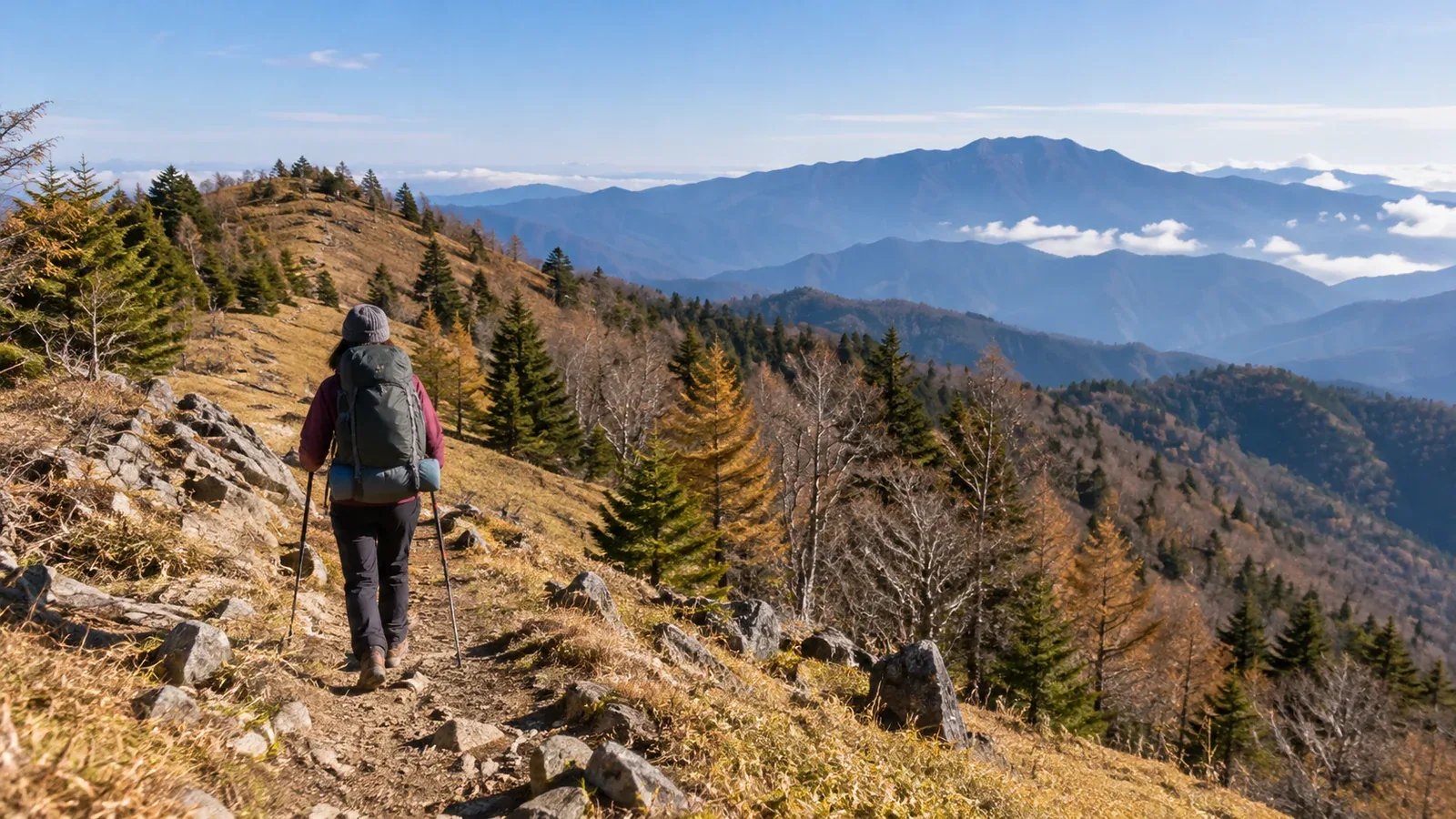
Mount Kumotori (2,017 m) is Tokyo's highest peak and one of Japan's 100 Famous Mountains. A traverse from Okutama Station along the Ishione Ridge and over the summit is long. Work out your route and equipment before leaving, along with where you'll decide to continue or turn back.
An out-and-back from Kamosawa, a hike along Ishione Ridge and a traverse to Mitsumine Shrine in Saitama each come with different distances, overnight stops and return transport. Here's how to plan your first Kumotori traverse and make decisions along the way.
Comparing the routes and what a traverse involves
For the Kamosawa route, take Nishi Tokyo Bus from Okutama Station to Kamosawa and climb towards Kumotori. If the bus terminates at Tozura, add the walk from Tozura to Kamosawa. The Ishione Ridge is a long trail that starts on foot at Okutama Station. The Mitsumine route leads from the Kumotori Sanso side via Shiraiwayama and other peaks to Mitsumine Shrine. Check Seibu Bus schedules and service notices for the return.
Kamosawa is a common starting point for Kumotori. Ishione links Mutsuishiyama, Takanosuyama and Nanatsuishiyama, among other peaks. Distance and time vary depending on whether you visit each summit or use the paths that bypass them. If you start at Kamosawa and finish at Mitsumine Shrine, arrange transport separately for the Okutama and Chichibu sides. The Okutama Visitor Centre lists the western bypass from Sanjo Darumi around Kumotori as closed. Check the latest trail notices.
One two-day example from the Okutama Visitor Centre climbs from Kamosawa, stays at Kumotori Sanso, and descends the next day from Nanatsuishiyama along the Ishione Ridge to Okutama Station. It covers roughly 24 km and takes 12 hours or more in total. In reverse, also check distance and cumulative elevation change on the map and estimate whether you can reach your first overnight stop in daylight.
One night or two? Work back from the walking time
Calculate the time on the move each day from your map before choosing one or two nights.
Published walking times are estimates for each section. Adjust them using past hikes of similar distance and elevation change, and allow for a heavier pack, fatigue, breaks and route checks. If you don't yet have a comparable time of your own, split the hike into shorter days and leave a margin beyond the published time.
Kumotori Sanso is north of the summit. Nanatsuishi Hut is on the Kamosawa side. Choose an overnight stop that works for the route, add the time from the summit to the hut and then set your start time. Gojunindaira is a designated campsite near the former Okutama Hut site and requires advance booking. Keep emergency shelters such as Takanosu out of your regular accommodation plan.
Check sunset for your date and plan to arrive in daylight. It can feel dark earlier in the forest or on north-facing slopes. Before you leave, decide how to shorten the route or contact someone if you can't reach the planned stop on time. Carry a headlamp and spare batteries.
How your kit changes for an overnight hike
Overnight gear falls into three groups: sleeping, keeping warm and carrying supplies.
Sleeping
For a hut stay, ask when booking whether bedding is provided and whether you need to bring a sleeping-bag liner or similar item. Camping adds a tent, sleeping bag and sleeping mat. Autumn nights on the ridge can get cold. Choose a sleeping bag for the actual temperature and check campsite openings and booking rules.
Keeping warm
Layer a moisture-wicking base layer, a warm midlayer and a windproof, waterproof shell. Carry extra insulation for stops, gloves and a hat. Frost or ice can form on the ridge in autumn. Check forecasts from the Japan Meteorological Agency and local hut reports for wind, temperature and footing on the ridge as well as at the trailhead.
Food and water
For a night away, plan trail food for day one, dinner, breakfast and trail food for the next day. Confirm meals when booking, and check where and how you can use a stove if cooking. Verify water sources and hut supplies, and carry enough to reach the next confirmed refill. The water source near Gojunindaira campsite is unmanaged. Plan another refill point or bring a way to treat water before drinking it.
Weather and turnaround decisions
Ishione is largely forested but has exposed spots, and rain combined with wind can chill you. Plan a turnaround point or a shorter option if bad weather approaches. If you hear thunder or see lightning, leave summits and ridges and quickly seek safe shelter, such as inside a building.
Check the following between the day before the trip and the morning you leave.
- Use Japan Meteorological Agency forecasts, warnings and advisories and local reports to check rain, wind, lightning and temperature for the whole trip.
- Shorten or postpone if heavy rain, strong winds, lightning, snow or ice are forecast and you lack the skills or equipment to handle them.
- On the morning of the hike, compare the sky and conditions around you with the latest forecast, then decide whether to go.
Set a point and a deadline for reaching it before you leave. If you're behind schedule there, turn back. Fatigue and the pull of the summit can cloud your judgement. Use the limit you set beforehand.
What past hikes tell you about your readiness
Review these experiences to decide whether a traverse to Kumotori suits you now.
- Completing day hikes with at least 1,000 m of cumulative ascent at a steady pace. This gives you a basis for repeated climbs and descents.
- Keeping a steady pace late in hikes of six to eight hours. This indicates whether you have energy left in the later stages of a traverse.
- Using a topographic map or an app to check your position and direction as you hike. This helps you avoid taking the wrong branch on the ridge.
These experiences are useful when planning an overnight traverse. If you haven't had much practice yet, check trail conditions and choose a day hike on Takanosuyama or Mitosan to practise keeping your pace and checking your map on a long outing.
Use your own hike records to estimate how you move and tire with a full pack and how you make decisions at junctions. Match your equipment and plan to that estimate.
What to do next
Check the Kamosawa, Ishione and Mitsumine sections on a topographic map and work back from your overnight stop and return transport. Use official sources for hut and campsite openings and reservations, and for trail status. File a hiking plan and share it with your group and family. You can also find partners in Nordwand's Base Camp or consult a certified guide.
References
- Geospatial Information Authority of Japan and Okutama Tourism Association (elevation and the Kamosawa route)
- Okutama Visitor Centre and Saitama Prefecture (Ishione, Mitsumine and trail conditions)
- Okutama Town and the huts (campsites, opening dates and reservations)
- Nishi Tokyo Bus and Seibu Bus (trailhead transport)
- Japan Meteorological Agency and Ome Police Station (weather, lightning and hiking plans)
References and sources
- Geospatial Information Authority of Japan | Elevations of Japan's major mountains
- Okutama Tourism Association | Hiking from Kamosawa to Mount Kumotori
- Okutama Visitor Centre | An example traverse on the Ishione Ridge
- Okutama Visitor Centre | Trail and road conditions
- Okutama Visitor Centre | Emergency shelters
- Nanatsuishi Hut | Access and suggested routes
- Kumotori Sanso | Overnight stays and local conditions
- Okutama Town | Gojunindaira campsite opening and reservations
- Saitama Prefecture | Mount Kumotori hiking safety map
- Nishi Tokyo Bus | Okutama Station stops and routes
- Seibu Bus | Mitsumine Shrine route
- Ome Police Station, Tokyo Metropolitan Police | Hiking plans and safety in Okutama
- Japan Meteorological Agency | Weather and hazard information
- Japan Meteorological Agency | How to stay safe in a thunderstorm