
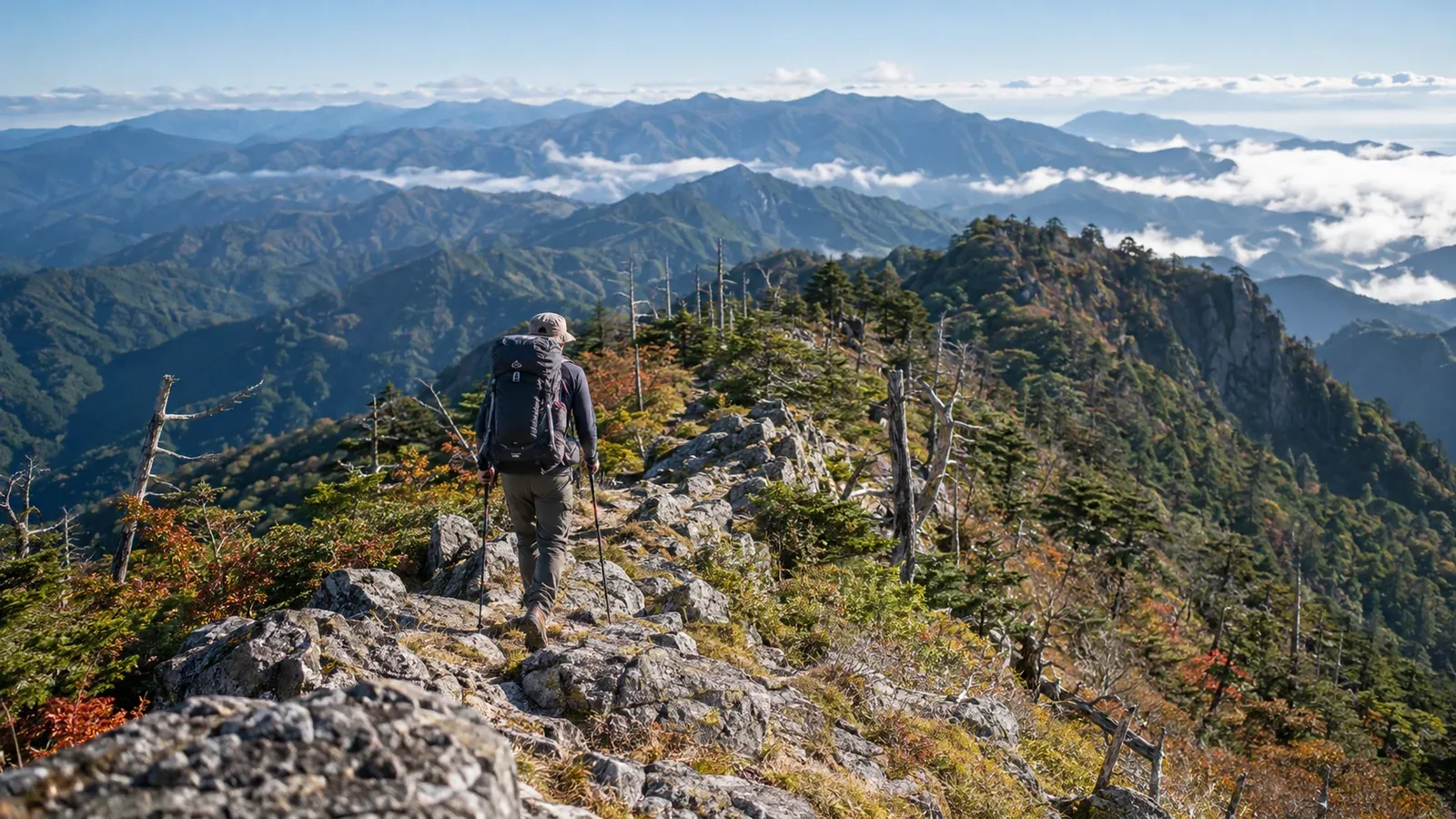
The Ōmine Okugakemichi is an old Shugendō pilgrimage trail running north to south along the backbone of the Kii Peninsula. It forms part of UNESCO’s Sacred Sites and Pilgrimage Routes in the Kii Mountain Range. Kamikitayama Village puts the distance from Yoshinoyama to Kumano Hongū Taisha at around 80 km. When planning your own hike, add the walks to and from the trailheads and any detours.
Two questions shape an Ōmine traverse: where to start and divide the route, and what makes this range distinctive. The trail combines deep old-growth forest, steep narrow ridges and difficult access. That combination calls for more preparation than a day hike along a ridge.
This article explains how to break the trail into stages, what the terrain and weather are like and which decisions matter on a first traverse. Hut opening dates, prices and transport can change. Check directly with the huts and the municipalities in Nara and Wakayama prefectures.
How the Ōmine Okugakemichi fits together
For planning purposes, it helps to divide the trail into northern and southern sections around Zenki.
The northern section passes Kimpusen-ji Temple in Yoshino, then goes over Sanjōgatake, Misen, Hakkyōgatake and Shakagatake toward Zenki. On the higher ridges you repeatedly climb and descend peaks between 1,700 and just under 2,000 m. At 1,915 m, Hakkyōgatake is the highest summit in the Kinki region and a hiking destination in its own right.
The southern section runs from around Zenki via Mount Tamaki to Kumano Hongū Taisha. Elevations are lower, but some stretches have widely spaced huts and shelters, with few opportunities to resupply or leave the ridge. Plan where to sleep and how to obtain food and water before committing to this section.
If you want to cover the entire trail, consider doing it over several trips. Start with a short stretch of the northern section to get a feel for Ōmine terrain.
What the Ōmine terrain demands
In several respects, the Ōmine ridge differs from other ranges in Kansai.
Narrow ridges and repeated steep climbs The ridge includes sections fitted with chains and ropes. In the heart of the northern section you repeatedly use chains to climb and descend steep ground. If you are new to scrambling on rocky ridges, practice on more manageable terrain first.
Few ways off the ridge There are few descent trails, so if weather deteriorates or someone feels unwell, reaching the valley quickly may be difficult. Mark the exits along your route and the nearest transport from each before you start.
Cumulative elevation change Even a short distance on the map can be tiring if you keep losing and regaining elevation. Work out the total ascent and descent each day, and use hikes with similar elevation change and pack weight to estimate your pace.
Water sources Mark sources on the map and work out how far you need to go off the ridge and back. Calculate how much water you need. Sources can run dry, so ask local managers or hut staff about recent conditions and carry enough to reach an alternative.
Choosing a season and reading the weather
The Ōmine Range lies in a particularly wet part of the Kii Peninsula. Some of Japan’s highest rainfall occurs in this area, and downpours in the rainy season or during typhoons can be more intense than visitors are used to at lower elevations.
When to go In spring, look for a window after the remaining snow melts and before the rainy season. In autumn, watch for typhoons and the first snow. Before leaving, check Japan Meteorological Agency forecasts and warnings as well as current snow and ice conditions on the ridge.
Winter and lingering snow Snow and ice around Misen and Hakkyōgatake can require skill with crampons and an ice axe. If you lack winter hiking experience, wait until your intended section is clear of snow and ice. Check whether emergency shelters are usable and whether National Route 309 has winter closures.
Rapid changes in the weather Conditions on the ridge can differ sharply from the forecast for the valley. If you hear thunder or see lightning, leave summits and exposed ridges and promptly seek a safe place such as a sturdy building. Standing close to a tree is dangerous, even in a forest. Read the Japan Meteorological Agency’s lightning safety guidance.
The restriction on women entering Sanjōgatake
Sanjōgatake still observes nyonin kinsei, a religious practice restricting women from entering the area within the sacred Shugendō boundary. Gates mark the boundary at Kiyojō Ōhashi, Gobanseki, Renge-tsuji and Amida-ga-mori, among other places.
Before planning the northern section, confirm who in your party can pass through. If the route is inaccessible to anyone, choose a stretch outside the boundary, such as Misen and Hakkyōgatake, or ask Ōminesan-ji Temple or Tenkawa Village whether a suitable detour is available before finalizing the itinerary.
Gear priorities for the Ōmine Range
This section focuses on equipment decisions specific to Ōmine terrain and conditions. See the other articles for general traverse gear.
Choose rain gear for days of exposure For a multi-day hike, pack a waterproof, breathable jacket and trousers. Keep insulation and spare clothing dry in your pack so you can stay warm if you get wet.
Check pack weight and balance Heavy or unevenly distributed loads make balance harder on rocky ridges and chain-assisted sections. Take a walk with the fully loaded pack to check for sway and see where the weight sits. Leave unnecessary items behind and keep essentials such as water, warm layers and a headlamp.
Map and compass Some sections of the old pilgrimage trail are signposted, while elsewhere the path is hard to make out. Be able to locate yourself using a 1:25,000 GSI topographic map and a compass. A phone GPS app is useful, and the paper map remains available if your phone runs out of battery or loses its connection.
Emergency contact and hiking plan Rescue can be difficult in parts of the range. Check the areas covered and the filing instructions issued by the Nara and Wakayama prefectural police, then submit your hiking plan to the relevant office. Make sure you have a way to call for help and tell someone at home your route and expected finish time.
Where to start
Get a 1:25,000 topographic map or the Yama to Kōgen Chizu for the Ōmine Range, then plan an out-and-back to Misen and Hakkyōgatake from the west entrance of the Gyōjagaeri Tunnel. Decide between a day hike and a night at Misen Hut based on fitness, daylight and hut opening dates. Before leaving, check Tenkawa Village or other local sources for road and trail restrictions and hut information, and check the Japan Meteorological Agency for the latest forecast. If you’d like to go with a guide, use Nordwand to find a certified guide who covers Ōmine.
References
- Geospatial Information Authority of Japan (GSI Maps)
- Japan Meteorological Agency (weather information and lightning safety)
- Nara and Wakayama prefectural police (filing hiking plans)
- Kamikitayama, Shimokitayama and Tenkawa villages (pilgrimage trail, Zenki and hiking routes)
- Agency for Cultural Affairs and UNESCO (cultural heritage and World Heritage)
References and sources
- Kamikitayama Village | Ōmine Okugakemichi from Yoshinoyama to Kumano Hongū Taisha
- Shimokitayama Village | The World Heritage site of Zenki
- Tenkawa Village | Misen and Hakkyōgatake
- Tenkawa Village | Sanjōgatake route and the gates marking the sacred boundary
- Agency for Cultural Affairs | Ōmine Okugakemichi
- UNESCO | Sacred Sites and Pilgrimage Routes in the Kii Mountain Range
- Japan Meteorological Agency | Normal weather in the Kinki region
- Japan Meteorological Agency | Forecasts and weather warnings
- Japan Meteorological Agency | Lightning safety
- Nara Prefectural Police | Mountain safety and filing a hiking plan
- Wakayama Prefectural Police | Filing a hiking plan
- Geospatial Information Authority of Japan | GSI Maps
- Nara Prefecture | Road restrictions