
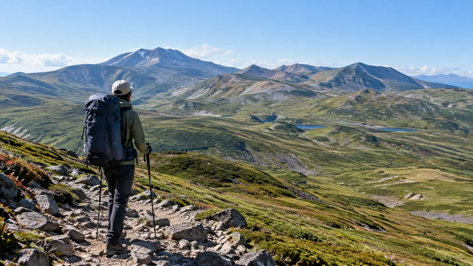
Daisetsuzan National Park extends from Omote Daisetsu, home to Asahidake, Hokuchindake, Kurodake and Tomuraushi, to the Tokachidake Range and Higashi Daisetsu. On a traverse, some stretches offer few descent trails and long distances through alpine terrain with no shelter from the wind. Allow margins in your schedule, equipment and stamina for changes in the weather.
The first question for a Daisetsuzan traverse is how far your current experience will take you. This article focuses on building an itinerary and assessing the risks specific to the range.
Understand the terrain before traversing Daisetsuzan
Ridges and plateaus around 2,000 m extend from the Asahidake area toward Tomuraushi. As you climb, the forest gives way to dwarf stone pine and alpine plants. Above the treeline, little breaks the wind, and rain and wind can persist for hours on some stretches.
The views are wide in clear weather. In rain and wind there is little shelter, and fog hides landmarks. On sections where the forest is far below, waiting until conditions deteriorate can cost time and energy.
Brown bears live in Daisetsuzan. Before leaving, check the national park council and other official sources for sightings and trail restrictions. Follow Hokkaido’s guidance for bear precautions on the trail and food storage at camp.
Are you ready to plan a traverse?
A multi-day traverse such as Asahidake to Tomuraushi calls for the experience below. Check the council’s Daisetsuzan grade and current trail information for each section you intend to hike.
- Overnight camping experience: Complete several hikes of at least one night carrying everything you need. Know how a loaded pack affects your pace and stamina.
- Decision-making in bad weather: Have experience deciding whether to continue or retreat in rain and wind. Hiking only in clear weather leaves you less prepared to make that call on a Daisetsuzan ridge.
- Map reading and route finding: Be able to locate yourself with a topographic map and compass where the trail is faint or the ridge is fogbound. A GPS app is useful, and a paper map works when the phone runs out of power or loses its connection.
- Reading alpine weather: Know how to interpret the summit forecast and decide when you have a window to cross and when to wait.
If you have little experience in any of these areas, build it on day hikes or overnight trips in Hokkaido or Honshu before committing to the Daisetsuzan ridges.
Reading the weather in Daisetsuzan
The typical summer hiking season runs from late June to the end of September. Snowfields may persist in midsummer, and snow can fall in September as daylight shortens. Before leaving, check trail conditions, snow and restrictions with the council and the official sources for your trailheads. For an extension toward Tokachidake, also check volcanic warnings from the Japan Meteorological Agency and local access restrictions.
Use forecasts and warnings from the Japan Meteorological Agency to assess how wind, precipitation and visibility will change along the ridge. Plan long exposed stretches for a period when conditions look stable. Postpone or turn back if conditions are poor, whatever the time of day.
Long ridges and few exits make lightning a particular concern. Check thunderstorm forecasts and the lightning nowcast. If you hear thunder or see lightning, leave summits and exposed ridges and promptly seek a safe place such as a sturdy building.
Build room for delays into the itinerary
An itinerary based entirely on published hiking times can unravel quickly. Pack weight, bad weather, repeated climbs and descents and slower travel in bear habitat can all add time.
Use the following principles when planning.
Keep daily stages short
Check the distance and elevation change between huts and campsites and give yourself time to reach them at your own pace. Ask whether the plan would still work if you lost an hour or rain cut visibility.
Allow a weather day or plan a way out
On a multi-day hike, identify somewhere safe to wait and carry enough water and food for the reserve day. Mark descent routes and transport, and decide in advance when you will turn back. If you plan to take a ropeway, check the last departure and also how long it would take to walk down if service stops.
Verify which huts you can use
Many Daisetsuzan shelters are unstaffed, and some allow overnight stays only in emergencies. Check the rules, staffing, advance notice, capacity and water supply with the council or hut manager. Make a backup plan in case a shelter is full or closed. Pitch tents at designated campsites, and check whether you need a portable toilet kit and where to dispose of it.
Adjust your gear for Daisetsuzan
Other articles cover the standard traverse kit. Here are the adjustments that matter in Daisetsuzan.
Allow extra protection against cold and wind: Wind and rain can chill you on the ridge even in summer. Choose insulation, gloves and a hat for the lowest temperatures and winds you expect. Keep a spare set of clothes dry in case you have to wait.
Rainwear quality: Choose a waterproof, breathable jacket and trousers for prolonged rain and wind. Dampness from sweat also makes you cold, so choose gear you can ventilate and wear with adjustable layers.
Brown bear precautions: If you carry bear spray, keep it within easy reach and learn how to use it beforehand. Seal food and rubbish in containers and pack out leftovers. Follow the instructions at each campsite and Hokkaido’s bear-safety guidance.
Water supply: Identify dry stretches and sources that may run dry, and carry enough water plus a reserve. To avoid infections such as echinococcosis, boil stream water or snowmelt before use, following the campsite guidance.
Where to start
Check the Ministry of the Environment, the Daisetsuzan National Park Council and the official information for your ropeway or trailhead for trail conditions, restrictions and hut access. Once your itinerary is set, file it as instructed by Hokkaido Prefectural Police and share it with family or another trusted person. On Nordwand you can find hiking partners in Hokkaido or ask a certified guide with experience of the traverse.
References
- Ministry of the Environment and Daisetsuzan National Park Council (landscape, trails and facilities)
- Japan Meteorological Agency (forecasts, lightning and volcanic activity)
- Hokkaido Prefectural Police (filing a hiking plan)
- Hokkaido Government (brown bear safety and preventing echinococcosis)
References and sources
- Ministry of the Environment | The landscape of Daisetsuzan National Park
- Daisetsuzan National Park Council | Mountains and hiking trails
- Daisetsuzan National Park Council | Daisetsuzan trail grades
- Daisetsuzan National Park Council | Hiking safety
- Daisetsuzan National Park Council | Shelters and toilets
- Daisetsuzan National Park Council | Designated campsites and water sources
- Daisetsuzan National Park Council | Brown bears
- Hokkaido Government | Avoiding brown bear encounters
- Hokkaido Government | Preventing echinococcosis
- Japan Meteorological Agency | Forecasts, warnings and lightning nowcast
- Japan Meteorological Agency | Lightning safety
- Japan Meteorological Agency | Volcanic warnings and eruption notices
- Asahidake Ropeway | Operating information
- Sōunkyō–Kurodake Ropeway | Operating information
- Hokkaido Prefectural Police | Filing a hiking plan