
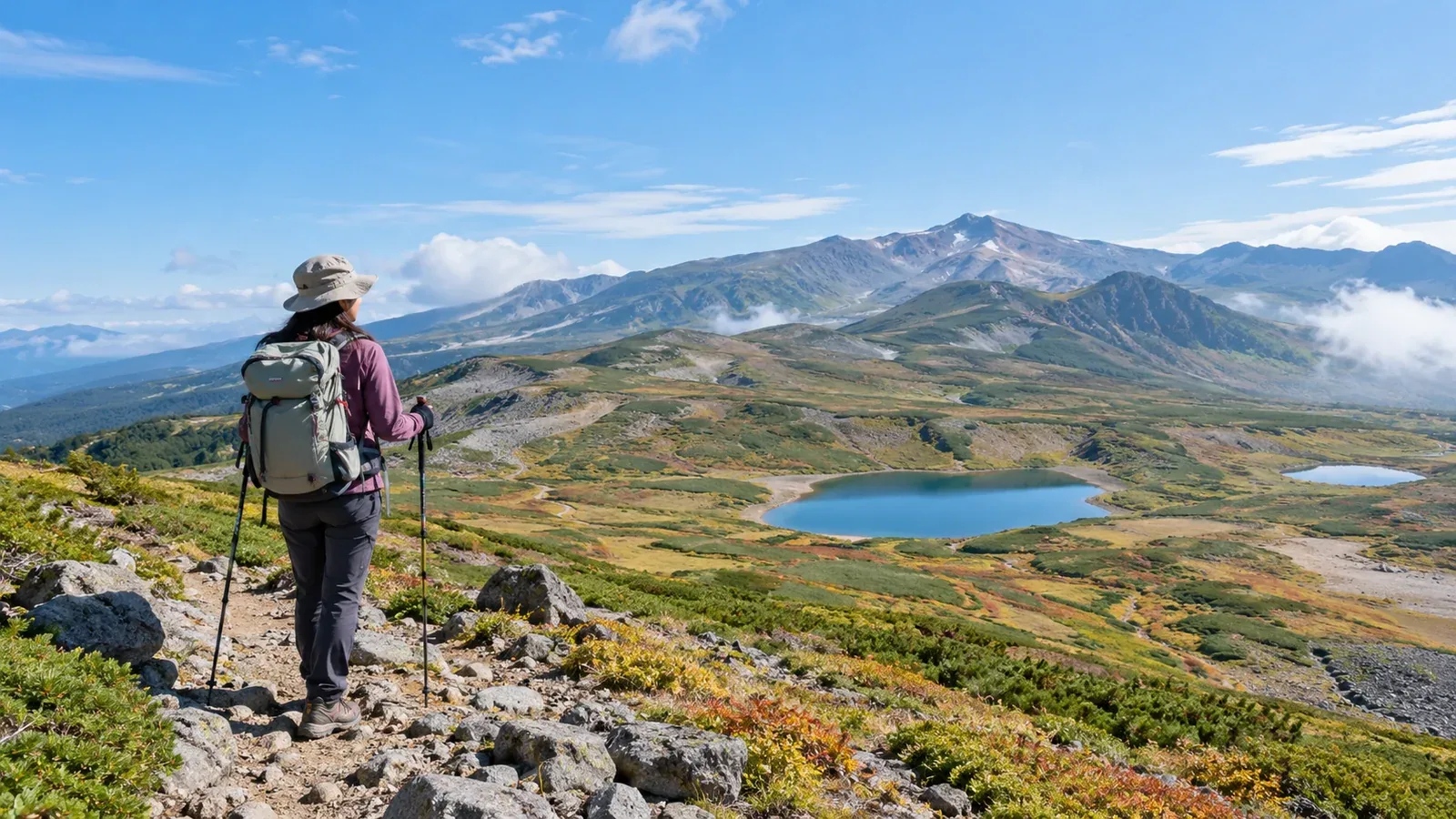
Hokkaidō has low mountains accessible from urban Sapporo and exposed ridges like those of Daisetsuzan. Even for a day hike, walking time, weather and ways to get off the mountain vary widely.
Use these examples from the Sapporo area, central and southern Hokkaidō, and Daisetsuzan to choose a route suited to your group’s experience and gear.
What to check before choosing a Hokkaidō hike
Pay particular attention to weather, brown bears, and facilities and options for getting off the trail.
Weather and cold. Even in summer, wind and rain on ridges like those in Daisetsuzan can chill you and visibility can drop quickly. Check the Japan Meteorological Agency forecast and local visitor center notices. Bring warm layers and rain gear suited to the destination.
Brown bears. Check sightings and closures from local authorities and park managers and at the trailhead. Walk in a group, make your presence known by talking or using a bell, and take all food and trash home. Turn back if you see tracks or droppings.
Facilities and ways off the trail. Some routes have only an unstaffed shelter or no hut at all. You may have nowhere to refill water or buy food. Check the map for shelters, turnaround points and ways to call for help.
Choosing an area by difficulty
Short routes near Sapporo, volcanoes in central and southern Hokkaidō, and the alpine terrain of Daisetsuzan each call for different checks.
Near Sapporo: where to start
Mount Moiwa, Maruyama and Mount Teine are near Sapporo. For a short route, start with the city’s nature trail map and current notices.
Mount Moiwa has several trailheads. Even this close to the city, bear sightings and closures occur. Check the city’s updates and signs at the trailhead.
Look up the walking time for your specific route. On even a short low-mountain hike, bring rain gear, a map and compass, trail food, water and a headlamp.
Central and southern Hokkaidō: longer outings with varied terrain
Options include Mount Yōtei, Niseko Annupuri, Mount Tarumae and the area around Mount Usu. Within the same area, a short walk and a long mountain hike can require different levels of experience.
Mount Yōtei, nicknamed Ezo Fuji, is a long hike. Makkari Village estimates more than eight hours round trip on the Makkari route, excluding breaks. Consider strong winds and lingering snow, and plan it when you have the fitness and experience. You can go with someone who knows the mountain or a qualified guide.
Access to active Mount Tarumae is restricted according to volcanic activity. Alongside the weather agency’s volcano information, check Tomakomai City’s notices for open trail sections and the access road. For the Mount Usu area, check volcanic information and local restrictions too.
Daisetsuzan: the Sugatami walk and ridge hikes
The Asahidake Ropeway goes to Sugatami Station at about 1,600 m. Walking around Sugatami from the station and climbing Mount Asahi, at 2,291 m, involve different terrain and walking times.
Check these points when choosing a route in Daisetsuzan.
- For a first visit, try the Sugatami loop. The Ministry of the Environment gives it about an hour. The climb from Sugatami Station to Mount Asahi has loose rock and exposed slopes and is Daisetsuzan Grade 3. The liaison council estimates 2 hours 50 minutes up and 2 hours 5 minutes down. Add time for breaks and weather.
- Alpine flowers. Flowering depends on elevation and snowmelt. Check current flowering and trail reports. Stay on the path to avoid trampling vegetation.
- Autumn cold and snow. High ground can have snow and ice even during the autumn color season. Check trail conditions and temperature. Choose a shorter walk or another day if the conditions exceed your gear or experience.
- Ropeway service and last ride. Service varies by season, strong wind and maintenance. Check the operator’s updates and set a turnaround time well before the last ride down.
From Sōunkyō, a ropeway and chairlift bring you near the start of the Mount Kuro trail. You still have to hike from the chairlift to the summit. Check lift service and trail conditions.
Gear to check for Hokkaidō
Along with standard hiking gear, check these items for your destination.
- Warm layers. Even in summer, bring insulation suited to the wind and temperature on the ridge and warm enough for stops.
- Rain jacket and trousers. Pack both to protect against rain and chilling wind.
- Bear precautions and a signaling whistle. Use a bell or other sound to announce your presence. Hokkaidō Police recommends carrying bear spray where you can reach it quickly. Learn how to use it beforehand. Carry a whistle for signaling in an emergency.
- Headlamp and spare power. Check the batteries or charge in case the descent runs late.
- Emergency blanket or bivy. Bring protection against wind and cold if you have to stop.
How to choose a route
Work through these checks when setting your itinerary.
- Match it to your fitness and experience. For a first outing, choose a short route you can turn back from easily, based on how long you usually walk.
- Refresh the forecast before leaving. Check wind, temperature, visibility and precipitation when planning, the day before and the morning of your hike.
- Check volcanoes, bears and closures. At volcanoes, check the alert level and restrictions for your trail. For all routes, look up bear sightings and closures.
- File a trip plan. Hokkaidō Police accepts plans online and lists the Japan Mountain Guides Association’s Compass service. File yours before leaving.
- Share your expected return and contact details. Tell family or another contact your route and descent time. Sign the trailhead register if one is provided.
Seasonal conditions
Snowmelt, flowering, autumn colors and snow cover vary by elevation and year. Check current local information alongside these seasonal patterns.
- Through around June. Lingering snow can hide the path. Check the slope and snow conditions. Choose a snow-free route if walking or navigating on snow would be difficult for you.
- July and August. Alpine flowers may be at their best. Wind and rain on Daisetsuzan’s ridges can still chill you.
- September. Autumn colors begin higher up. Check the latest weather and trail conditions for cold mornings and evenings and possible early snow.
- October onward. Expect more snow and ice at higher elevations, with snow possible on low hills. Check snow, closures and transport, and choose a route you can manage in winter conditions.
Plan your next hike
Start with a short route whose walking time and return transport you can check. Review current weather and bear reports. You can find people familiar with the area in Nordwand’s Base Camp or consult a qualified guide.
References
- Japan Meteorological Agency weather forecasts
- Daisetsuzan National Park trail information
- Hokkaidō Police hiking plan guidance
- Hokkaidō Police brown bear precautions
- Japan Meteorological Agency volcano information
References and sources
- Japan Meteorological Agency | Weather forecasts
- Japan Meteorological Agency | Volcano information
- Sapporo City | Nature trails and closures
- Sapporo City | Brown bear sightings on nature trails
- Hokkaidō Police | Preventing incidents with brown bears
- Hokkaidō Police | Safe hiking and filing a trip plan
- Makkari Village | Mount Yōtei via the Makkari route
- Tomakomai City | Mount Tarumae hiking and restrictions
- Ministry of the Environment | Daisetsuzan National Park and the Sugatami loop
- Daisetsuzan National Park Liaison Council | Mount Asahi route
- Asahidake Visitor Center | Trail conditions and bear reports
- Asahidake Ropeway | Service information
- Kurodake Ropeway | Ropeway and chairlift information