
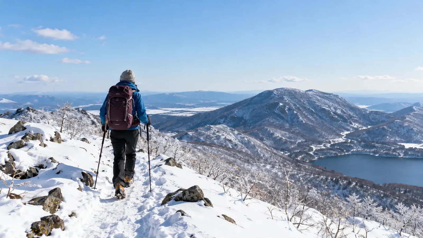
When you’re ready to try hiking in the snow, start by choosing the route. Snow, ice, wind and shorter days change how far you can go and how easily you can turn around. A short walk in suitable terrain with someone experienced is a good first objective.
Here are five things to check and examples from Kantō, Kansai and Shinshū (Nagano). Each mountain can have routes with very different demands. Check current trail and road closures, snow, forecast and transport before deciding where to go.
Five checks when choosing your first winter route
Look at the whole trip, from reaching the trailhead to getting home. Plan an outing with room for delays and a straightforward way to turn around.
1. Check access and keep the climb short
Snow can slow the approach, forest roads may close and parking may go unplowed. Check the return bus or last lift as well as the outward trip. Choose less elevation gain and a shorter distance than you would on a summer hike, and allow time to get down in daylight.
2. Avoid terrain with steep slopes and serious falls
Look for gentle terrain clear of avalanche start zones, paths and runouts, including slopes above the route. Avoid steep traverses, exposed drops and corniced ridges. A broad ridge can still hide a cornice or become hard to navigate in a whiteout.
3. Plan a straightforward retreat
Choose a route you can retrace in deteriorating conditions. Identify places to stop and reassess, and set a turnaround time before leaving. If you plan around a hut, confirm its winter opening and access and have a plan if it’s unavailable.
4. Choose a clear route you can navigate yourself
A well-used route can have signs and tracks, but wind and fresh snow can cover tracks in minutes. Other hikers may be heading somewhere else. Practise reading a topographic map and using a compass, and carry an offline route and a backup.
5. Go with someone experienced in winter terrain
For your first outings, go with a guide qualified for the route and season or a companion with relevant winter experience. Practise fitting traction, walking on snow and making turnaround decisions on suitable terrain before tackling more exposed routes.
Kantō: Akagi (Kurobi) and Nasu
At Mount Akagi (Kurobi) in Gunma, the usual Kurobi trail starts near Lake Ōnuma and climbs steeply over rocky ground that can ice up. Check Gunma Prefecture’s current road closures and the bus timetable from Maebashi. Stay on shore unless the local operator has explicitly opened an area for an ice activity. Choose a shorter, gentler outing if the Kurobi climb exceeds your experience.
On Mount Nasu (Chausu and Asahi) in Tochigi, exposed terrain can bring strong winds and hard snow. The ropeway’s 2026 season is scheduled to end on December 13, and the road beyond Daimaru Onsen is scheduled to close on December 14. Check the operator and prefecture separately for current dates. The exposed traverse towards Mount Asahi and a winter summit are poor first objectives. Check guided snowshoe dates at the Nasu Heisei Forest for a different way to start in the area.
Kansai: the Hira Mountains and Mount Ibuki
The Hira Mountains (including Mount Buna) in Shiga have trailheads accessible from the JR Kosei Line. Rail access can simplify the trip, while the upper terrain can bring deep snow, steep sections and navigation problems. Check the Hira route notices and use official signs and your map. Choose a lower route with a straightforward return if the upper mountain conditions exceed your experience.
Mount Ibuki should come off your winter shortlist. Maibara City prohibits access from its side of the mountain’s foot year-round, including in winter, after major slope failures. The Ibukiyama Driveway is scheduled to end its 2026 season on November 23 and then close for winter. Check both notices and choose another outing.
Shinshū: Nyūkasa and Kirigamine
The Fujimi Panorama gondola can take you to an upper station around 1,780 m on Mount Nyūkasa. The resort publishes snowshoe routes, including shorter options. Check snow and wind, the gondola and last descent, and choose a marked course that fits the day. A short walk or a guided outing can be your full objective.
At Kirigamine (Mount Kuruma), check winter road access, the resort’s snowshoe routes and lift status. The resort identifies the lifts snowshoers may use and where you can cross the ski area. Stay out of protected wetlands even when they are covered in snow. Wind, ice and poor visibility can make open slopes hard to navigate, so choose a short route or turn back if conditions deteriorate.
Winter equipment to match the route
Choose equipment for the actual terrain and forecast. Get instruction before relying on tools you have never used. If a route needs skills you haven’t practised yet, choose easier terrain.
- Traction and compatible boots. Choose what the surface and terrain require. Chain-style spikes can be unsuitable on steep, hard snow or ice.
- Ice axe where the route calls for one. Learn to use it in a supervised setting before relying on it.
- Gaiters. Keep snow from getting into your boots.
- Insulation and windproof layers. Carry a warm layer for stops and spare gloves.
- Goggles and a face covering. Protect your eyes and exposed skin in wind and blowing snow.
- Headlamp and spare batteries. Carry them even on a short day hike and protect the spares from the cold.
See the winter equipment articles in Nordwand Magazine and check the fit and compatibility of your boots and traction before the trip. Carry a map, compass and offline navigation, emergency shelter and first aid, and practise using them.
Before you go
Pick one short route that fits the group’s experience, then check forecasts and warnings, snow, access and local notices. Leave your plan with someone who knows when to raise the alarm. Nordwand’s Base Camp and guide request tools can help you find an experienced companion or a guide qualified for the route and season.
Further reading
- Japan Meteorological Agency forecasts and warnings
- National Police Agency mountain incident reports
- Prefectural mountaineering associations and training
- Japan Mountain Guides Association qualifications
References and sources
- Japan Meteorological Agency · Weather forecasts
- Japan Meteorological Agency · Warnings and advisories
- National Police Agency · 2025 mountain incident report
- Japan Mountaineering and Sport Climbing Association · Member associations
- Japan Mountain Guides Association · Guide qualifications
- Japanese Alpine Club · Kurobi route
- Gunma Prefecture · Seasonal road restrictions
- Kan-etsu Transportation · Akagi bus service
- Maebashi tourism office · Lake Ōnuma ice activity notices
- Nasu Ropeway · Operating dates
- Tochigi Prefecture · Nasu winter road closures
- Nasu Highland Visitor Center · Trail information
- Nasu Heisei Forest · Guided activities
- Hira Mountains trail council · Route notices
- Maibara City · Mount Ibuki access prohibition
- Ibukiyama Driveway · Operating dates and winter closure
- Fujimi Panorama Resort · Snowshoe and winter walking routes
- Fujimi Panorama Resort · Gondola timetable
- Kirigamine Visitor Center · Winter map and protected areas
- Kurumayama SKYPARK · Snowshoe access and lift guidance