
Glacial Landform and the Three Steps
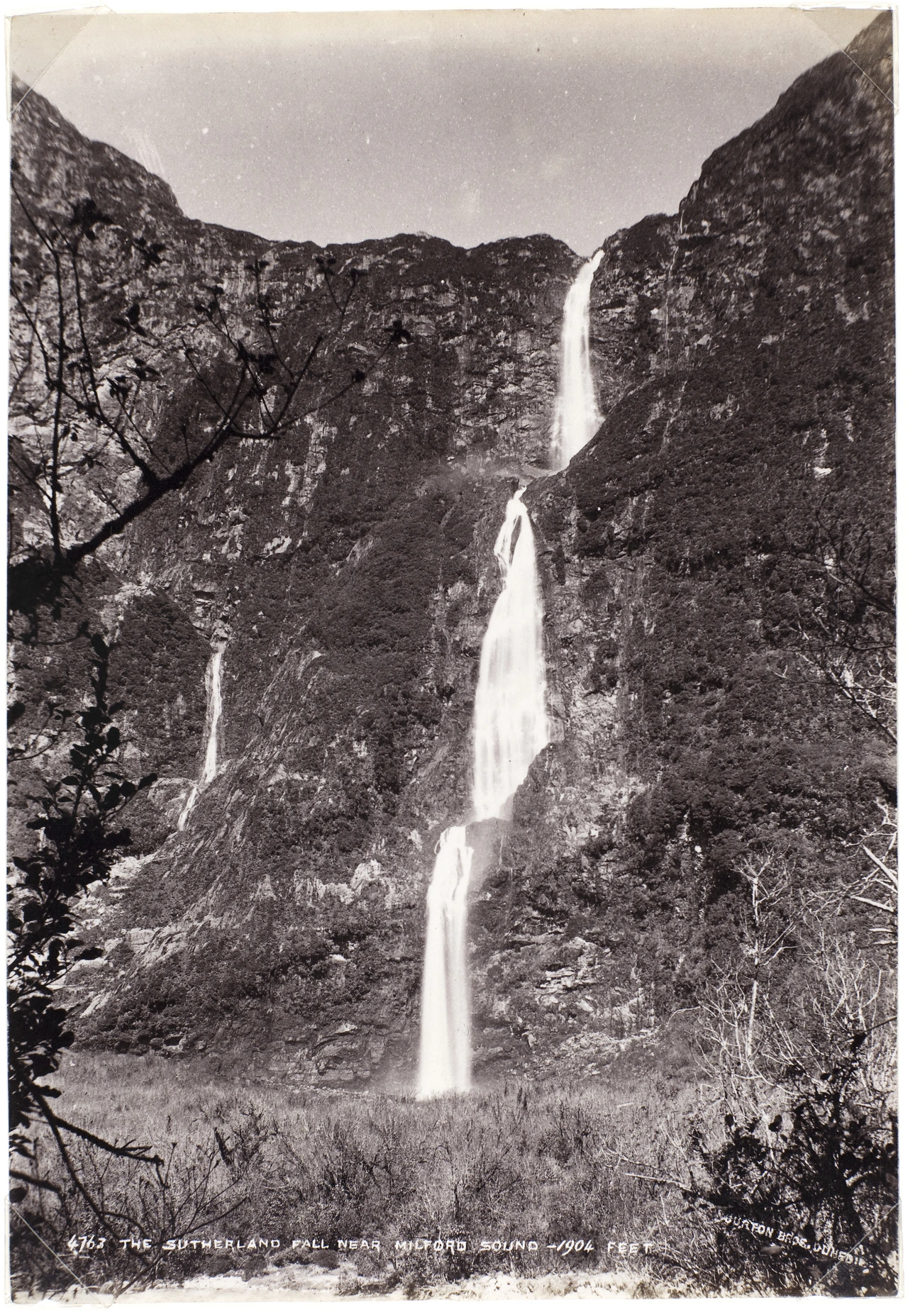
Successive glaciations left Fiordland with deep, steep-sided valleys and smaller basins in the mountains. Lake Quill sits in a cirque, a bowl scooped out by a glacier. Its outlet remains high above the Arthur Valley. In Moodie’s October 1888 photograph for the Burton Brothers studio, all three drops appear in a single frame. The inscription on the print gives their combined height as 1,904 feet.
Routes through northern Fiordland
Māori travelled inland from Piopiotahi through Omanui and the Clinton Valley to Te Ana-au. In November 1880, Donald Sutherland and John Mackay recorded the falls while exploring the Arthur Valley. In 1888, the government paid Sutherland to cut an access track, and Quintin McKinnon and Ernest Mitchell surveyed the connection from the Te Ana-au side.
Quill’s 1890 letter places the falls between mountains he knew as Mount Sutherland and Mount Hart. In January 1891 the Otago Witness also used both names when describing the slopes above Lake Quill. The name Mount Sutherland in today’s New Zealand Gazetteer identifies a mountain roughly 40 kilometres away, northeast of the falls.
William Quill's 1890 Ascent
On 9 March 1890, Quill took an alpenstock, a billhook and a rope for the descent. His letter describes the uppermost of the three stages as the hardest. At the top he planted a piece of cloth marked with his name and the date. The lake now bears his name.
Quill died the following January while trying to reach Milford via Gertrude Saddle. New Zealand’s Ministry for Culture and Heritage records his death as a catalyst for the founding of the New Zealand Alpine Club on 11 March 1891.