
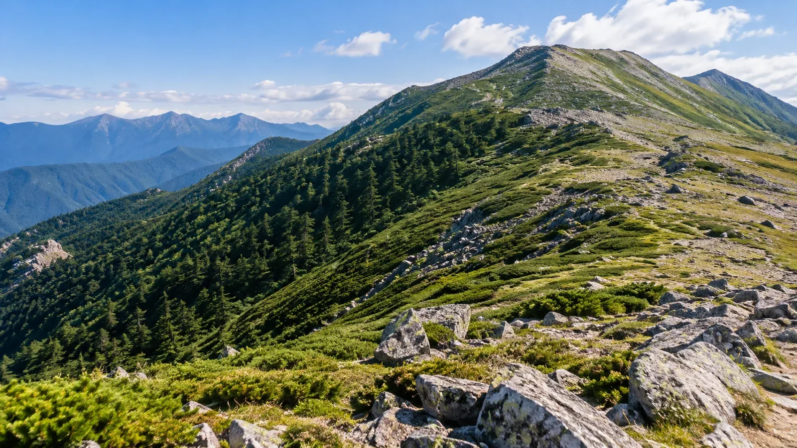
Climb through a forest and the tall trees may give way to low dwarf pine, grass and rocky slopes. The treeline is the upper elevational limit where tall trees form a continuous forest.
Step out of the trees and the wind and sun hit you directly. In fog, trail markers can be harder to see. As you watch the vegetation change, consider what you can check before heading onto the ridge.
What limits the growth of tall trees?
In high mountains, cool temperatures during the growing season limit tree growth. The roots, stems and branch tips need sufficient warmth to form new tissue.
A global study of climate-driven treelines found that the average growing-season temperature around the roots was roughly 6–7°C at many sites. Ground temperature and growing conditions vary. You cannot use that figure to identify the treeline from a day’s air temperature or the elevation on your watch.
Wind and snow matter too. Strong winds can damage branches, long-lasting snow can shorten the growing season, and avalanches or rocky slopes can limit soil development. All of these affect how high tall trees can grow.
Treeline elevations in Japan
Ministry of the Environment materials give about 2,500 m as a guide for the Northern Alps. In Daisetsuzan, the treeline has been reported around 1,500–1,600 m. These figures apply to the areas described.
Even on the same mountain, sunlight, wind exposure, snowfall and avalanches change the upper limit of forest from slope to slope. Different plants grow where the wind strips snow away and where it piles up.
For your route, consult hiking maps and notices from huts or trail managers to find where forest ends and the trail reaches a ridge exposed to wind.
From forest into the alpine zone
In some places the treeline looks sharp. In others it is a transition where short trees and grassland mingle.
In Daisetsuzan, coniferous forest gives way to Erman’s birch, with a belt of Siberian dwarf pine above. This low pine spreads close to the ground. Higher up, grass and loose rock appear, with vegetation changing according to snow cover and wind exposure.
In Japan, the alpine zone generally begins above the upper limit of tall forest and includes dwarf pine scrub. If the path becomes hard to see in grass or on rock, use a map and compass or another reliable navigation tool to check your position before following faint tracks.
What changes on an open ridge?
Before leaving the forest, check four things: wind, lightning, sunlight and visibility.
Wind and cold. With fewer trees to block the wind, clothing damp with sweat or rain can cool you quickly. Keep a windproof layer and insulation accessible so you can put them on in a sheltered spot before the ridge.
Lightning. If thunderstorms are forecast, reconsider when you will cross exposed ridges and identify a safe building or other suitable shelter. If you hear thunder, leave summits and ridges and get to a safe place promptly. Do not shelter directly under tall trees.
Ultraviolet radiation. UV levels increase at altitude, and snow reflects additional radiation. Bring a hat, clothing that covers exposed skin, sunglasses and sunscreen.
Visibility and losing the route. In fog on grass or loose rock, tracks and markers can disappear. If you lose the route, stop and establish your position with a map, compass or map saved for offline use.
How warming affects treelines
A study of records from 166 sites worldwide found that the treeline advanced uphill or toward colder regions at 52% of the sites. Many of the other sites showed little change. These figures describe the sites the researchers compared.
Ground temperature, snow cover, soil and other plants all affect how quickly a treeline shifts as the climate warms. To compare older photographs with today’s vegetation, match the location, season and direction of the view.
Stay on trails and designated areas when taking photographs in the alpine zone. Keep out of dwarf pine and other alpine vegetation.
What to check before reaching the ridge
Check the weather and trail status before leaving. Find where the trees end, where you can shelter from the wind and at which junction you can turn back. Reassess the wind and clouds before stepping onto the ridge, and add a layer or turn back if needed.
Sources for further reading
- Japan Meteorological Agency lightning safety and World Health Organization ultraviolet guidance.
- Ministry of the Environment national park and alpine habitat materials, and research on treeline temperatures and shifts.
- GSI Maps from the Geospatial Information Authority of Japan.
References and sources
- Ministry of the Environment: how the landscapes of Chūbu-Sangaku National Park formed
- Ministry of the Environment: World Natural Heritage candidate review for Daisetsuzan
- Ministry of the Environment: features of Daisetsuzan National Park
- Ministry of the Environment: Monitoring Sites 1000, second alpine survey report
- Körner and Paulsen: a worldwide study of high-altitude treeline temperatures
- Harsch and colleagues: a global meta-analysis of treeline response to warming
- Japan Meteorological Agency: how to protect yourself from lightning
- World Health Organization: ultraviolet radiation
- Geospatial Information Authority of Japan: GSI Maps