
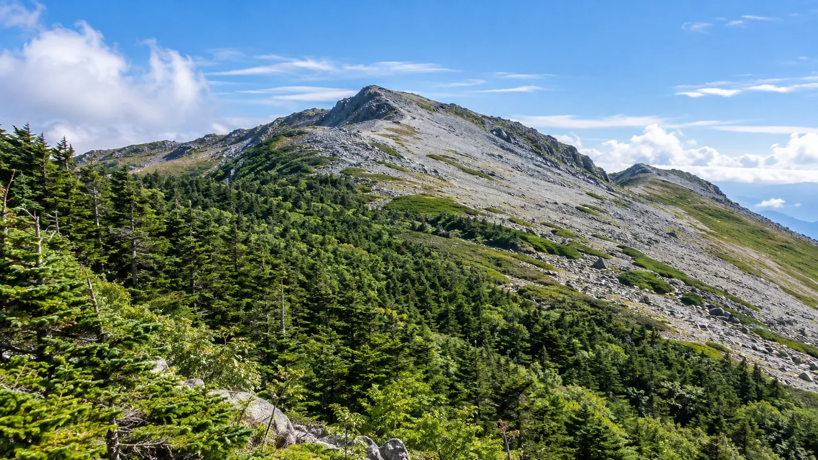
When climbing a mountain, you may come to a point where the trees suddenly give way to open sky. This boundary is called the treeline. In Japan it is often put at around 2,500 metres, but it varies with the range and the climate.
Knowing where the treeline lies has practical value. Above it you lose shelter from the wind, temperatures drop and exposure to lightning increases. The scenery and the conditions change together. Understanding that shift helps you choose gear and plan your time on the mountain.
What sets the treeline?
Tree growth depends on three factors: temperature, snow cover and wind. With elevation, temperatures fall (around 0.6°C for every 100 metres is a common rule of thumb), winter snow deepens and winds strengthen. Together these factors can prevent trees from taking root and growing upright.
In ranges with alpine terrain, such as Japan’s Northern and Southern Alps, stands of Siberian dwarf pine often spread above the treeline. These pines are trees, but grow low along the ground, an adaptation to strong winds and heavy snow. Beyond the dwarf-pine belt you enter alpine terrain dominated by bare rock and alpine plants.
Treelines on Hokkaido’s mountains often occur lower than on Honshu. Their elevation also varies by range across Tohoku, Kanto, Chubu and western Japan. North- and south-facing slopes can have different treelines even on the same mountain. Check where the boundary is likely to be on your own route before setting out.
What changes above the treeline?
The conditions change substantially above the treeline. These are the main differences to watch for when you are new to hiking.
Wind and body temperature. Trees break the wind in the forest. On a ridge above the treeline, winds may be several times stronger. Stronger wind makes it feel much colder. That is why you can need windproof and insulating layers near the summit even in summer.
Lightning risk. In a forest you are generally lower than the surrounding trees. On an exposed ridge you can become the tallest object. Continuing along a ridge when thunderclouds approach is dangerous. For detailed guidance, consult official information from the Japan Meteorological Agency and mountaineering organisations.
Trail markers and visibility. Below the treeline, paths winding between trees can sometimes be easier to follow. Above it the views open up, but fog can turn the landscape white and make the trail hard to see. Learn to read the terrain and look for cairns (piles of stones used as markers) and paint marks on rocks.
Ultraviolet radiation. At higher elevations there is less atmosphere overhead and UV exposure increases. With no shade from trees above the treeline, sunglasses, sunscreen and a hat become useful gear.
What to check before crossing the treeline
Leaving the forest is an important decision point on a hike. Make a habit of checking the following before continuing, so you have a wider margin for error.
- Check the weather again. Look at the sky just before leaving the forest as well as before you set off. If clouds are moving fast or cumulonimbus clouds are building, consider turning back. Look up a forecast for the range in advance, using official information such as the Japan Meteorological Agency’s mountain-weather resources.
- Keep windproof and insulating layers within reach. Move them from the bottom of your pack to a place where you can pull them out quickly.
- Check water and food. Above the treeline, water sources are often scarce apart from streams or snow gullies. Check the map for places to resupply.
- Check the time. Work backwards from how long you need to spend on the ridge. On summer hikes, when lightning is more likely in the afternoon, a common approach is to plan the time above the treeline for around midday.
Taking in the change of scenery
The treeline also opens up views you never get in the forest: 360-degree ridge panoramas, seas of clouds and colonies of alpine plants such as komakusa and Iwa-gikyō, an alpine bellflower.
When you see these landscapes for the first time, understanding why particular plants grow there gives you more to notice on the trail. Alpine plants flower in the short summer, and many plants above the treeline have well-developed roots. Take particular care to stay on the path. Alpine vegetation can take decades to recover from trampling.
Above the treeline, the locations of mountain huts sometimes determine how far you can go. Opening seasons and booking requirements can change from year to year. Before you leave, check the hut’s official information or that of the local authority that manages the area.
What to do next
Find out whether your chosen mountain has a treeline and check its approximate elevation on a map or in the local authority’s hiking information. If the route crosses it, plan for wind protection and what to do if thunder threatens. In Nordwand’s Base Camp or one of its interest-based communities, you can also ask people who have been there about local conditions.
References
- Japan Meteorological Agency: mountain-weather information
- Japan Mountaineering and Sport Climbing Association: hiking safety information
- Ministry of the Environment, Japan: natural parks and alpine vegetation