
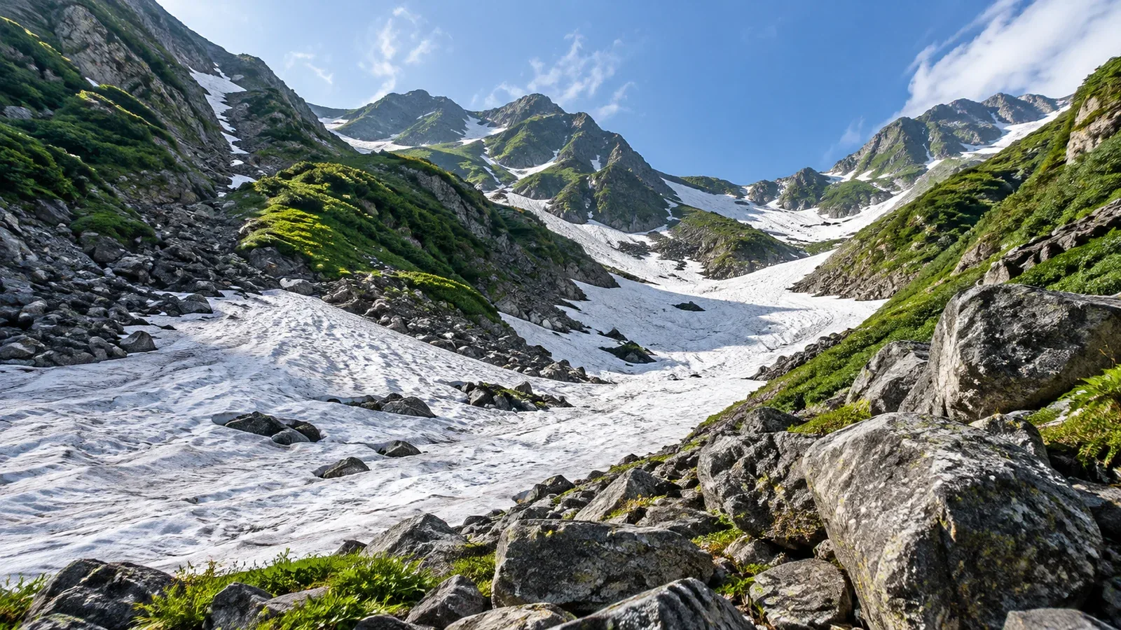
Snow can still lie in mountain gullies and hollows in July or August. These strips or slopes of lingering snow are known as snow patches. When terrain collects winter snow and spring and summer melt conditions allow it to persist, it can remain after the snow around it has gone.
Here is why snow collects in some places and what controls how quickly it melts. We’ll also look at what to check before and during a hike when the trail crosses a snow patch.
What controls how fast snow melts?
How long snow lasts depends on both its depth and how much heat reaches it in spring and summer.
Air temperature. Air is generally cooler at higher elevations. Even at the same elevation, the day’s weather and the shape of a valley can change the temperature.
Sunlight. North-facing slopes and deep gullies can be shaded for longer. In shade, less heat reaches the snow from direct sun.
Wind and humidity. Wind moves snow in winter. In summer, it changes the exchange of heat and water vapor between snow and air and affects melting.
How valleys collect snow
In valleys and hollows, snow carried from nearby slopes adds to the snow that fell there.
Avalanches and drifts. Snow can fall down slopes or be blown off ridges into valley bottoms and lee slopes. Research in the Northern Alps found small glaciers sustained by this extra snow at elevations below where the surrounding climate would normally allow them.
Shade and cold air. Valley walls can block sunlight. On clear, calm nights, cold air from slopes can flow down into valley bottoms.
A ridge and a valley at the same elevation can lose their snow at different times because they collect different amounts and receive different amounts of sun.
Winter snowfall and summer weather change what remains
After a snowy winter, more snow is available at the start of the melt season. Summer temperature, sun and humidity affect melting, so the extent and depth can differ from one year to another in the same gully.
Large snow patches and snowbeds remain through midsummer in Daisetsuzan. The Yamunai-sawa on Mount Rishiri also holds a perennial snow patch at relatively low elevation. For a hike, check recent reports on your section of trail instead of relying on a fixed elevation.
In September 2026, Hakuba Village closed the Hakuba Daisekkei route through the end of the season because a safe line across the snow could not be established. Route access depends on conditions such as cracks and rockfall as well as the amount of snow.
What to check before crossing
Stop before stepping onto the snow. Check the slope, what lies below it, cracks in the snow and where you will exit. Find out if there is an official snow-free route.
Snow hardness. After a cold night, snow may be hard in the morning and soften during the day. A slip on a steep, firm slope can turn into a fall. If the crossing requires crampons or an ice axe and you cannot use them confidently, take another official route or turn back.
Falling rock and ice. Gullies can channel rock or ice from the slopes above. Stones sliding on snow may be hard to hear. Check the terrain above you and local warnings, and obey closures.
Cavities under the snow. Meltwater channels, the edges of a patch and areas around exposed boulders can have cavities below the surface. A continuous white surface does not show how thick the snow is. Stay off areas where you suspect a cavity or collapse.
Finding the route. Snow can hide summer trail markers and the exit. Check your position with a map, compass or offline map and follow local instructions. If you cannot find a safe way through, turn back.
Summer snow, perennial snow patches and glaciers
Some summer snow melts away that year and some survives until the next snow season. A patch that remains through the melt season year after year is called a perennial snow patch.
A persistent body of ice that flows under its own weight is a glacier. In Shakushi-sawa and Kaerazu-sawa in the Northern Alps, measurements of ice thickness and movement confirmed glaciers.
A patch’s size reflects snowfall and melting in a particular year. To study links to climate, researchers observe the same place over time and compare it with snowfall, terrain and other factors.
Check the route before leaving
Consult the latest information from huts, local authorities or park managers about access, equipment and official alternatives. If your plan involves steep snow, learn and practise the required skills in advance and choose your route based on the conditions you find.
Sources for further reading
- Snow and glacier observations from Niigata University, Hokkaido University and the National Institute of Polar Research.
- Ministry of the Environment guidance for hiking in Daisetsuzan and crossing snow in Shiretoko.
- Hakuba Village closure notices and the Nagano Prefectural Police summer hiking guide.
- Mountaineering Scotland guidance on choosing routes and equipment for late snow.
References and sources
- Niigata University: glaciers in the Northern Japanese Alps and what sustains them
- Hokkaido University: summer snowmelt and runoff in alpine areas
- Ministry of the Environment: features of Daisetsuzan National Park
- National Institute of Polar Research, ArCS II: observations at the Yamunai-sawa snow patch on Mount Rishiri
- Hakuba Village: closure of the Hakuba Daisekkei route
- Nagano Prefectural Police: Summer Hiking Safety Book 2025
- Rausu Visitor Center, Shiretoko: Mount Rausu and the Shiretoko range Q&A
- Ministry of the Environment: choosing a hike using the Daisetsuzan grading system
- Mountaineering Scotland: late lying snow