
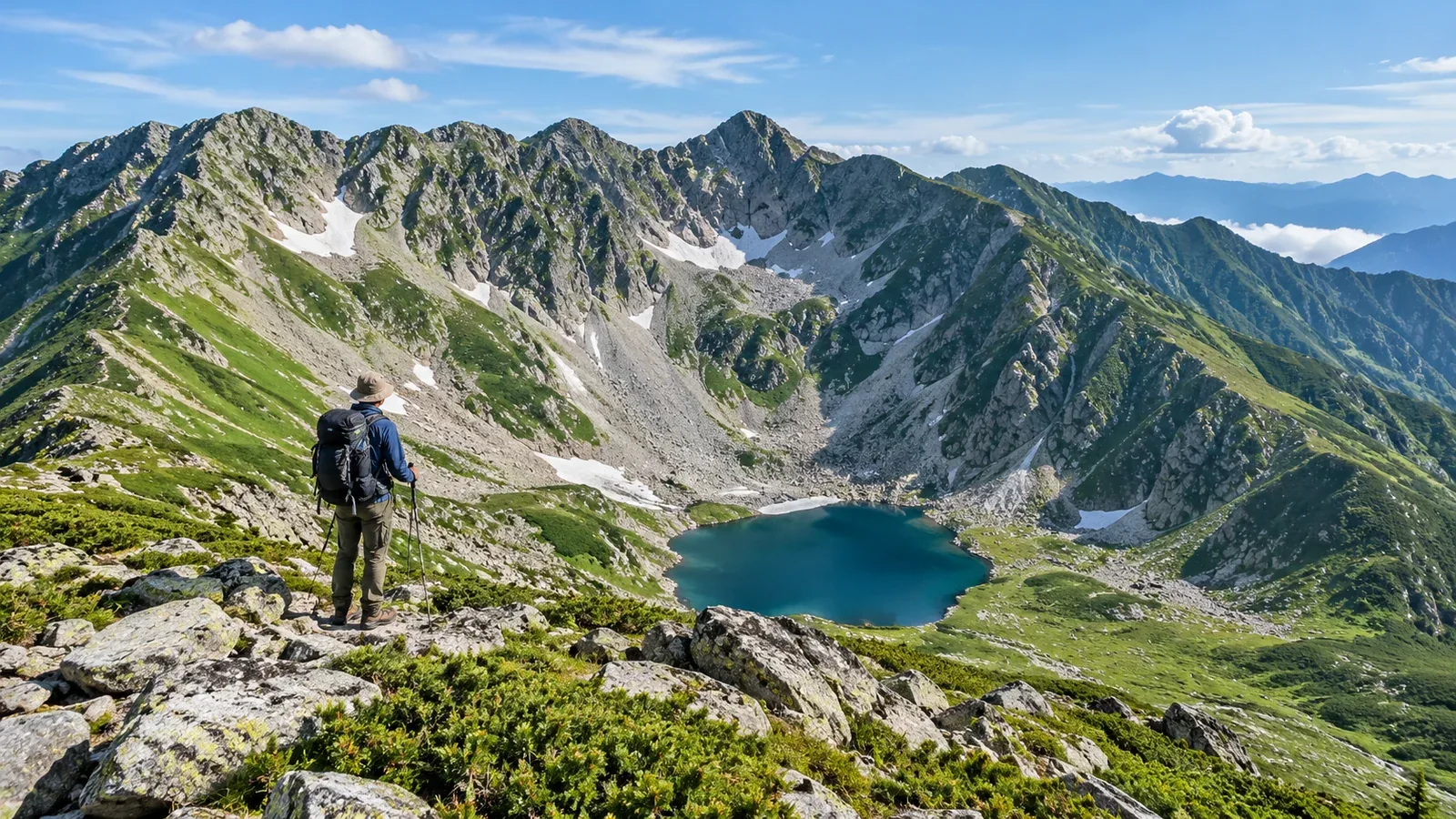
Just below a mountain ridge, cliffs sometimes wrap around a hollow like the rim of a huge bowl. A hollow carved this way by a glacier is called a cirque. In Japan, you’ll often hear it called kāru, from the German Kar.
A cirque has a steep wall on the uphill side, a gentler floor beneath it, and an opening toward the valley. The outline survives after the ice retreats. It gives you a clue to why the wall you’re looking up at is so much steeper than the slope underfoot.
Here’s how glaciers carve these hollows, where to see them in Japan, and how to match what you see on a map with what’s in front of you.
How a cirque forms
When snow survives the summer and builds up year after year, the lower layers compact into ice. Once the ice begins to flow slowly downhill under its own weight, it starts to carve the valley. Sand and stones caught in the base of the ice grind against the bedrock. The ice also carries off blocks that break loose along cracks.
Ice can build up where snow drifts collect or in shade where snow lingers. Moving ice deepens the floor. In the steep wall behind it, water in rock cracks freezes and thaws, further weakening the rock. Together, these processes shape a bowl that opens toward the valley.
After the glacier retreats, water can collect if the floor lies below a step in the bedrock at the outlet, or if sediment blocks the outlet. The resulting lake is called a tarn. You can still see the change in slope from floor to wall in a cirque without a lake.
Where to see cirques in Japan
During colder glacial periods, glaciers developed in Japan’s high mountains. Distinctive examples remain in the Northern, Central, and Southern Alps and in Hokkaido’s Hidaka Range.
Northern Alps (Hida Mountains). The Karasawa Cirque, ringed by the Hotaka peaks, is a classic example. The Yari–Hotaka massif preserves traces of glaciers cutting through rock formed by earlier volcanic activity.
Central and Southern Alps. Two examples are Senjōjiki Cirque below Mount Kisokoma in the Central Alps and Yabusawa Cirque on Mount Senjōgatake in the Southern Alps. At Senjōjiki, you can see the cliffs and the hollow from the ropeway station or from the walking trail when it’s open.
Hokkaido’s Hidaka Range. Nanatsunuma Cirque lies near Mount Poroshiri. Along the skyline you can also see knife-edged ridges left between slopes carved by ice on either side.
Altitude and latitude matter, as do the orientation and shape of slopes where snow collects. That helps explain why two sides of the same mountain can have very different profiles.
How to read a cirque in the field
Look for it on a map first. Then you’ll have an easier time matching the contour lines to the slopes you can see.
Spotting one on a topographic map
On GSI Maps, look for horseshoe-shaped contours below a ridge. Close-set lines on the inside show a steep wall. Wider spacing marks the gentler floor. Other landforms can look similar, so check a geological map or local signs before identifying it as glacial.
What to look for on the trail
- Headwall. This is the steep rock wall enclosing the back of the hollow. If you see scree spread out below it, start by looking at the whole slope from a safe spot on the trail.
- Floor. Find the point where the steep headwall gives way to gentler ground. Sediment carried by the ice and rocks that have fallen from the wall can leave an uneven surface.
- Outlet and water. Look where the bowl opens into the valley. A rim of bedrock or sediment can hold back water, leaving a pond or wetland.
How moraines fit into the picture
A moraine is an accumulation of rocks and sediment carried by a glacier and deposited at places such as its edge or toe. A mound of debris near the outlet may dam a pond. If you see one, notice where it sits in relation to the surrounding walls and the valley.
What to watch for when walking in a cirque
Use open trails and viewpoints to look around. Leaving the trail to check a feature you saw on the map can bring you close to rockfall or lingering snow.
Rockfall. Below a headwall or a slope of loose rock, choose a rest spot away from likely rockfall paths. Follow any closures or signed detours.
Lingering snow. Snow can last into summer in the shade or where drifts collect. A slip on hard morning snow can send you all the way down the slope. If you lack the equipment or skills the crossing calls for, take an official snow-free route or turn back.
Weather. The floor may be sheltered while wind at the outlet or on the ridge is much stronger. Check the forecast for your destination. If fog hides your next landmark, stop and work out your position before going farther.
The time recorded in a cirque
Even where you can see no ice today, the shape shows that there was once enough ice to carve into the valley. Whether you’re looking up from below the cliffs or down from a ridge, you can ask what made the slopes you’re seeing.
Back at the map, trace the headwall, the floor, and the outlet with your finger. Once you know where those three parts sit, it’s easier to make sense of a cirque in another range.
Try it on your next hike
Start by opening GSI Maps at Senjōjiki or Karasawa. Compare where the wall ends and the floor begins. Before heading out, check with a mountain hut or the local land manager for remaining snow, closures, and where walking is permitted.
Sources
- Glacial erosion, deposition, and moraine formation (U.S. National Park Service)
- Glacial landforms at Karasawa, Senjōjiki, Yabusawa, and in the Hidaka Range (Japan Ministry of the Environment and Chūō Alps Komagatake Ropeway)
- Contour lines and 3D terrain (Geospatial Information Authority of Japan)
- Deciding whether to cross a slope with lingering snow (Mountaineering Scotland)
References and sources
- U.S. National Park Service: How Glaciers Change the Landscape
- Japan Ministry of the Environment: How glaciers shaped Mount Yari and the Hotaka peaks
- Chūō Alps Komagatake Ropeway: Sightseeing and walking trails
- Kanto Regional Environment Office: On the 3,033-meter summit of Mount Senjōgatake
- Japan Ministry of the Environment: Features of Hidaka-sanmyaku Erimo-Tokachi National Park
- Geospatial Information Authority of Japan: GSI Maps
- Mountaineering Scotland: Late lying snow