
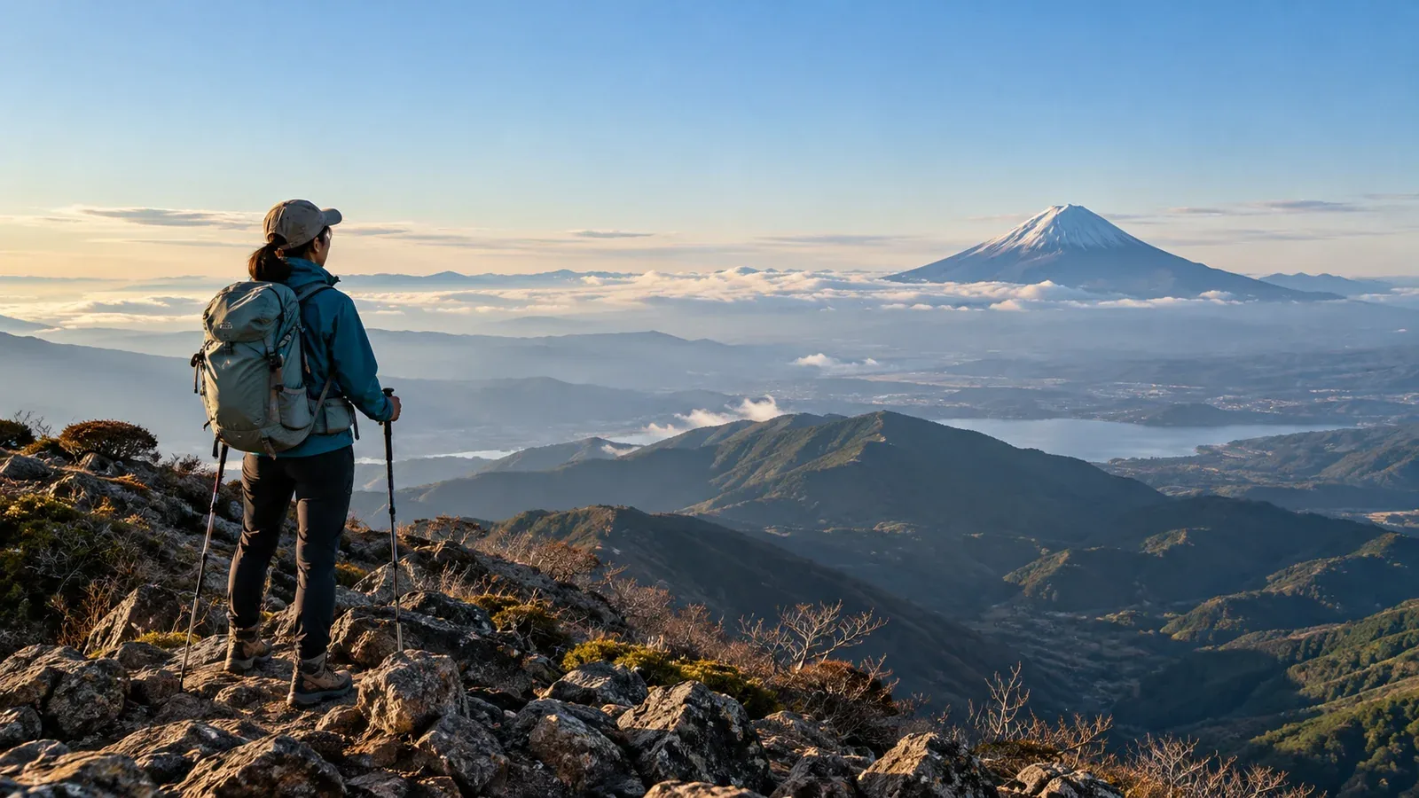
If you’re hiking to see Mount Fuji, check where the viewpoint is and what clouds or haze might be present that day. On the same mountain, a clear view toward Fuji can look very different from a wooded spot. Clouds may cover Fuji’s summit even on an otherwise sunny day.
This guide explains what makes a good viewpoint and what you can check before leaving. Understanding the terrain and weather that affect the view helps you choose a route that suits your fitness, schedule and starting point.
Four factors that affect views of Mount Fuji
Check what lies between the viewpoint and the mountain, how far away it is, how clear the air is, and what the season and time of day mean for visibility.
① Line of sight. Check whether a ridge or other terrain lies between the viewpoint and Fuji. The profile tool in GSI Maps shows elevation along that line. Use trail guides and photos to check for trees or structures that could block the view.
② Distance and clarity of the air. Mount Fuji is 3,776 m high. The farther away it is, the smaller it appears and the more haze, dust or intervening clouds can obscure it. There is no fixed distance at which it stops being visible.
③ Season and weather. From some distant viewpoints, Fuji is easier to see on clear winter days. Check clouds, haze and wind for your date, and find out whether the trail to the viewpoint is snowy or icy.
④ Time of day. Morning is one option, but the time alone doesn’t guarantee a view. Check how clouds and haze may change during your hike. If summer thunderstorms are possible, prioritize a plan that keeps you off exposed ridges.
Narrowing the choices by direction, distance and difficulty
Mount Fuji straddles Shizuoka and Yamanashi, and its profile changes with the viewing angle. At the Takichiyama lookout in Atami, Shizuoka, Mount Hōei is visible on the near side. Compare photos from different viewpoints to find a profile you’d like to see.
Start with the area you can reach
Look within reach of a day trip or overnight stay. The Ministry of the Environment’s 100 views of Mount Fuji includes Mount Mitsutōge in Yamanashi and Mount Kinkan in Izu. Use a map to check the direction to Fuji from each viewpoint.
It can help to think of distance bands around Fuji, such as 50, 100 or 150 km, as you look through GSI Maps. This shows which prefectures and mountain areas are in range for your search.
Check the difficulty and where the view opens up
A summit isn’t always the viewpoint. Trees may cover the top while a ridge or pass along the way has an open view. Draw a line from the viewpoint to Fuji and check hiking maps or route guides for whether that direction is clear.
If you’re starting out, look at distance, elevation gain and footing first. A mountain close to Fuji can still have a long trail. If a route that suits your experience has a viewpoint along the way, you can make that the destination.
What to check before your hike
Weather forecasts and cloud cover
The day before and morning of your hike, check regional forecasts, warnings and advisories for both your viewpoint and the area around Fuji. Even with sunshine in the forecast, clouds can cover your viewpoint or Fuji. Check an elevation-appropriate forecast and cloud cover, and use a live camera for a look on the day.
Visibility and recent conditions
Photos from people who hiked there in the last day or two can give you an idea of the view. Conditions can change before you arrive, so use them as one piece of information.
Your route and descent time
It’s easy to spend longer at a summit while waiting for clouds to clear. Set an estimated arrival time and a firm time to leave even if Fuji hasn’t appeared. Descending after sunset increases the risk of falls and losing the trail.
What to do if you can’t see Fuji
Clouds can close in even when conditions looked favorable. Be ready to end the hike on schedule.
A long wait in summit cloud can leave you cold or mean descending after dark. Head down and try again another day.
You may still see Fuji from a ridge, pass or lookout before reaching the summit. Locate these points on a hiking map in advance so you can shorten the route if needed.
Skills, equipment and other practical checks
During autumn foliage season and holiday weekends, parking, public transport and huts can get busy. Ask local authorities, transport operators and huts about parking, reservations and restrictions on roads and trails.
In winter or while snow remains, shaded and higher sections can be snowy or icy. Check that your equipment and skills suit the surface and terrain. If you’re unsure, choose a viewpoint without snow or ice, or go another day.
Next steps
Use GSI Maps to check direction and distance from each viewpoint to Fuji, then shortlist two or three. Check regional forecasts, local mountain information and official access restrictions. In Nordwand’s Base Camp, you can also ask people who have hiked there about the viewpoints.
References
- Geospatial Information Authority of Japan: GSI Maps, terrain profiles and maps
- Japan Meteorological Agency: regional forecasts, warnings and advisories
- National Police Agency and prefectural police: mountain incident statistics
References and sources
- Geospatial Information Authority of Japan: the elevation profile tool in GSI Maps
- Geospatial Information Authority of Japan: Mount Fuji’s elevation
- Ministry of the Environment: 100 views of Mount Fuji
- Ministry of the Environment: Mount Hōei seen from the Takichiyama lookout
- Japan Coast Guard: visibility of Mount Fuji from Sunosaki Lighthouse
- Yamanashi Prefecture: Mount Fuji live cameras
- Japan Meteorological Agency: weather forecasts
- Japan Meteorological Agency: staying safe around lightning
- National Police Agency: mountain incident statistics