
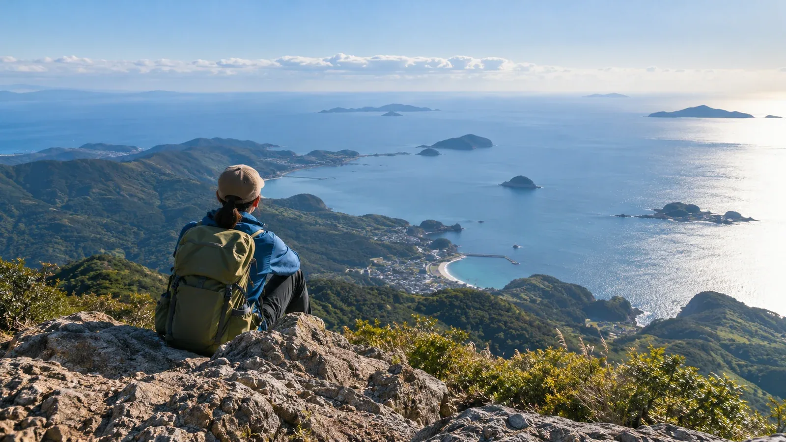
If you want a hike with a view of the sea, start with the terrain. Weather, season and haze affect what you’ll see on the day. The position of the mountain, the distance to the sea and the elevation of the viewpoint can help you pick a route with the kind of view you want.
Here’s how to find and compare mountain routes with sea views, with examples to help you choose around your fitness, travel dates and starting point.
What makes it possible to see the sea?
Understanding why one viewpoint works and another doesn’t makes it easier to narrow the options.
Distance to the sea and elevation of the viewpoint affect the angle and how much of the sea you can see. A nearby coast can still be hidden by an intervening ridge. For distant views from inland, clouds and haze matter alongside the terrain.
The shape of the mountain and how open the viewpoint is also matter. Trees can block the view from a summit close to the shore. Rocky ridges, grassy tops and built lookouts may offer a clearer view in particular directions. Check maps and hiking reports to see whether the view is panoramic or open on one side.
Coastal mountains, peninsulas and islands are places to look for viewpoints facing the sea. On the Bōsō or Izu peninsulas or on Izu Ōshima, the stretch of coast you see depends on the direction of the viewpoint and the ridges in front of it. Check the point along your route, as well as where the mountain sits.
Choose the kind of sea view you want
Start with what you want to see, and the choice of routes gets easier.
A steep view down to the sea
Mountains near the coast can have viewpoints overlooking a harbor or the sea. On Mount Nokogiri on the western side of the Bōsō Peninsula, viewpoints look out over Tokyo Bay. Elevation above the sea alone won’t tell you the route difficulty. Check for steep steps, rock and other conditions underfoot.
A broad view toward the distant horizon
From farther inland, a bay or peninsula may stretch out in the distance. In clear conditions, for example, you can see the Izu Peninsula across Suruga Bay from the east side of Mount Fuji’s summit. Clouds, fog, haze and Asian dust can obscure distant views. Check the conditions for the day as well as the season.
Sea views from an island mountain
In good conditions, Mount Mihara on Izu Ōshima looks across the sea to the Izu Islands and the Izu Peninsula. On Chichijima in the Ogasawara Islands, Nakayama Pass overlooks nearby coastline. Check ferry or flight status, local transport and any trail or volcanic access restrictions with local authorities and operators.
How to shortlist routes
Gather information in this order.
- Decide your travel range, fitness and available dates. If the view leads you to choose a hike beyond your fitness, you lose the margin for delays and fatigue.
- Check the mountain and sea on a topographic map. Use the profile tool in GSI Maps to see whether a high ridge lies between the viewpoint and the coast. Check route guides and photos for trees and buildings.
- Check the terrain and route difficulty. Look at local government hiking pages, mountaineering club reports or official hut information. Note the estimated time, elevation gain and terrain, then confirm current access with the operator or trailhead notices.
- Check which way the viewpoint faces. Look at route guides and recent photos to see whether it’s open all around or in one direction. Draw a line on the map from the viewpoint to the coastline you want to see.
- Check weather and visibility for the date. Look up Japan Meteorological Agency regional forecasts and alerts, plus a forecast for your elevation, cloud cover and fog. If you’re looking for a distant view, the agency’s Asian dust information can also help.
How views change with the season and time of day
The sea can look quite different at different times of year and day.
Late autumn and early winter can offer distant sea views when the air is clear. Account for early snow, ice and short daylight when choosing equipment and a route.
Summer clouds and haze can hide the view. An early start doesn’t remove the chance of bad weather. If rain or thunderstorms are forecast, review when you’ll be out and which sections are on ridges.
The time of day changes the direction of the sun. Reflections and backlighting change how the sea looks. For evening light, first check whether you can get down safely before sunset. If that’s difficult, choose a roadside lookout or another easily reached viewpoint.
Safety details that are easy to overlook
Coastlines, islands and peninsulas pose different challenges from inland routes.
Watch for changes in wind and cloud on the coast. Moist air can form cloud as it reaches the mountains, reducing visibility. Recheck the forecast that morning and head down with time to spare if the weather gets worse.
Some places have no mobile reception. Share emergency contacts, your descent route and your expected return time in advance. Check where and how to file a hiking plan with the local authority.
Rocks and cliffs near the coast can be tempting viewpoints, but a slip can have serious consequences. Stay in areas open to visitors and take in the view from marked or fenced lookouts.
Next steps
Decide whether you want to look down on the sea or see it in the distance, then pick two or three options you can reach on a day trip or with an overnight stay. Use GSI Maps and local government information to check terrain, difficulty and access. In Nordwand’s Base Camp, you can also ask people who have walked in the area about the direction of the view and how it changes by season.
References
- Geospatial Information Authority of Japan: elevation profiles in GSI Maps
- Japan Meteorological Agency: regional forecasts, warnings and Asian dust information
- Ministry of the Environment: Soramame air quality monitoring network
- Prefectural and municipal hiking information and hiking plan submission pages
References and sources
- Geospatial Information Authority of Japan: the elevation profile tool in GSI Maps
- Kyonan Town: Mount Nokogiri hiking routes
- Ministry of the Environment: the Izu Peninsula seen from the summit of Mount Fuji
- Ōshima Town: Mount Mihara hiking information
- Ogasawara Village: Chichijima visitor guide
- Tokyo Metropolitan Government: ferry and flight status for Ōshima
- Japan Meteorological Agency: volcanic warnings and eruption notices
- Japan Meteorological Agency: weather forecasts
- Japan Meteorological Agency: Asian dust information
- Ministry of the Environment: air quality monitoring