
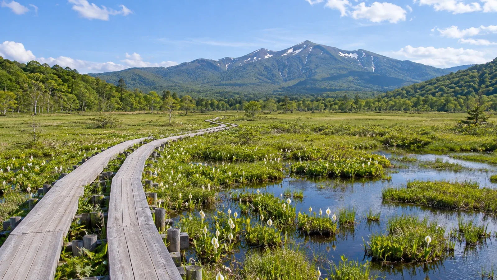
As you descend from the surrounding mountains, boardwalks stretch across Ozegahara at about 1,400 meters above sea level, passing scattered pools. The movement of water and sediment, followed by thousands of years of accumulated plant remains, created this broad wetland between the mountains.
Ozegahara is a wetland, while Ozenuma to the east is a lake. Tracing their histories draws your attention to the streamside plants and patches of sphagnum you can see from the boardwalk.
A basin shaped by volcanoes and rivers
According to the Oze Preservation Foundation, a shallow lake once occupied the site of modern Ozegahara. Sediment from the mountains later accumulated, and rivers meandered and repeatedly flooded. Peat is thought to have begun forming about 8,000 years ago in oxbow lakes and areas that stayed wet after floods.
Mount Hiuchigatake is a 2,356-meter volcano. The Japan Meteorological Agency attributes the formation of Ozenuma, east of Ozegahara, to a debris avalanche that ran south from Hiuchigatake and dammed a river. The lake has a separate history from the wetland.
Ridges enclosing Ozegahara include Mount Keizuru to the north and Mount Shibutsu to the west. Japan’s Ministry of the Environment describes volcanic rocks in the surrounding area and serpentinite on Mount Shibutsu. From the boardwalk, the distant ridges show the extent of the basin around the wetland.
Peat layers: The ground beneath your feet
When dead plants are submerged in a wetland, little oxygen reaches them. Cool temperatures also slow decay. Partially decomposed organic matter builds up and becomes peat.
According to the Oze Preservation Foundation, peat is roughly 4.5 to 5 meters deep at the center of Ozegahara. Its depth and rate of accumulation vary by place and period. Under your feet lie layers of plant material that have persisted for thousands of years.
Boardwalks protect the soft peat and surface plants from trampling. Take your photos from the boards, keeping your feet and tripod out of the wetland.
Fens, transitional mires, and raised bogs
To distinguish wetland types, ask where the water comes from and how high the peat surface is relative to the surrounding water level.
A fen receives minerals carried by streams or groundwater. In Oze, reeds, Asian skunk cabbage, and marsh marigolds grow in these areas.
In a raised bog, peat builds up until its surface rises above the surrounding groundwater level. Rain and snow become the main water sources. Sphagnum moss and sundews grow in this mineral- and nutrient-poor setting.
Raised bog covers much of central Ozegahara, and there are also transitional mires with features of both types. The peat surface has small hummocks and hollows. The little pools where water collects are called chitō in Japanese.
Where sphagnum grows
Sphagnum moss can grow in wet places with few nutrients. At Ozegahara, small changes in the height of the ground affect where sphagnum and other wetland plants grow.
Sphagnum leaves have large cells that hold water. As the upper parts keep growing, the lower parts die and become submerged. Some of that plant material becomes peat.
Rain- and snow-fed areas tend to be more acidic and nutrient-poor than areas that receive minerals from groundwater. These differences are reflected in which plants grow there.
Plant material decays slowly in waterlogged peat. As peat accumulates, changes in the height of the ground alter how water reaches it and which plants can grow. The wetland gradually changes shape.
Climate change and the future of the wetland
Peat stores carbon taken up by plants. When the water level falls and oxygen reaches the peat, decay speeds up and carbon dioxide enters the atmosphere. The UN Environment Programme identifies water levels as an important factor in peatland greenhouse gas emissions.
Changes in the timing of snowmelt and in the amount of water lost from plants and the ground in summer can alter a wetland’s water supply. Deer browsing also affects the plants at Oze. Monitoring by Japan’s Ministry of the Environment and others documents local changes.
As you walk along the boardwalk, compare the tall plants along the streams with the low plants across the middle of the wetland. Water flow and subtle shifts in ground level help explain the pattern.
Before you visit
Check with the Oze Preservation Foundation or Japan’s Ministry of the Environment for transport restrictions at your trailhead, such as Hatomachi or Numayama Pass, and closures along your route. The visitor centers have materials on the vegetation and landforms.
Sources
- Ozegahara’s landforms, peat depth, and wetland plants (Oze Preservation Foundation and Japan Ministry of the Environment)
- Hiuchigatake’s volcanic history and the formation of Ozenuma (Japan Meteorological Agency), and peatland water levels and greenhouse gases (UN Environment Programme)
- Trailhead access, trail conditions, and vegetation conservation (Oze Preservation Foundation and Japan Ministry of the Environment)
References and sources
- Oze Preservation Foundation: The natural history of Oze
- Japan Meteorological Agency: Mount Hiuchigatake
- Japan Ministry of the Environment: Natural features of Oze National Park
- Oze Preservation Foundation: How a wetland grows
- UN Environment Programme: Greenhouse gas emissions from peatlands
- Oze Preservation Foundation: Getting to the trailheads
- Oze Preservation Foundation: Latest notices
- Japan Ministry of the Environment: Conservation in Oze National Park