
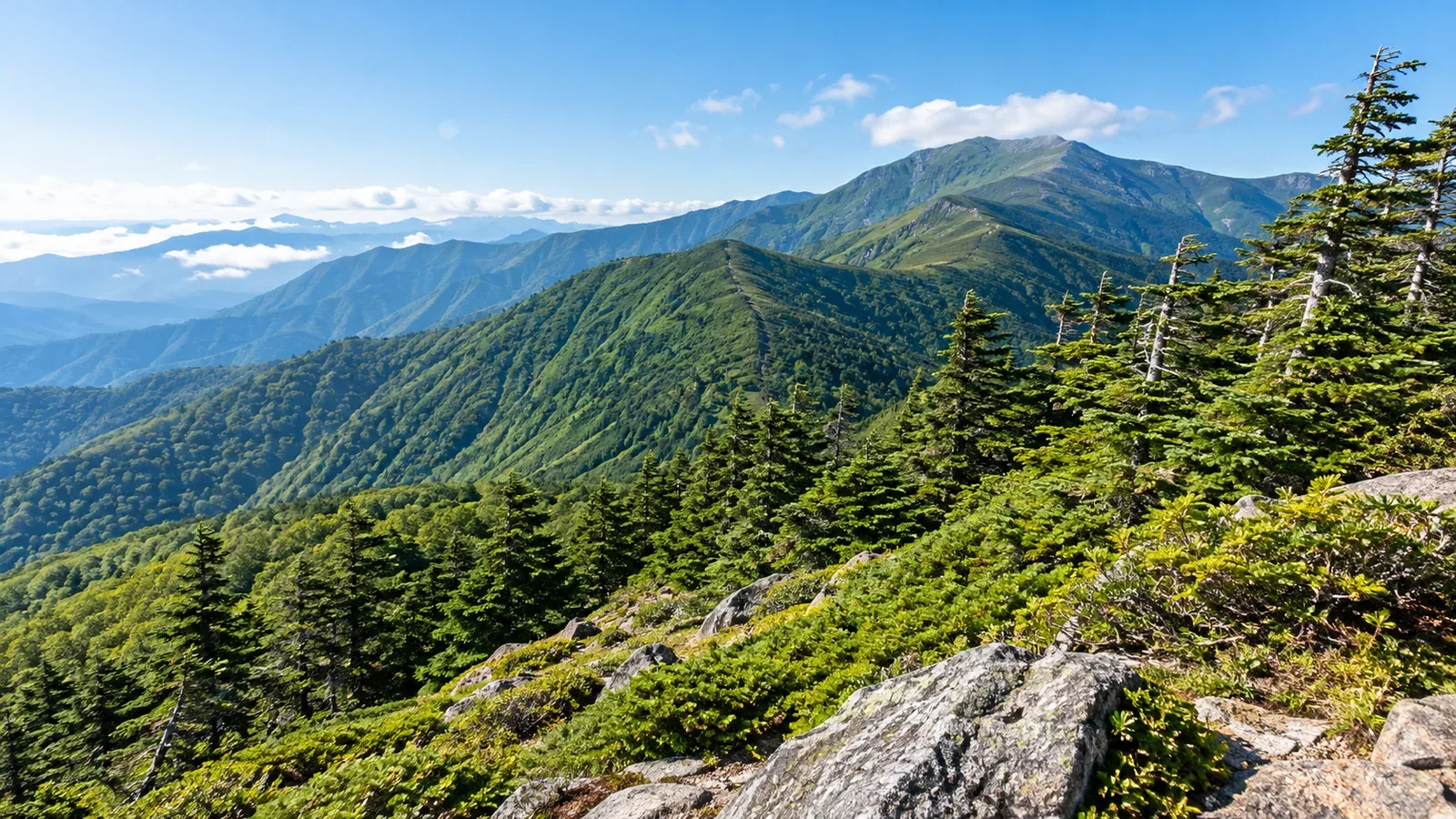
As you climb, broadleaf trees may thin out and conifers become more common. Higher up, the canopy gets lower, and shrubs or open grassland take the place of tall trees. The change in plant communities with elevation is called altitudinal zonation.
Even on the same mountain, forest boundaries shift with the direction a slope faces and the way snow lingers. A change in the types or heights of the trees tells you something about the slope you’re on.
Let’s look at the vegetation zones of central Honshu. Comparing them with Daisetsuzan and Yakushima reveals differences that elevation alone can’t explain.
Why vegetation changes with elevation
Temperatures generally fall as you climb. Winter cold, the length of the growing season, wind, snow cover, and soil depth all affect tree growth. Differences in sunlight and drainage can support different plants even at the same elevation.
Tall trees, for example, struggle on slopes exposed to strong winds. Siberian dwarf pines spread their branches along the ground. In winter, snow protects the parts it covers from wind. Where snow builds up can shape how trees and shrubs grow even on the same slope.
When the snow melts also determines how long plants have to grow. A hollow that holds drifts and a ridge where the wind strips snow away may support different plants at the same elevation.
The main vegetation zones of central Honshu
A Ministry of the Environment guide to Mount Haku uses about 500, 1,500, and 2,500 meters as boundaries in its diagram of central Honshu. These figures give a rough idea of where vegetation changes. In the field the boundaries shift from one mountain or slope to another, and several kinds of trees may grow together.
Lowlands and hills (foothills to about 500 meters)
In warmer areas you’ll find evergreen broadleaf trees such as Japanese white oak (Quercus myrsinifolia) and sudajii (Castanopsis sieboldii). In satoyama, the hills and woodlands around villages, secondary woods that grew back after wood harvesting and plantations of Japanese cedar or hinoki cypress still reflect how people used the land.
Montane zone (about 500 to 1,500 meters)
Deciduous broadleaf trees here include Japanese beech, mizunara oak, and maples. Light in the forest changes with the seasons. In spring, sunlight reaches the ground before the leaves open. In autumn the leaves turn color.
Higher up, conifers begin to mix into the forest in some places. The dominant trees may change gradually along the trail.
Subalpine zone (about 1,500 to 2,500 meters)
Conifers such as Veitch’s fir and Maries’ fir grow in the Northern Alps. Moss grows on the shaded forest floor. In windy spots you may see trees with most of their branches on the sheltered side.
Near the upper part of the subalpine zone, you may come across Erman’s birch with its light bark. It can grow among the conifers or in stands of its own on parts of a slope.
Alpine zone (from about 2,500 meters)
Beyond the treeline, tall trees no longer form a continuous forest. Here you’ll find low stands of Siberian dwarf pine, alpine grassland, and slopes of rock or gravel. The plants that grow on the grassland and among the rocks vary with soil moisture and the timing of snowmelt.
The treeline sits at different elevations on different slopes. Even on neighboring ridges, tall forest may extend farther on one slope than on another, depending on how wind strikes it and where snow lingers.
How Daisetsuzan and Yakushima differ
In Hokkaido’s Daisetsuzan, the mixed forest at the foot of the mountains gives way to conifers, then Erman’s birch, Siberian dwarf pine, and alpine plants. The landscape above the treeline appears at lower elevations than in the central Honshu example.
On Yakushima, south of Kyushu, subtropical plants grow near the coast. Higher up, you pass through evergreen oak and chinquapin woods and then mixed forests with ancient Japanese cedars known as yakusugi. Near the summits, wind-shaped scrub and Yakushima dwarf bamboo grassland take over.
The same elevation can support different plants in different parts of Japan. A regional field guide or a local sign can help you distinguish trees that look alike at first.
Reading changes in vegetation on a hike
Notice the height of the trees and how many are conifers, then compare what you see with the map and your altitude reading. Forest type alone gives little certainty about your position. Check for mapped features such as ridges or junctions as well.
Just below the treeline is a good place to decide whether to go onto the ridge. Beyond the shelter of the trees, you’ll feel more wind, and wind and rain can chill you.
- Check conditions on the ridge. Look up the wind and thunderstorm forecasts before you go. If you hear thunder, stay off the ridge and seek safe shelter such as a building promptly. Sheltering under a tree is dangerous.
- Keep a windproof and a warm layer handy. Pack them where you can reach them quickly, so you can add a layer while you’re still somewhere safe and sheltered.
- Review your turnaround time. If your pace or the weather is different from what you expected, check how much time you have left for the descent and where you can turn off before you head onto the ridge.
Pay attention to the ground as well. When a dirt path through the woods opens onto rock or gravel, the stride you’ve been using may no longer work.
Hiking to see how plants change
If you want to see a beech forest, look for a route that spends some time in it. For alpine flowers, check local reports for what’s in bloom and where you can see it from the trail.
In autumn the grasslands may change color at a different time than Erman’s birch or maple leaves. The best timing shifts with the slope and from year to year, so check the latest reports from huts or visitor centers.
Stay on the path even when photographing flowers and moss. Stepping around mud or crowds can damage plants and widen the trail. Take breaks in designated spots.
Try it on your next hike
Mark where you expect the forest to change or the tall trees to end. On the trail, look at tree height and the ground beneath you, and compare what you see with what you pictured from the map.
Sources
- Diagram of vegetation zones in central Honshu and the Mount Haku example (Japan Ministry of the Environment)
- Vegetation by elevation in the Northern Alps (Japan Ministry of the Environment)
- Vegetation in Daisetsuzan and Yakushima (Japan Ministry of the Environment)
- What to do if lightning approaches a ridge (Japan Meteorological Agency)
- Protecting alpine plants alongside trails (Japan Ministry of the Environment)
References and sources
- Japan Ministry of the Environment: Vegetation zones you can see as you climb
- Japan Ministry of the Environment: Features of Chūbu-Sangaku National Park
- Japan Ministry of the Environment: Features of Daisetsuzan National Park
- Japan Ministry of the Environment: Features of Yakushima National Park
- Japan Meteorological Agency: How to stay safe from lightning
- Japan Ministry of the Environment: Visitor management in Daisetsuzan National Park