
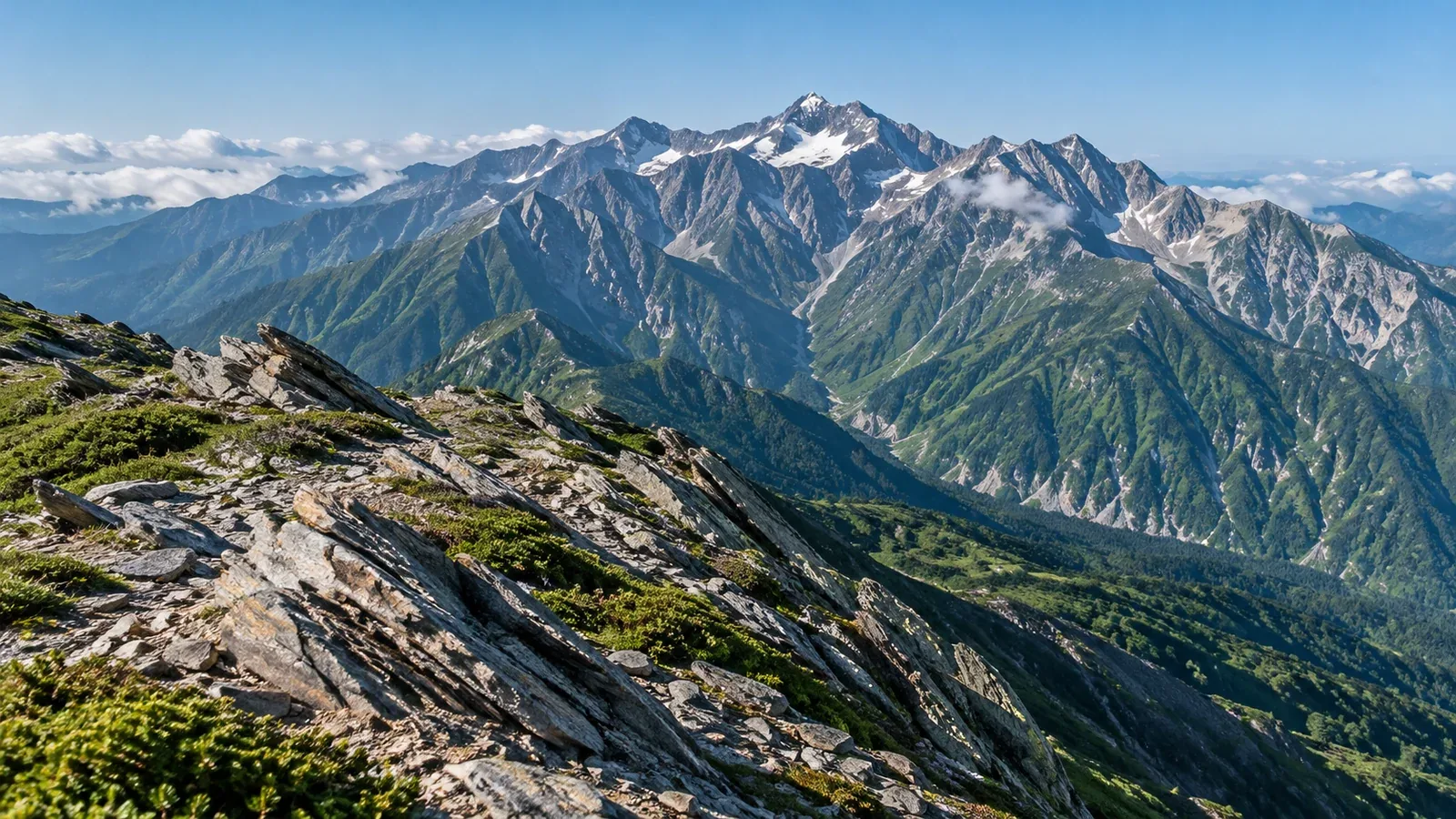
A deep valley opens below a rocky ridge, and tilted layers show on the slope. These landscapes reflect what happened after the rocks formed, as the land was lifted and worn away.
Tectonic plates are rigid slabs of the Earth’s outer shell, made of crust and part of the upper mantle. A movement of a few centimeters a year can, over long periods, fold rock layers, move faults and shape mountain ranges.
Several plates meet around Japan. How did the uplift of the Southern Alps, the deep valleys of the Northern Alps and the volcano of Mount Fuji come about?
What happens where plates converge
Subduction is the process in which a denser oceanic plate descends beneath another plate. The Pacific and Philippine Sea plates subduct around Japan. Some sediments and other materials from the ocean floor can be scraped onto the overriding plate, building an accretionary wedge.
When continents collide, rocks can fold or stack up along faults, thickening the crust. The Himalayas and Tibetan Plateau grew where the Indian and Eurasian plates collided.
In central Honshu, the Itoigawa–Shizuoka Tectonic Line separates areas with different geology and marks the western edge of the Fossa Magna. The collision of the Izu–Bonin arc, carried on the Philippine Sea Plate, with Honshu contributed to the rapid uplift of the Southern Alps.
Uplift: the upward movement of land
Uplift is the upward movement of land or bedrock. Compression can fold rock layers or push one side of a fault up, raising the bedrock.
Japan’s Ministry of the Environment dates the rapid uplift of the Southern Alps to about a million years ago and gives a present-day estimate of 3–4 mm a year. Rates vary by place and over time, and erosion continues alongside uplift.
The crust can also rise slowly after melting glaciers reduce the weight on the surface. Isostasy describes how the Earth’s rigid outer layer adjusts to changes in load.
Erosion carves valleys, eruptions build volcanoes
Rivers wear away rock and carry sand and stones downstream. Glaciers scour valley floors and slopes as they flow. Rockfalls and the movement of weathered fragments also reshape the land.
Even where bedrock rises, surface elevation also depends on how much erosion removes. A river can cut deep into a valley while a nearby ridge changes at a different rate.
Glaciers carve broad U-shaped valleys and bowl-shaped hollows called cirques near valley heads. Karasawa in the Northern Alps and Senjōjiki in the Central Alps preserve traces of glacial erosion.
At Mount Fuji, lava and fragments from eruptions piled up. The Geological Survey of Japan’s map dates the beginning of Fuji’s volcanic activity to about 100,000 years ago. Repeated eruptions since then built up the volcano. Subducting plates are also involved in the formation of magma beneath Japan’s volcanoes.
Landforms you can observe from the trail
Jagged ridges, rounded summits and deep valleys reflect the type of rock, erosion by rivers and glaciers, and movement of the land. Use what you see as a starting point and compare it with the surrounding terrain on topographic and geological maps.
At an outcrop visible from the trail, look for tilted or curved layers. You may see signs that sedimentary layers folded or tilted after they formed. Bands in rock can have other origins, so use a geological map to learn what type of rock you are looking at.
Some straight valleys form where a river erodes rock shattered along a fault. Along the Hime River in Itoigawa, you can follow the relationship between the landform and the Itoigawa–Shizuoka Tectonic Line on a map.
On unstable slopes or in areas with rockfall, follow signs and access restrictions. View outcrops from a safe position on the trail.
Comparing topographic and geological maps
Before a hike, use the contours in GSI Maps to find ridges and valleys, then check GeoNavi for the local rocks and faults. After the hike, match the locations of your photos to the map to connect what you saw with how it formed.
Sources for further reading
- GSI Maps shows the shape of ridges and valleys through contours and shaded relief.
- GeoNavi shows the distribution of rocks near the surface and the main faults.
- The Japan Meteorological Agency’s volcano information shows activity and alerts for volcanoes you plan to visit.
- The Ministry of the Environment’s national park guides give examples of landforms in each mountain area.
References and sources
- Geological Survey of Japan, AIST: geology and structure of the Japanese islands
- Geological Survey of Japan, AIST: how did mountains form?
- U.S. Geological Survey: understanding plate motions
- City of Itoigawa: Ōmi River jadeite locality and jadeite boulders
- Ministry of the Environment: features of Minami Alps National Park
- Kantō Regional Environment Office: the Southern Alps’ less familiar features
- Ministry of the Environment: features of Chūbu-Sangaku National Park
- Komagatake Ropeway: hiking routes in the Central Alps
- Geological Survey of Japan, AIST: Japan’s volcanoes and magma
- Geological Survey of Japan, AIST: Geological Map of Fuji Volcano, second edition, geological descriptions
- Geospatial Information Authority of Japan: GSI Maps
- Geological Survey of Japan, AIST: GeoNavi
- Japan Meteorological Agency: volcano information