
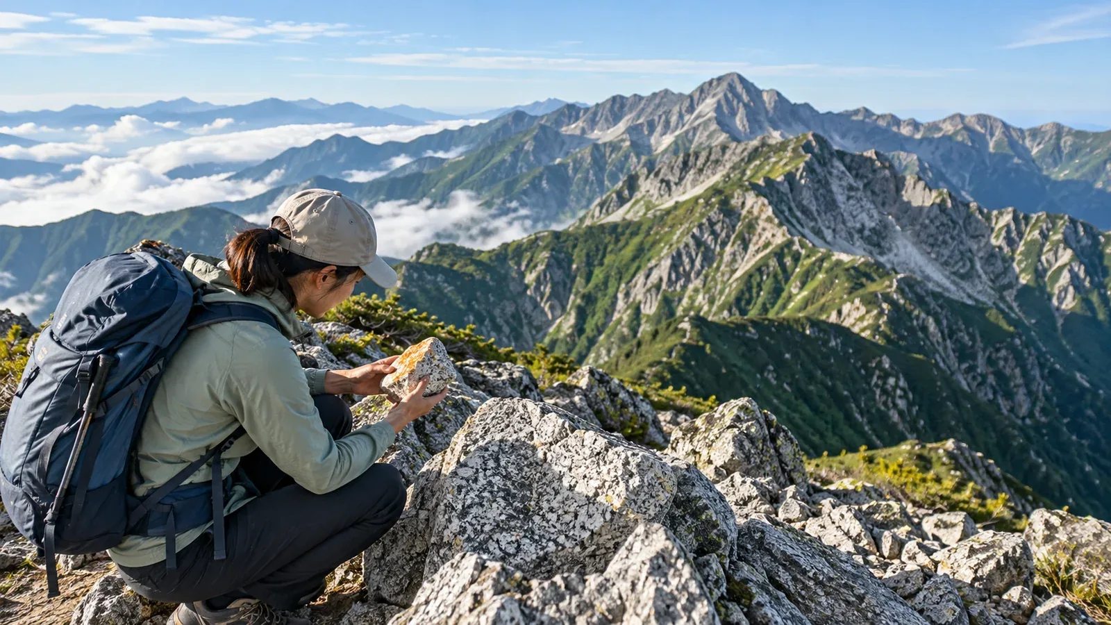
Pale rocks around Kisokomagatake, steep pinnacles in the Yari–Hotaka area and red chert in the Southern Alps catch the eye on hikes through the Japanese Alps. Knowing where these rocks formed and how they reached the surface reveals several layers of history along the same ridge.
On the trail, fractures, weathering, moisture and slope angle all affect footing, alongside the rock type. Here are features to look for when identifying rocks and conditions to check when deciding where to step.
Start by comparing the geology of the three ranges, then look at what can help you recognize granite and metamorphic rocks.
Geology of the three ranges
The Northern Alps are the Hida Mountains, the Central Alps are the Kiso Mountains, and the Southern Alps center on the Akaishi Mountains. Plate movements, volcanic activity, uplift and erosion have exposed different rocks in each range.
The Northern and Central Alps have granitic rocks, and the Northern Alps also have volcanic and metamorphic rocks. The main ridge of the Southern Alps includes extensive accretionary complexes containing rocks formed in the ocean, such as sandstone, mudstone and chert.
Granite: magma that cooled underground
Granite is an intrusive rock formed when magma cools slowly underground. You can see crystals of feldspar, quartz and biotite, and the rock may be pale or light pink. In the Central Alps, Kisokoma Granite makes up a large part of the main ridge.
Rocks formed underground are exposed when the land rises and erosion removes the overlying rock. In the Northern Alps’ Yari–Hotaka area, you can see granitic rocks alongside welded tuff, made of hot volcanic material that settled and fused.
Look at rocks underfoot and slopes where granite is mapped.
- Pinnacles and rocky ridges. Erosion and fractures can leave jagged ridges. Volcanic rocks can form pinnacles too, so compare the shapes with a geological map.
- Loose grains from weathered rock. As granite breaks down, it can produce coarse sand known in Japan as masa. On a slope, loose grains can move under your boots and cause a slip.
- Joints in the rock. Where fractures known as joints intersect, blocks may detach. Avoid stopping beneath cliffs and follow local rockfall warnings and closures.
Metamorphic rocks and rocks from the seafloor
Metamorphic rocks form when heat or pressure changes the minerals or texture of older rocks. The sandstone, mudstone and chert that make up much of the Southern Alps’ main ridge originated in material deposited on the seafloor. As plates subducted, parts of the accretionary complexes containing those rocks were carried underground and metamorphosed.
In the Sanbagawa metamorphic belt, crystalline schist formed under relatively low temperatures and high pressure. Foliation is the planar texture produced when minerals align.
In the Central Alps, rocks of the Ryoke metamorphic belt occur alongside granitic rocks that intruded into them. The belt is known for rocks metamorphosed under relatively high temperatures and low pressure.
The surfaces and colors of schist and other rocks offer clues to their identity.
- Splitting along foliation. Rock may detach where foliation dips down the slope or intersects other fractures.
- Rock polished by streams. Flowing water can smooth rock surfaces. Wet rock and algae also affect grip, so look at the actual footing.
- Dark or green rock. The color of schist depends on the minerals it contains. Look at the mineral alignment and fracture patterns as well.
Observing rocks from the trail
At an outcrop, find a safe spot on the trail and compare color, grain and fracture shape.
Look at color and crystals
- Color. White or light pink feldspar, grayish quartz and dark mica are common in granite. Schist may be green, black or silvery gray, depending on its minerals.
- Crystal arrangement. Granite shows grains of several minerals. Schist may have mica or other minerals aligned in one direction.
- Fracture pattern. Granite can break into blocks along joints. Schist can split into slabs along foliation.
- Shine. Rock with mica may have surfaces that reflect light.
Compare the terrain with a geological map
Use pale rocky ridges or flat slabs in streams as starting clues, then look up the rocks in GeoNavi. Compare with GSI Maps contours to see how the mapped rock units relate to ridges and valleys.
When a rock is hard to identify
Some metamorphic rocks started out as granite, and rocks such as gneiss can show prominent bands. If you cannot identify a rock, record its color, grain and fractures to look up later. Judge your footing by loose stones, moisture, slope angle and other conditions you can see.
What to check on rock, beneath cliffs and at streams
Even on the same rock type, weather and slope conditions change how easy it is to walk.
Wet rock. Moisture, fine sand or mud on the surface can make a boot slip. Check where you can place your hands and feet, and turn back if you cannot pass safely.
Rockfall sections. If you see cracks or fresh fallen rock, check the slope above and heed local notices. Stay out of closed sections.
Stream crossings. Check the depth, current, wet footing and whether you can climb out on the other side. If the water is high after rain or you cannot tell how to cross safely, turn back.
Open a map before your next hike
Look up the area in GeoNavi and check its ridges and streams in GSI Maps. After the hike, match your photos to their locations on the map to connect the rocks you saw with the history of the range.
Sources for further reading
- Geological Survey of Japan district maps show the rocks around Tateyama, Kiso and Yarigatake.
- GeoNavi shows the distribution of strata and rock types.
- GSI Maps shows ridges, valleys and slope steepness.
- The Ministry of the Environment’s national park materials cover Southern Alps geology and local trail guidance.
References and sources
- Geological Survey of Japan, AIST: geology of the Tateyama district
- Geological Survey of Japan, AIST: Kisokoma Granite
- Geological Survey of Japan, AIST: geology of the Agematsu district
- Geological Survey of Japan, AIST: geology of the Yarigatake district
- Ministry of the Environment: features of Minami Alps National Park
- Geological Survey of Japan, AIST: geology and structure of the Japanese islands
- Geological Survey of Japan, AIST: rock classification
- Geological Survey of Japan, AIST: GSJ Chishitsu News, vol. 14, no. 4
- Geological Survey of Japan, AIST: GeoNavi
- Geospatial Information Authority of Japan: GSI Maps
- Ministry of the Environment: precautions for hiking via Tokugō Pass