
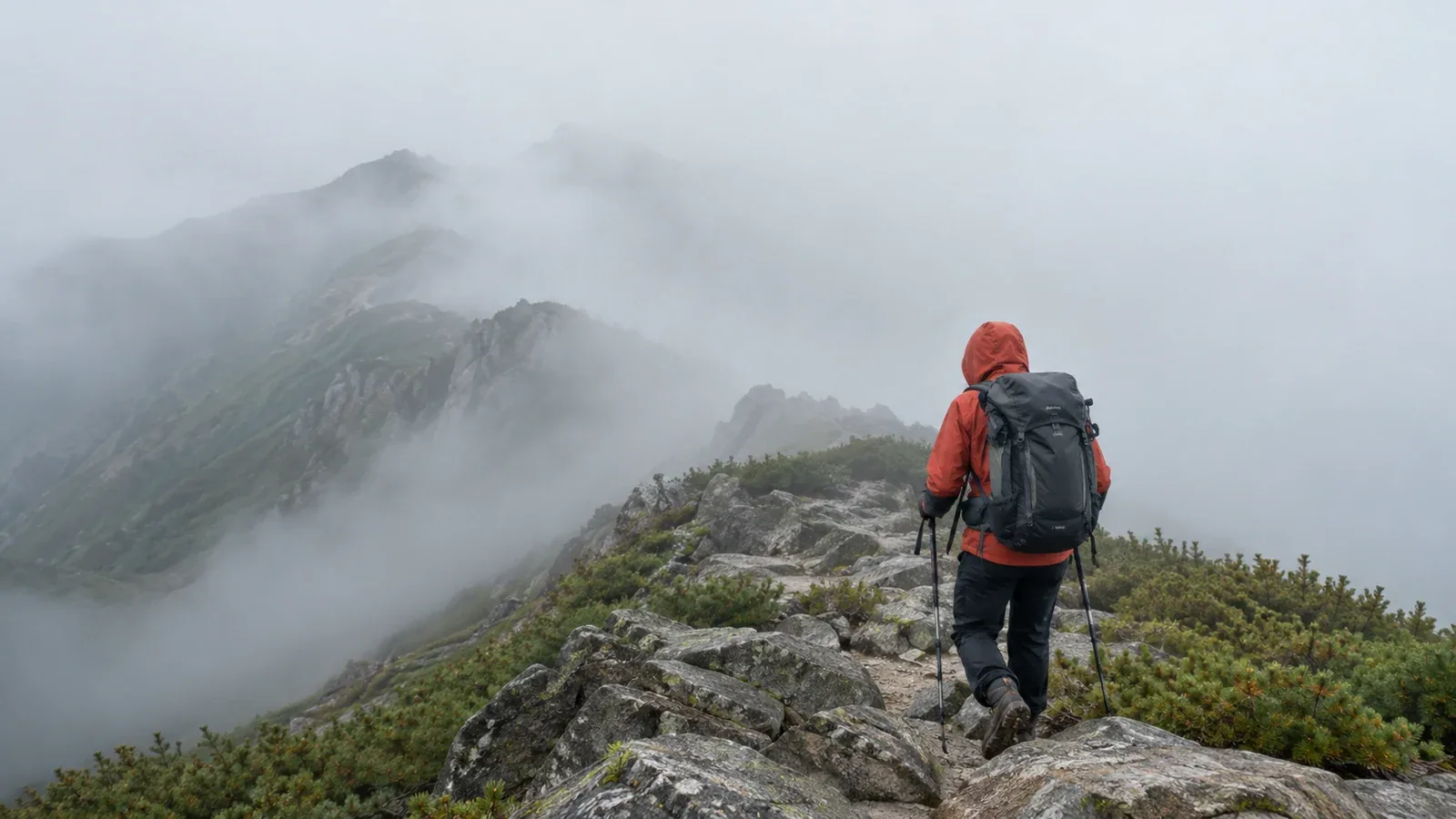
A hike can start in sunshine and reach a ridge hidden in cloud. In Japan, hikers often call this gasu, from the word “gas.” Poor visibility makes it easy to miss a junction or lose track of a drop, while damp and wind can make it harder to stay warm.
Understanding fog helps you plan when and where you might meet it. On the trail, base your decision on your confirmed position, the terrain ahead, how the weather is changing and how easily you can get back.
What hikers call fog on the mountain
The Japan Meteorological Agency (JMA) uses fog for conditions in which tiny suspended water droplets reduce horizontal visibility below 1 km. Hikers may meet it as fog forming near the ground or by walking into a cloud that touches the mountain.
Radiation fog can form when the ground cools overnight and chills moist air near the surface. It often collects in valleys or basins and can look like a sea of clouds from above. It may thin after sunrise, but its timing varies.
Low cloud on the mountain can cover the ridgeline as it moves in. Moist air forced up a slope can also cool and condense, creating cloud on the mountain. Fog around a summit can accompany several weather patterns, including those with thunderstorms.
Steam fog can form when colder air passes over warmer water and moisture condenses in the air. You may see it just above a pond or other body of water.
You can use these patterns to anticipate poor visibility. How far you can see and what terrain you need to cross matter more for the decision on the ground than identifying the type of fog.
When fog or low cloud is more likely
The timing depends on the region, season and weather. Before setting out, check regional forecasts and warnings and a mountain forecast that covers your elevation and expected times.
Early mornings. Cooling overnight can produce fog in valleys and at trailheads. Dew on plants can also wet your clothes as you pass. Keep rain protection accessible and put it on as conditions warrant.
Warm days. Heating can help clouds build if the air is moist and unstable. Poor visibility, showers and thunder can develop at different times of day. If storms are forecast, plan to leave exposed ground with time to spare, or choose another plan.
Approaching fronts or lows. Cloud can cover the ridgeline, and wind or rain can increase. Check the expected cloud base, visibility, wind and temperature together when the forecast provides them.
What poor visibility changes
Visibility can vary over short distances and change quickly. A short stretch of fog can conceal terrain that matters.
Losing the route. Trail signs, junctions and the edges of slopes can disappear. An obvious-looking track can lead off route, particularly on rocky ground or where several tracks meet.
Getting cold. Damp clothing and wind increase heat loss. If the group slows down or stops, check how everyone is doing and add windproof and insulating layers while you can do so safely.
Pressure to keep moving. Uncertainty and fatigue can lead people to follow a guess. Agree as a group to pause and check whenever the terrain and map do not agree.
What to do when visibility drops
Take these steps from a safe spot. If you hear thunder or see lightning, get away from exposed ground toward suitable enclosed shelter as soon as you can move safely.
Stop and confirm where you are
Stop on stable ground away from drops. Compare the map and compass with the trail, slope and last confirmed feature. Use an offline map or GPS as a cross-check, and carry a paper map and compass. When you know where you are, identify the next unmistakable checkpoint and what lies between you and it.
Check how the weather is changing
Cloud movement and visibility can tell you what is changing now. The sky you can see cannot reliably tell you when the cloud will lift or whether a storm is coming. Use forecast updates if available and reassess whether the route still gives you a safe way back.
Stay warm while you decide
Put on insulation and protection against wind and rain before you become chilled. Choose a protected, stable place for a stop when possible, and have food and water as appropriate. Pay attention to persistent shivering, clumsiness or confusion and seek help if you cannot keep someone warm and get them down safely.
Decide whether to continue, turn back or get help
Treat any of the following as a reason to stop and reassess. Return by a known, safe route where possible. If you cannot locate yourself or move safely, avoid guessing a descent. Shelter as best you can and call for help when needed.
- Your location is uncertain or the terrain does not agree with the map.
- You hear thunder, see lightning or would have to enter exposed ground with a storm approaching.
- Wind and wet clothing are making it difficult to keep someone warm.
- The next stretch has no reliably identifiable checkpoint, or it leads near steep ground you cannot assess.
- Fatigue, hunger or loss of concentration is affecting someone’s ability to navigate or move safely.
Continue only if you can confirm the conditions below and reassess at each checkpoint.
- You know where you are and can identify the marked route.
- You can follow the next leg without relying on guesses about drops, junctions or footing.
- The weather gives you enough margin to cover that leg and return, and everyone can stay warm.
- You have a known, usable route to turn back or shorten the trip.
Agree on when to stop before setting off. Reconfirm your location at junctions and whenever the conditions change.
Preparing for low visibility
Make a plan that still works if a cloud covers the next ridge or hides a familiar landmark.
Check the latest forecasts for low cloud, visibility, precipitation and wind. Save an offline map, carry a paper map and compass, and practise checking your location in clear weather first. Note junctions, slope changes and retreat routes before you need them.
Carry a waterproof jacket and trousers and insulation suitable for the conditions, even if the forecast is fair. Keep them accessible so you can add them before reaching exposed ground or becoming cold.
Put it into practice
Before your next hike, mark a ridge or junction where fog would make navigation harder, then pick a definite checkpoint and a safer alternative. Nordwand’s Base Camp is a place to exchange local observations with other hikers. You can also practise navigation with an experienced group or a qualified guide.
Sources
- Japan Meteorological Agency and UK Met Office: fog, low cloud and forecasts
- Mountaineering Scotland and Nagano Prefectural Police: navigation and getting back on route
- US CDC and Japan National Police Agency: cold exposure and mountain incident statistics
References and sources
- Japan Meteorological Agency: terminology for fog and visibility
- Nagano Local Meteorological Office: fog formation and types
- UK Met Office: how fog forms
- UK Met Office: guide to mountain forecasts
- Japan Meteorological Agency: lightning safety
- Mountaineering Scotland: what to do when navigation goes wrong
- Mountaineering Scotland: using smartphones and GPS for navigation
- Nagano Prefectural Police: mountain rescue case study on route finding
- US Centers for Disease Control and Prevention: preventing hypothermia
- Japan National Police Agency: mountain incident statistics