
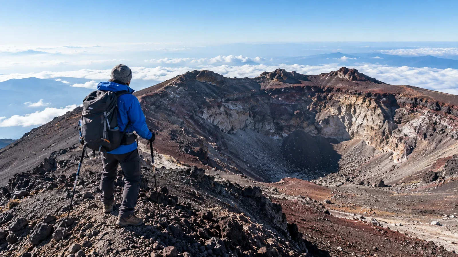
From the top of Mount Fuji, you can follow a trail around the crater. This is Ohachimeguri, a roughly 3 km loop around a crater about 780 m across at its widest. Kengamine, Japan’s highest point at 3,776 m, rises on the southwest rim.
If your plan was to head straight down when you reached the top, the loop can be tempting. Here’s how to estimate the extra time, what the approach to Kengamine is like, and what to check before setting out.
Where to start and how long to allow
The Yoshida and Subashiri trails reach the rim near Kusushi Shrine, and the Fujinomiya Trail reaches it near the inner sanctuary of Fuji Sengen Taisha. The Gotemba Trail meets the rim on the south side. The loop is about 3 km, with stretches of loose volcanic gravel and rock.
The official estimate is about 90 minutes of walking. Add time for stops, queues and the pace of your slowest companion. Above 3,700 m, you may get out of breath sooner than expected, and gusts or poor footing can slow you down considerably.
The top of your ascent route and the summit of Kengamine are separate points. Kengamine is closer to the top of the Fujinomiya Trail than to Kusushi Shrine. Check a summit map for your starting point and direction, and use your pace on the day to decide how far to go.
The approach to Kengamine via Uma-no-se
The steep slope just below Kengamine is called Uma-no-se, or “Horse’s Back.” Loose gravel can slide underfoot, especially on the way down. Check the grip on your boots before the trip and stay on the marked trail.
Take particular care on this stretch.
- Use short, controlled steps and look for firm footing before putting your weight down.
- Use poles only if they help you stay balanced. Keep away from the edge and never rely on the safety fence as a handrail.
- Leave space between hikers. If people are queuing, move when you have a clear place to step.
- Take your time on the way down. Turn back from a safe spot if the slope, wind or traffic makes it difficult to move securely.
At the summit, a stone marker identifies Kengamine as Japan’s highest point. A photo queue can add time. Decide in advance how much of your schedule you can spend there.
When to skip the loop
Decide at the rim based on the weather, your condition and the time and energy you have left. Reaching the end of the ascent trail is already a good point to start down.
Skip the loop if you notice any of these signs.
- Headache, nausea or unusual fatigue that could indicate altitude sickness
- Gusts that make it hard to stand or walk steadily
- Thunder, approaching storm clouds or fog that hides the trail
- Too little time to finish the loop and get down safely with time to spare
- Snow or ice you cannot cross safely, or a closure notice
If you feel ill, stop in a safe place and tell your companions. If symptoms are mild and you can walk safely, descend with someone. If symptoms persist, are severe or prevent a safe descent, call 110 or 119 for help.
Check conditions the day before and again before leaving. Use Japan Meteorological Agency warnings and summit forecasts linked by the official Mount Fuji climbing site. Check again at the rim. A clear trailhead can coincide with high winds at the summit.
Opening dates and restrictions
The crater rim has its own opening schedule. In 2026 the full loop opened from July 10 to September 10, after the Yoshida and Subashiri trails had already opened. The provisional dates for the 2027 climbing season do not confirm when the rim itself will open. Follow all closures, including in snow or after the season.
Confirm the trail and facility status for your own dates through the official Mount Fuji climbing site and prefectural notices. A walking trail can open on a different schedule from the summit toilets, huts or post office.
Leave enough time and energy to descend
Once you reach the rim, check whether everyone is warm, steady on their feet and able to eat and drink. Several hours of ascent can leave you with less energy for a rocky loop and a long descent than you expected.
Budget for the descent first. Official walking estimates from the rim range from 2 hours 40 minutes to 3 hours 35 minutes, depending on the route, before breaks. Add a margin for fatigue, delays, daylight and your last bus. At junctions, check the name and color of your planned descent route.
Plan the ascent, optional loop and descent together. Set a turnaround time that protects your descent schedule, then revisit it at the rim based on how the climb went.
Before your hike
Check the opening notices and summit forecast, download the summit and descent maps, and check your boots and warm layers. On a first visit, consider going with a qualified guide or a companion who knows the route.
Sources
- Official Mount Fuji climbing site: Ohachimeguri and summit facilities
- Yamanashi Prefecture: official Mount Fuji guide and summit map
- Official Mount Fuji climbing site: full crater rim opening notice for 2026
- Official Mount Fuji climbing site: summit weather and emergency guidance
References and sources
- Official Mount Fuji site: crater rim walk
- Yamanashi Prefecture: distance around the crater rim
- Yamanashi Prefecture: summit map
- Full crater rim opening notice for 2026
- Trail and facility opening schedules
- Official walking estimates for the four routes
- Summit weather and advisories
- In case of emergency
- Planning for the next climbing season