
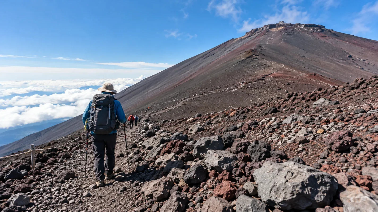
The Fujinomiya Trail is the shortest of Mount Fuji’s four summit routes by distance. It also starts highest and has the smallest elevation gain of the four. The trail climbs steeply on rock, and you return on the same path. Allow time and energy for the descent.
Use this guide to compare the terrain, prepare for the high start and decide when to turn around. Confirm trail opening dates, entry rules and transport for the season you plan to climb.
A high trailhead and a steep, direct route
Fujinomiya’s 5th Station is at about 2,400 m. The official route guide lists roughly 1,320 m of elevation gain to the summit area and 4.3 km each way. The path covers that rise over a short distance. Official walking estimates are 5 hours 10 minutes up and 2 hours 40 minutes down, excluding breaks.
The section to the 6th Station is relatively gentle. Above it, the trail gets steeper with rock and hard ground, and it becomes rougher farther up. Plan for careful foot placement and slower movement where traffic meets on the narrow path.
How the four trails compare
Look at footing, services and return options as well as the distance. The official route guide has maps for all four trails.
- Fujinomiya: The shortest, with steep rocky stretches and a shared ascent and descent path.
- Yoshida: The most popular, with many huts on the climb and a designated descent route.
- Subashiri: A forested start and a descent that includes the loose-gravel Sunabashiri. Its upper sections are shared with Yoshida.
- Gotemba: The longest and greatest elevation gain, with relatively few huts and long stretches of loose volcanic gravel.
You descend the same steep rocks you climbed on Fujinomiya. Yield to uphill hikers where you can do so safely, and wait for space to pass in narrow areas. Leave time for a controlled descent, even if the distance looks short.
What to check before choosing Fujinomiya
Opening dates, entry and transport
In 2026 the route above the 6th Station opened on July 10 at 09:00 and closed on September 10 at 17:00. Shizuoka charged ¥4,000 and required a safety lesson and entry procedures. Hut reservations were required for entry between 14:00 and 03:00. During the 2026 private-car restriction, from July 10 at 09:00 to September 10 at 18:00, drivers transferred at Mizugatsuka to a shuttle or taxi. The 2027 season is tentatively early July to early September, with exact dates and route rules to be announced. Check both notices before booking.
Allow for altitude from the start
A bus or car brings you directly to about 2,400 m. The official Mount Fuji site suggests resting for about one to two hours near the 5th Station. Allow time to adjust and then climb slowly. A break at the start cannot replace gradual ascent and monitoring for symptoms.
Stop ascending if headache with nausea, dizziness or unusual fatigue develops after gaining altitude. Descend safely if symptoms worsen or fail to improve. Confusion, inability to walk steadily or breathlessness at rest calls for urgent help and descent with assistance where safe. Alert companions or hut staff, and call 110 or 119 in Japan if rescue is needed.
Essential gear
Even in summer, the upper mountain can be cold, wet and windy. Prepare for an unplanned stop as well as continuous walking.
- Warm layers and windproof, waterproof outerwear: Keep a dry insulating layer ready for cold stops.
- Hiking footwear: Choose secure-fitting footwear with grip for rock and loose gravel.
- Headlamp: Bring a hands-free light and backup power even if you plan to return in daylight.
- Water and food: Carry enough for the trip and delays. Check hut operating hours before counting on purchases.
- Trekking poles if you use them: They can assist balance on suitable ground. Stow them when you need your hands or when they make passing difficult.
Decisions on the trail
Keep a sustainable pace
Start slowly and make sure everyone can keep up comfortably. Ease off when breathing becomes hard or footing demands more attention. Adjust your plan based on the group’s pace rather than chasing a timetable.
Take short breaks in safe places. Check for headache, nausea, unexpected fatigue or changes in balance. Allow extra time where the route becomes steeper and more exposed.
Set a turnaround point before you leave
Agree on a time and conditions for turning back. Worsening weather, symptoms, uncertain footing or a shrinking margin before darkness are reasons to stop and reassess. Descend by the signed route when it’s safe.
Wind and exposure increase near the upper stations and crater rim. Check official forecasts and trail notices before setting out, and reassess on the mountain. Avoid committing to the upper route if a storm is approaching.
Hut stay or day hike
An overnight stay can give you time to rest. Reserve directly and confirm the hut’s check-in time. Watching sunrise from a hut or another suitable location can avoid a push to the summit in the dark.
For a day hike, choose a start time that allows for the gate, transport, breaks, weather and a daylight descent. Avoid climbing overnight without sleep and reassess even on a clear morning if conditions change.
Descend the shared rocky path carefully
Save energy for steep rock, loose gravel and people coming uphill. Use the signed trail and stay within its edges.
- Use poles only where they help: Place them on firm ground, and stow them when the rock requires your hands.
- Look for solid footing: Put your foot down where it feels secure and transfer weight gradually.
- Take shorter steps on loose ground: Slow down rather than trying to slide or run.
- Take extra care on wet rock and in narrow sections: Keep room around you and pause at a stable place before passing.
Before you go
Check the official opening dates, fee, entry procedures and road restrictions for the season. Read the forecast the evening before and again on the day. Confirm your hut or day-hike schedule and return transport. Nordwand can help you find a guide if you want local advice on the route.
Sources
- Official Mount Fuji climbing website: Fujinomiya Trail
- Shizuoka Prefecture: entry rules and road restrictions
- Japan Meteorological Agency: forecasts and warnings
- CDC Yellow Book: altitude illness
References and sources
- Official Mount Fuji climbing website — Fujinomiya route description and access
- Official Mount Fuji climbing website — Seasonal opening and facilities
- Official Mount Fuji climbing website — Current season outlook
- Shizuoka Prefecture — Entry requirements
- Shizuoka Prefecture — Private-car restrictions
- Official Mount Fuji climbing website — Health and safety
- Japan Meteorological Agency — Forecasts and warnings
- CDC Yellow Book — Altitude illness