
Terrain and Cartographic Record
Erwin Schneider conducted field surveys between 1955 and 1963, and the Khumbu Himal map at 1:50,000 scale first appeared in 1965. Günter Seyfferth later prepared a reproduction of that map and gives 27°51′23″ N, 87°00′14″ E as the coordinate for East Col.
East Col and historic Sherpani Col each drain a distinct short glacial side valley descending eastward toward the Barun, while both passes open westward onto the broad shared ice of the West Barun Glacier basin. West Col sits on the opposite western rim of the same glacier trough, where the route descends toward the upper Honku valley.
Early Expeditions and the 1961 Traverse
George Lowe's 1954 New Zealand Alpine Club Barun expedition investigated routes across the region, building early knowledge of the glacier approaches. In April 1961 the Himalayan Scientific and Mountaineering Expedition conducted a high traverse across the glaciated plateau between West Col and a pass J. Harrison's account names East Col, then descended to the upper Barun. Romanes and Annallu reconnoitred West Col on 6 April, and Pemba Tensing and Pasang Tensing joined the team helping prepare the approach on 8 April.
Relay teams carried supplies across the glaciated plateau beyond West Col and built camp on a moraine terrace above Barun Glacier. Harrison records Hillary and Mulgrew accompanying the first Sherpa carry across the final stretch on 17 April, with the pass named East Col throughout that account as expedition nomenclature for the crossing.
Variable Naming in Modern Accounts
In October and November 2012, Jean-Claude Latombe crossed what he called Sherpani Col at an observed altitude of 6,146 m alongside Nyima Gyaltshen and Lhakpa, who helped guide the team across both that pass and West Col in a single day. The Japanese Alpine Club published a 2022 autumn traverse report in Yama no. 934 in March 2023, recording a crossing under the name Sherpani Col at 6,180 m and listing West Col at 6,190 m in a chapter covering three passes including Amphu Labtsa.
Peter Urwin's photograph 102 labels East Col at 6,146 m as a crossing separate from the saddle he recorded under the name Sherpani Col. Nepal's Department of Tourism lists West Col and Sherpani Col in an expedition access route that passes through Makalu Base Camp.
Eastern Rim Passes of the West Barun Glacier Basin
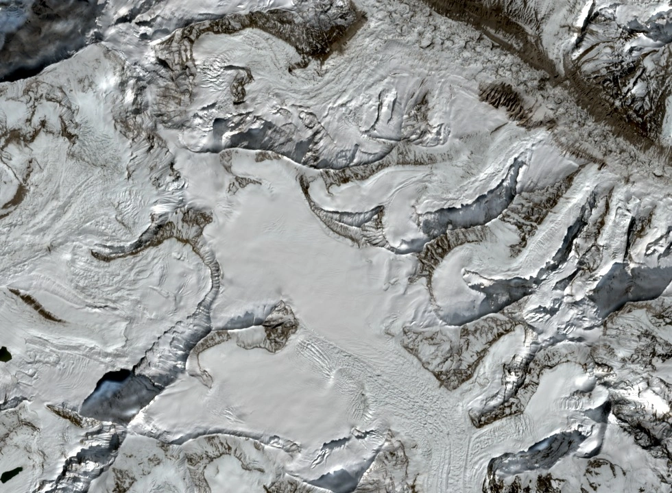
The Sentinel-2 true-colour image acquired on 13 October 2026 shows the broad ice of the West Barun Glacier basin filling the centre of the frame, with the eastern rim cut by two distinct notches and short glacial approaches descending eastward from each. Historic Sherpani Col lies approximately two kilometres southeast of East Col along the connected ridgeline, with the intervening elevated ridge section separating the two notches visible as continuous terrain.
A 1996 Himalayan Journal account of a Baruntse descent records the team leaving the high plateau, descending steep rock, crossing unstable moraine, and reaching a camp near the junction of glaciers below. The authors recorded the pass they crossed as Sherpani Col at 6,100 m, a figure distinct from both the 6,110 m cartographic label and the 6,180 m value appearing in later accounts.