
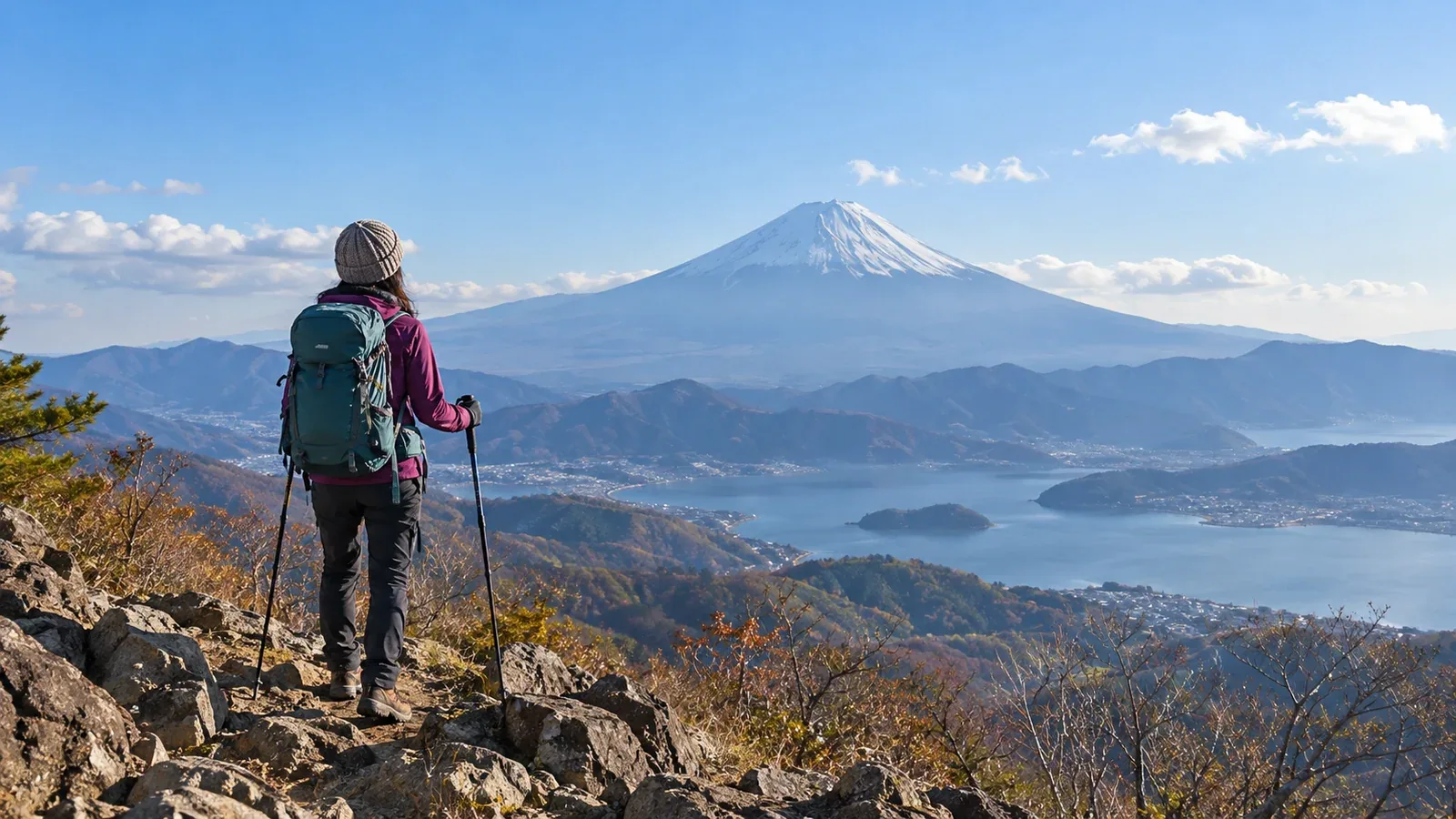
Some mountains in Yamanashi give a close view of Mount Fuji's broad slopes. Others put a lake in the foreground. Trees may cover the summit, and clouds or haze can hide the mountain. Choose a route with the weather in mind.
Use your fitness, transport and the season to choose a day hike with views of Mount Fuji. Here are some areas to consider and things to check before you set out.
Why Yamanashi has good views of Mount Fuji
Mount Fuji is a freestanding peak at 3,776 metres. On the Yamanashi side are Lake Yamanaka, Lake Kawaguchi, Lake Sai, Lake Shōji and Lake Motosu. Some viewpoints show Fuji above a lake. Others look over its lower slopes from a ridge.
Clouds, fog and haze affect how far you can see. Some days from autumn through winter have clear air, but cloud cover varies day to day. Use the forecast and local webcams.
Check how open the summit is. Some mountains have conifers blocking the view in the direction of Fuji. Look for descriptions of the view from the summit in hiking guides or trip reports.
Five criteria for choosing a mountain
1. Direction and obstructions
Find the bearing from the viewpoint to Mount Fuji on a map and check for intervening ridges or trees. Even if the summit is wooded, a lookout or ridge along the way may offer a view.
2. Elevation and viewing angle
Elevation, distance from Fuji and the intervening terrain affect the view. Choose a viewpoint for the scene you want, whether that is looking up at Fuji from lower ground or seeing its lower slopes or a lake as well.
3. Difficulty and walking time
Check total ascent, round-trip walking time and any rocky or chained sections, and compare them with a route you walked recently. For a first hike, choose a short route with known footing where you can turn back.
4. Transport
Some trailheads are accessible by public transport and others are easier by car. If a station on the Fujikyuko or JR Chūō Main Line is within walking distance, or a bus serves the trailhead, you can plan without a car. From a station you are still limited by the first and last trains, but a day trip can be easier to organise.
5. Crowds and time margins
Trails, lookouts and transport can get busy on days off. Plan backward from sunset and your return service. Allow time for breaks, queues and changes in pace.
Places to consider
These are examples. Consult municipalities, trail managers and trailhead notices for current times, elevation change, restrictions and access.
Mountains around the Fuji Five Lakes
Mount Mitsutōge is the collective name for Kaiun, about 1,785 metres, Osutaka and Kenashi. The route from Mitsutōge Station on the Fujikyuko Line and routes that use a bus from Kawaguchiko Station differ in walking time and ascent. Check the bus for your day and the route map.
Mount Ishiwari, 1,413 metres, is northeast of Lake Yamanaka. You can see the lake and Fuji from the summit. Ishiwari Shrine's boulder is along the way. Allow for the long staircase and steep slope above the shrine.
Mount Shakushi, about 1,600 metres, can be approached from Fujiyoshida and other areas. The summit looks toward Mount Fuji, its lower slopes and the Southern Alps. Check distance and footing from each trailhead before choosing.
Mountains in Ōtsuki and Tsuru
Mount Takagawa, 976 metres, has a route on foot from Hatsukari Station on the JR Chūō Main Line and an open summit. Allow for the walk to the trailhead as well as the ascent.
Mount Iwadono, 634 metres, can be reached on foot from Ōtsuki Station. Ōtsuki City says the trail from the Kowaze trailhead via Fureai-no-Yakata to the summit has been available since 25 December 2025. Older maps may differ from current conditions. Check the latest map for closures and rocky stretches.
Mount Kuki, 970 metres, has approaches from Kasei Station on the Fujikyuko Line and Saruhashi on the JR Chūō Main Line. Ōtsuki City identifies the Fujimidai viewpoint near the summit. Locate it and your route on the map.
Mount Kuratake, 990 metres, and Mount Takahata, 982 metres, are options for a traverse using Yanagawa and Torisawa stations on the JR Chūō Main Line. Check distance, footing, the exit and return trains. There are steep climbs and sections by streams.
Mountains in Daibosatsu and Okuchichibu
Mount Daibosatsu, 2,057 metres, is one of Japan's 100 Famous Mountains. You can see Fuji from the ridge near Daibosatsu Pass. Buses to Kamihikawa Pass run on selected dates. Check the timetable from Kai-Yamato Station. Prepare for wind and cold on the ridge.
Mount Kentoku, 2,031 metres, has several rocky and chained sections. Yamanashi City's guide to the route from Kentoku Park describes a bypass for the chain just below the summit. Assess your experience on rock and the day's conditions, including the other chains.
What to check before you go
On clear days from autumn into winter, still prepare for cold, strong wind, ice or snow. Check the following before leaving.
- Weather: check the Japan Meteorological Agency forecast and local mountain information the day before and that morning. Wind and temperature can differ between the foothills and the ridge.
- Trail conditions and closures: typhoons or heavy rain can damage or close trails. Check the latest information from Yamanashi Prefecture, local authorities or huts.
- Sunset: enter the place and date in the National Astronomical Observatory of Japan calculator. Terrain can make it dark earlier. Allow time to descend before sunset and reach your transport.
- Clothing and equipment: plan for wind, temperature and footing as well as elevation. Carry warm clothing and rainwear, and choose a different route if you cannot handle the snow or ice.
Next steps
Use your transport options and recent walking times to narrow the list to one or two mountains. Check trail notices and the Japan Meteorological Agency forecast before choosing a day. Look for hiking companions and route information in Nordwand's Base Camp and shared hiking logs.
References
- Japan Meteorological Agency weather forecasts
- National Astronomical Observatory of Japan sunrise and sunset times
- Yamanashi Prefecture and municipal trail and access notices
- National Police Agency and Yamanashi Prefectural Police mountain incident statistics
References and sources
- Yamanashi visitor guide: Mount Mitsutōge hiking routes
- Fujisanroku Electric Railway: Mitsutōge Station
- Fujikyu Bus: local buses from Kawaguchiko Station
- Yamanakako Tourism Association: Mount Ishiwari hiking route
- Yamanashi visitor guide: Mount Shakushi
- Ōtsuki City: Twelve Views of Mount Fuji hiking information
- Ōtsuki Tourism Association: Mount Takahata
- Kōshū City: hiking Mount Daibosatsu
- Eiwa Kotsu: 2026 Daibosatsu–Kamihikawa Pass bus
- Yamanashi City: Mount Kentoku from Kentoku Park
- National Astronomical Observatory of Japan: sunrise and sunset calculator
- Japan Meteorological Agency: weather forecasts