
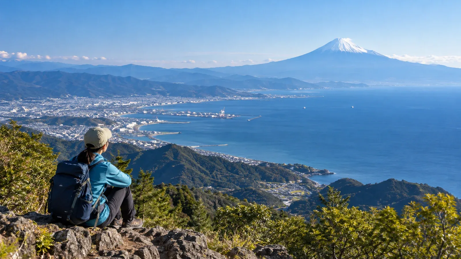
Some mountains in Shizuoka offer views of both Suruga Bay and Mount Fuji, 3,776 metres high. From some viewpoints you see Fuji across the water. From others, the sea and the mountain are in different directions.
Clouds, haze and the season affect the view. Here is how to choose a viewpoint and check transport, footing and weather for a first day hike.
When can you see both the sea and Fuji?
Reaching the summit does not guarantee a view. It helps to know what might obscure it before you plan.
The view of Mount Fuji depends on clouds around the mountain and between you and it. The summit can be hidden even when the forecast says sunny. On some days you can see it earlier, so check forecasts and local webcams for cloud cover when choosing a start time.
The view of the sea changes with haze and the direction of the light. The sea lies in different directions depending on the viewpoint. For photos, check the direction of the sea and the sun on a map.
Check the Japan Meteorological Agency forecast the day before and again in the morning. Use local webcams, where available, to check visibility toward Fuji and the sea.
How to choose an area for your first hike
Compare where the viewpoints are, what the footing is like, how much you will climb and how long you will walk.
Elevation and trail condition
Even paths with signs or boardwalks can have junctions and slippery sections. Check the latest notices from the municipality or trail manager. Choose a route with manageable walking time and ascent.
Elevation and views
Even a low hill can overlook both Suruga Bay and Mount Fuji if the viewpoint is open. Check the map for lookouts along the way as well as at the summit. Look at the ascent and footing separately from the summit elevation.
Viewpoints in Izu, on Fuji's southern slopes and along Suruga Bay
Shizuoka Prefecture stretches east to west, with different terrain and climate in each area.
On the Izu Peninsula, Darumayama Kōgen Rest House overlooks Mount Fuji across Suruga Bay. It is also a starting point for a walk to Mount Kinkan. If you take the bus from Shuzenji Station, check the times in both directions.
On the southern side of Mount Fuji, Iwamotoyama Park in Fuji City has viewpoints over the mountain and Suruga Bay. Locate the park's viewpoints on a map and choose how far you want to walk.
Along the Suruga Bay coast, Mount Mankanpō in Yaizu and Mount Hamaishi in Yui, Shizuoka City, have lookouts over Fuji and the bay. You can walk up Hamaishi from JR Yui Station. Yui Hamaishi Wakuwaku Forest along the route is the former Hamaishi Outdoor Centre. In Yaizu, check junctions and closures on the tourism association map.
What to pack
Even on low mountains in Shizuoka, mornings and evenings get colder from autumn onward and ridges can be windy.
Clothing: layer for wind and temperature. Wear quick-drying clothes and bring warm layers and rainwear.
Footwear: choose shoes that fit and grip wet rocks, roots and mud.
Water and food: carry your supplies and plan as if there were no shops or vending machines. Allow enough water for the walking time and temperature, plus a reserve. Snacks such as chocolate, nuts and energy gels are useful along the way.
Maps and navigation: bring an offline or paper map and prepare for your phone battery running out. See Shizuoka Prefectural Police guidance on how and where to submit a hiking plan.
On the day of the hike
These choices can affect the view and the rest of your outing.
- Choose a start time. On some days Fuji is visible in the morning. Use the cloud forecast, walking time and first available transport to plan your start.
- Check the forecast and local conditions. Check the Japan Meteorological Agency forecast the day before and in the morning. Look at clouds, wind and visibility as well as the sunny icon.
- Be prepared to turn back. If there is no view from the summit, consider another lookout or another day. A hike without a view is still a hike. Going off plan in search of a view can lead to an accident.
- Finish the descent before sunset. Check the National Astronomical Observatory of Japan calculator for your place and date. The terrain can make it dark earlier. Leave time for the descent and the return journey, and carry a headlamp.
Seasons and crowds
Some autumn days have clear air. Car parks and trailheads can get busy during the autumn colours. Check the footing, transport and sunset for your day.
Even on clear winter days, ridges can be windy and shaded stretches icy. Check the trail notices and choose a different route if you lack equipment or skills for the ice and slope.
Summer days are long, but heat and sun can be intense, and clouds can hide Fuji. Check the Ministry of the Environment's heat index and heatstroke alerts. Consider postponing or cancelling if dangerous heat is forecast.
Next steps
Pick a viewpoint and check the trail and transport with the municipality or trail manager. Look at the Japan Meteorological Agency forecast the day before and again that morning. Submit a hiking plan using the Shizuoka Prefectural Police guidance. In Nordwand's Base Camp, you can also ask people who hike nearby.
References
- Japan Meteorological Agency weather forecasts
- Shizuoka Prefectural Police hiking plan guidance
- Official Shizuoka Prefecture and municipal visitor and hiking information
- Geospatial Information Authority of Japan maps
References and sources
- Izu City: Darumayama Kōgen Rest House
- Izu visitor guide: Mount Kinkan and Kiyose Forest
- Fuji City: Iwamotoyama Park
- Yaizu Tourism Association: hiking map
- Shizuoka City: Mount Hamaishi
- Shizuoka City: Yui Hamaishi Wakuwaku Forest
- Fujinomiya Tourism Association: seeing Mount Fuji
- Japan Meteorological Agency: weather forecasts
- Ministry of the Environment: heat index and heatstroke alerts
- National Astronomical Observatory of Japan: sunrise and sunset calculator
- Shizuoka Prefectural Police: hiking plans
- Geospatial Information Authority of Japan: GSI Maps