
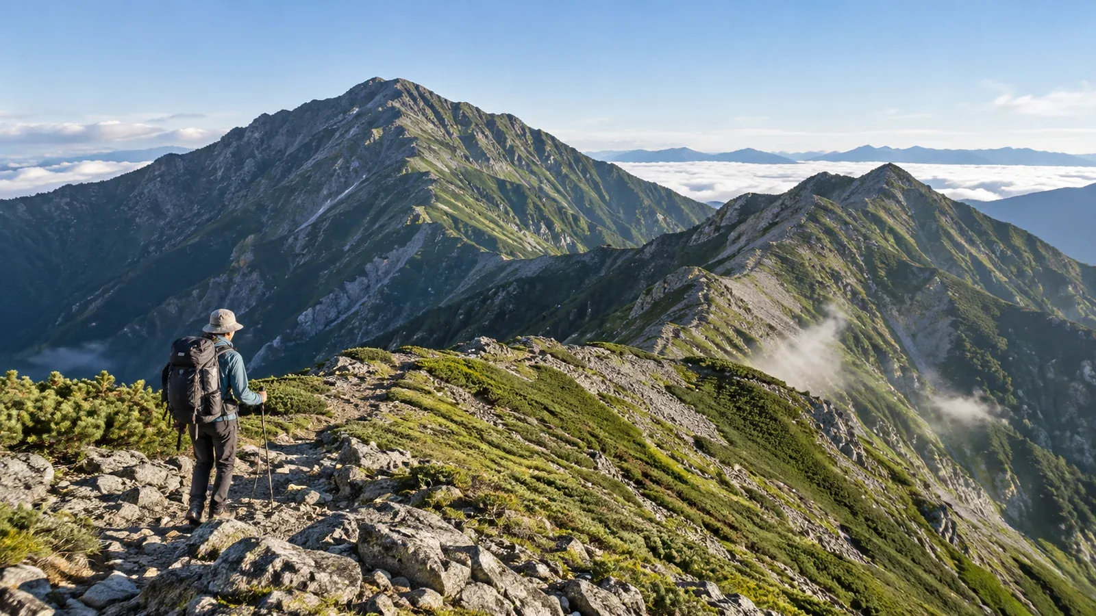
If you're planning your first traverse above 3,000 metres in Japan's Southern Alps, consider Kitadake (3,193 m) and Ainodake (3,190 m). Kitadake is Japan's second-highest peak, and Ainodake shares third place with Okuhotakadake. Start at Hirogawara, reached via Ashiyasu or Narada, and use Kitadake Sanso, a hut on the ridge, as a base for reaching both peaks in one trip.
This is an introduction to the Southern Alps for people who already have hiking experience. A ridge above 3,000 m calls for preparation for altitude sickness, changing weather and long days on foot. Here's how to assess your experience before planning and what to decide on the trail.
Experience to have before attempting the traverse
Before heading to Kitadake and Ainodake, consider your experience hiking at altitude, your endurance on long days and your ability to navigate and read the weather.
Experience acclimatising to altitude. When you're unaccustomed to altitude, you may develop a headache, fatigue or loss of appetite on ridges above 3,000 m. Going through the acclimatisation process on mountains such as Yarigatake or Yatsugatake’s Akadake can help you recognise changes in how you feel. If you develop symptoms that could be altitude sickness, stop ascending. If they worsen, descend promptly.
Experience hiking six to eight hours in a day. Shiraneoike Hut gives three to four hours uphill from the hut to the Kitadake summit. Add the sections from Hirogawara to Shiraneoike Hut and from the summit to Kitadake Sanso. Use Yamanashi Prefecture's segment maps to add up your chosen route and allow for breaks and delays. Make sure you can sustain the planned walking time with a pack.
Basic navigation and weather skills. When cloud covers the ridge, trail marks can be hard to spot in places. Learn to use a topographic map and compass, and check Japan Meteorological Agency forecasts, warnings and advisories alongside local information before setting out.
If any of these skills are still developing, build experience in the Yatsugatake range or on an introductory route in Japan's Northern Alps. You'll get more out of the Southern Alps when you go.
How to split up the route
You can plan this as a two-day, one-night trip or take three days and two nights. On a three-day schedule, you can sleep lower the first night and adjust the following day's route according to how you feel and what the weather is doing.
Two days and one night
On day one, climb from Hirogawara to Kitadake Sanso. On day two, hike to Ainodake and back, then descend to Hirogawara. Day one is long and takes you straight up to a sleeping altitude of 2,900 m. Day two is long too, so set a turnaround time for Ainodake and check the return transport from Hirogawara in advance. Rearrange your trip if you can't get a booking at Kitadake Sanso.
Three days and two nights
On day one, climb to Shiraneoike Hut (about 2,236 m) and see how you feel. On day two, cross Kitadake and reach Kitadake Sanso, then make the out-and-back trip to Ainodake if time and weather allow. On day three, descend to Hirogawara. Continuing over Notoridake and down to Narada changes the finish and the stages, so plan that traverse separately.
Both Kitadake Sanso and Shiraneoike Hut require advance bookings for hut stays and camping. Opening dates vary by year, so check the current official information.
Getting to Hirogawara and knowing the restrictions
The roads to Hirogawara have private vehicle restrictions on both the Ashiyasu and Yashajin side and the Narada side. In hiking season, use a bus or taxi. Shared taxis also run from Ashiyasu. Outside the operating period, the roads are generally closed to vehicles. Heavy rain can stop bus and taxi services too.
Bus departures from Ashiyasu, on the Yamanashi side, are limited. Missing the first one means a later start from Hirogawara, less time to walk on day one and a tighter window for checking in at the hut.
Check operating dates, timetables and fares with Yamanashi Kotsu or your transport operator, and check road status with Yamanashi Prefecture. Services vary by date, so confirm both the outward and return journeys.
Decisions on the ridge
The usual route from Hirogawara to Kitadake goes via Shiraneoike Hut and up Kusasuberi. The Minami-Alps City Ashiyasu Mountain Museum lists the lower Okanbasawa route, from Hirogawara to Futamata, as closed. Even if it appears on an older map, leave it out of your itinerary and check the latest trail notices before leaving. When snow is still lying, ask the huts about snow conditions even on open trails.
The ridge from Kitadake to Ainodake may look gentle on the map, but repeated climbs and descents make it more tiring than the distance suggests. Kitadake Sanso gives a one-way estimate of one and a half to two hours from the hut to Ainodake. For the return trip, allow for breaks and account for your condition, wind and visibility. If you're continuing towards Notoridake, the long descent to Narada requires a separate plan.
How to make weather decisions. Thunderclouds can build in the summer afternoon, but lightning is possible earlier as well. Check the Japan Meteorological Agency forecast and local information the day before and on the morning of your hike. Set times for reaching the ridge and turning back. If you hear thunder or see lightning, leave summits and ridges and quickly seek safe shelter, such as inside a building.
Equipment priorities
On a ridge above 3,000 m where the temperature can change sharply even in summer, prioritise the following equipment.
Warmth and wind protection
It can get cold on the ridge even in summer, and the wind makes it feel colder. Carry insulating layers such as a fleece or light down jacket, plus a windproof outer layer. Rainwear alone may leave you cold when you stop for a break or an unexpected delay.
Rainwear
The Southern Alps are known for high rainfall. Bring a breathable waterproof jacket and trousers, and remember your pack cover.
Food and water for the trail
Places to refill are scarce along the ridge. Water is available at Kitadake Sanso when it is open, but ask the hut about availability and conditions before you set out. Use the map and hut information to calculate how much to carry, and drink regularly while walking.
Headlamp and time to spare
Test your headlamp before leaving and carry spare batteries. Give yourself a generous start and plan to arrive at the hut in daylight.
What to do next
Review your experience and consider the three-day route via Shiraneoike Hut or the two-day route with a night at Kitadake Sanso. Check this year's official information for hut openings and bookings, trail and road restrictions, and the return transport. You can also exchange information in Nordwand's Base Camp with hikers who've walked the same route.
References
- Yamanashi Prefecture and Minami-Alps City Ashiyasu Mountain Museum (route maps and closures)
- Kitadake Sanso and Shiraneoike Hut (opening dates, reservations and walking times)
- Yamanashi Prefecture and Yamanashi Kotsu (road restrictions and buses)
- Japan Meteorological Agency and Ministry of Health, Labour and Welfare Quarantine Stations (weather and altitude sickness)
References and sources
- Geospatial Information Authority of Japan | Elevations of Japan's major mountains
- Yamanashi Prefecture | Southern Alps route segment maps and grades
- Minami-Alps City Ashiyasu Mountain Museum | Okanbasawa closure and trail information
- Yamanashi Prefecture | Southern Alps private vehicle restrictions and road conditions
- Yamanashi Kotsu | Hirogawara bus schedules and fares
- Kitadake Sanso | Walking times and hut opening information
- Kitadake Sanso | Water supply and facilities
- Shiraneoike Hut | Elevation, walking times and opening information
- Japan Ministry of Health, Labour and Welfare Quarantine Stations | Altitude sickness symptoms and response
- Japan Meteorological Agency | Weather and hazard information
- Japan Meteorological Agency | How to stay safe in a thunderstorm