
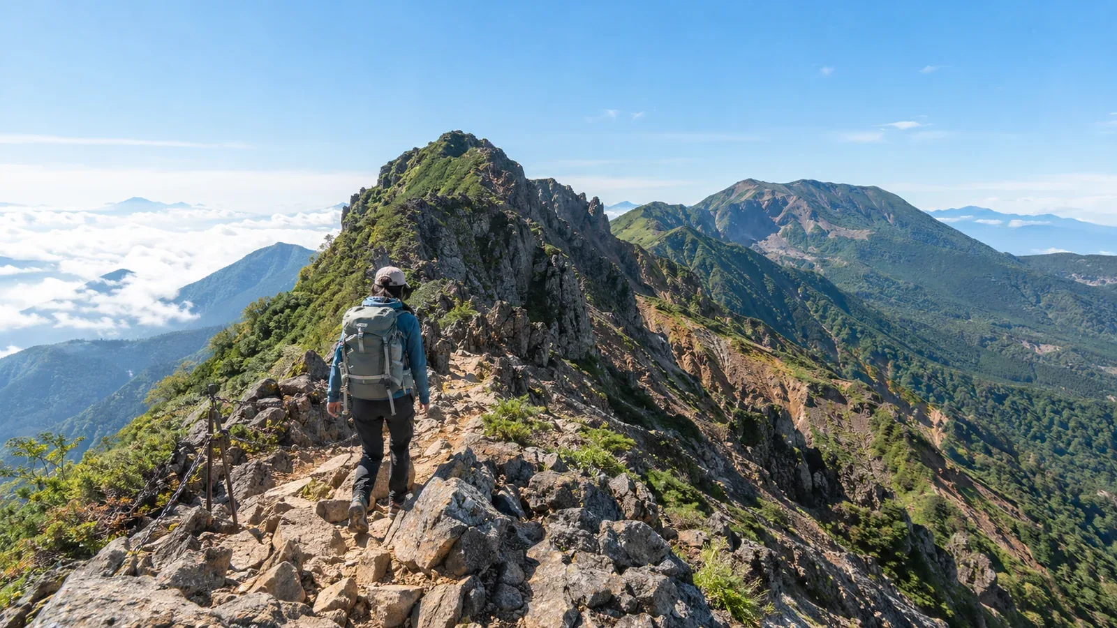
The southern Yatsugatake traverse links Akadake, Yokodake and Iodake. Yokodake has chains and ladders on rocky ground, and the ridge is exposed to wind, rain and lightning. There are huts along the way, but snow, ice, weather and trail conditions can change the difficulty considerably. This guide focuses on snow-free conditions.
Review your experience on rock, your schedule and overnight stops, and the available descents. Then judge whether your skills and the conditions are a match for the route.
Hut opening dates and prices, transport and closures can change. Check the latest information from the huts, transport operators and local authorities.
What kind of route is this?
Akadake (2,899 m) is the highest peak, followed northwards by Yokodake (2,829 m) and Iodake (2,760 m). Nagano Prefecture's example loop starts and ends at Minoto. It is 15.3 km with 9.8 hours of standard walking time, physical demand 4 and technical grade C. If you start at Minotoguchi, add the walk between Minotoguchi and Minoto in both directions.
Near Yokodake's Okunoin summit, there are chains and ladders on both the Iodake and Akadake sides. Wet rock, strong winds, snow and ice make them harder. The top of Iodake is broad, but the crater side drops steeply. In fog, check the route markers and keep away from the crater rim.
Before planning an overnight traverse, check two things.
- Skills on rock. Can you climb and descend steep rock calmly using chains and ladders?
- Experience on rock with a loaded pack. Even if you've hiked Akadake on a day trip, an overnight pack changes your balance and movement.
If you are unsure on either point, practise on easier rock with an experienced hiker or guide. Try both ascending and descending with your pack before planning the traverse.
The plan — direction, overnight stops and trailheads
Which direction to walk
Going north from Akadake, climbing from Gyoja Hut via Jizo Ridge or Bunzaburo Ridge puts steep ground and rock early in the day. Going south from Iodake still involves a climb from Akadake Kosen or the Sakuradaira side, with Yokodake's rock coming later. Think through which way you'll tackle the chain sections and how much time and energy each segment will leave you.
How many nights to plan
The route can be split into two days and one night or three days and two nights. Akadake Kosen and Gyoja Hut are below the ridge. Akadake Tenboso and Iodake Sanso are on it. Where you stay changes the time you reach the rock and how long each day takes. For a first overnight traverse, see whether two nights fit.
Main trailheads
A bus runs from Chino Station to Minotoguchi on operating days. Minotoguchi and Minoto, farther along the forest road, are different places. If you're going to Minoto, check the latest road conditions. Returning to the Minoto side makes a loop. Descending to Sakuradaira means a different finish. Sakuradaira has no scheduled bus, so arrange a taxi and its pickup point, or plan to collect your vehicle, and check the forest road in advance.
Ridge hazards and how to prepare
Fast changes in weather
Conditions on the ridge may differ from those below. The day before and on the morning of the hike, check Japan Meteorological Agency forecasts, warnings and advisories and hut reports. Set times for entering the key section and turning back. Lightning is possible even with an early start. If you hear thunder or see lightning, leave summits and ridges and quickly seek safe shelter, such as inside a building.
Wind makes the ridge feel colder. Autumn can bring low temperatures and ice. Even in clear weather, carry a windproof, waterproof jacket and insulation.
Queues on rocky sections
At weekends and on holidays, you may have to wait at Yokodake's chains and ladders. Allow time for queues and prepare for the cold while standing still. Keep space ahead and behind, test your footing to avoid dislodging rocks and wait out of the line of falling stones.
Check escape routes before starting
Jizo Ridge runs from Jizo-no-Kashira to Gyoja Hut. Bunzaburo Ridge descends to the same hut from a junction south of Akadake. Both have steep rock and steps and can be unsafe in bad weather. On the Iodake side, routes descend from Akaiwa-no-Atama towards Akadake Kosen or via Oren Hut to Sakuradaira. Check the approach to each junction, conditions on the descent and onward transport, and keep the option to turn back.
Choosing equipment for the traverse
An overnight pack is heavier and changes how you balance and move on rock. Choose the following equipment with your overnight arrangements and the weather in mind.
Pack capacity and fit. A 30–40 L pack is one starting point for a night in a hut, but size it for your actual gear. Put the kit in and see whether the pack shifts as you move.
Layers. Bring a fleece or light down jacket that's easy to put on and take off. Autumn mornings and evenings can drop below freezing. Check wind, temperature, snow and ice with the Japan Meteorological Agency and the huts.
Headlamp and spare batteries. Choose a headlamp bright enough for an early start from the hut in the dark. Carry a spare set of batteries or a spare battery pack separately.
Map and compass. Visibility drops sharply when cloud covers the ridge. A phone app is useful, but batteries can run down or a phone can shut down in the cold. Carry a paper map and compass and know how to use them.
Choosing and booking huts
Check each hut's opening and booking conditions. Ask about availability early for summer and the autumn foliage season. Check camping conditions separately from those for a hut stay.
Choose where to stay by working out when you'll reach Yokodake's rocky ground. A nearby hut can give you an early start, but check the weather and rock conditions before you leave and change the plan if needed. Find the huts and walking times on the map to work out your schedule.
What to do next
Mark chains, huts and possible descents on a topographic map. Check official sources for hut openings and reservations, trails and transport. File a hiking plan if you use Nagano Prefecture's designated trails. You can also look for partners through Nordwand's Base Camp or consult a guide.
References
- Geospatial Information Authority of Japan and Nagano Prefecture (elevations and route grades)
- Yatsugatake Nature Cruise (guide to the rocky sections)
- Chino City, Alpico Kotsu and Oren Hut (trailhead access)
- Nagano Prefecture and the huts (hiking plans, opening dates and reservations)
- Japan Meteorological Agency (weather information and lightning safety)
References and sources
- Geospatial Information Authority of Japan | Elevations of Japan's major mountains
- Nagano Prefecture | Nagano hiking route grades, 2026 table
- Yatsugatake Nature Cruise | Chains and ladders between Akadake, Yokodake and Iodake
- Chino City | Buses to Yatsugatake trailheads
- Alpico Kotsu | Minotoguchi bus route
- Oren Hut | Access to Sakuradaira
- Akadake Kosen and Gyoja Hut | Opening and local conditions
- Iodake Sanso | Opening and local conditions
- Nagano Prefecture | Mountain huts in Yatsugatake
- Nagano Prefecture | Filing a hiking plan and designated trails
- Japan Meteorological Agency | Weather and hazard information
- Japan Meteorological Agency | How to stay safe in a thunderstorm