
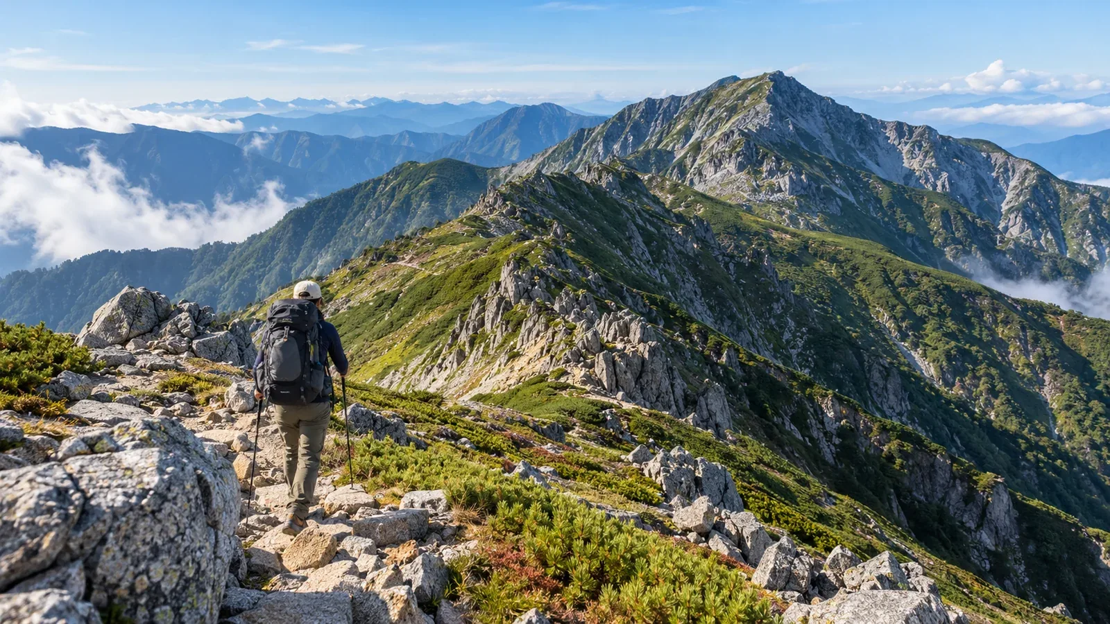
For a southbound traverse of Japan's Central Alps from Kisokomagatake to Utsugidake, take the ropeway up to Senjojiki Station at 2,612 m and finish on foot down the Ikeyama Ridge to the Komagane Highlands. In the other direction, that long ridge is your first climb. Decide which direction to walk, how many nights to allow and where you could turn back.
The long north–south ridge has few huts or exits. Between the rock around Hokendake, the repeated climbs and descents south of Hinokiodake and the long descent on the Ikeyama Ridge, this route calls for experience with both traverses and rocky terrain.
The overall route and how the ridge fits together
Nagano Prefecture's example from Senjojiki to the Komagane Highlands links Kisokomagatake (2,956 m) and Utsugidake (2,864 m). It is 21.3 km, with 16.2 hours of standard walking time, physical demand 6 and technical grade C. Heading south, the route goes through Gokurakudaira, Nigorisawa Omine, Hinokiodake, Kumazawadake, Higashikawadake and Kisodono Pass before Utsugidake. Utsugi Komaho Hut sits just below the summit on its east side. The itinerary changes depending on whether you cross Hokendake.
Three things to know about the ridge.
Difficulty varies by section. Many ropeway passengers walk the out-and-back route to Kisokomagatake, but Hokendake is a steep rocky ridge. South of Hinokiodake, there are more rocky sections and repeated climbs. Assess the footing and difficulty of each segment.
There are few ways off the ridge. The Hinokio Ridge east of Hinokiodake is one possible exit. It's a long descent, and you need to check the bus service at Hinokio Bridge. Consider other exits only after checking the topographic map, whether the trail is open and the transport from the bottom.
Know where to refill water. Reliable water is scarce along the ridge. Check hut openings, their water arrangements and the condition of water sources in advance. Carry enough to reach the next confirmed refill point.
Which direction to walk and how many nights to allow
Why go southbound from Kisokoma to Utsugi?
Going south means taking the ropeway to Senjojiki and leaving the Ikeyama Ridge descent for the last day instead of climbing it on the first. Decide for day one whether to tackle Hokendake's chain sections or return to Senjojiki and climb again to Gokurakudaira.
Going north starts with the Ikeyama Ridge climb from the Komagane Highlands to Utsugidake. Nagano Prefecture puts the Komagane Highlands at 860 m and Utsugidake at 2,864 m, a difference of about 2,000 m between the two points alone. How much you climb on day one depends on where you stay. Check the last ropeway and bus for when you reach Senjojiki.
How to divide the days
Here is one way to divide the route over three days and two nights.
- Day 1. Take the ropeway to Senjojiki and climb Kisokomagatake. Cross the rocky ridge of Hokendake, or return to Senjojiki and climb to Gokurakudaira. Continue via Nigorisawa Omine and stay at Hinokio Hut.
- Day 2. Go from Hinokiodake via Kumazawadake, Higashikawadake and Kisodono Pass to Utsugidake. Stay at Utsugi Komaho Hut if you have a reservation. To shorten the day, book a night at Kisodono Sanso and leave Utsugidake and the descent for the following day.
- Day 3. Descend the Ikeyama Ridge to the Komagane Highlands.
For your first time on this route, allow for ropeway queues, the time needed to cross the rock and a long descent. Fitting it into two days and one night leaves less room for changes in weather or how you feel. Work out each day's walking time and divide the route at overnight stops you can use.
The key sections — Hokendake and the climb to Utsugidake
Hokendake (about 2,931 m)
Hokendake is a steep rocky ridge with chains on both the north side towards Nokkoshi Jodo and the south side towards Gokurakudaira. Wet rock and a large pack make it more difficult. To avoid Hokendake, go from Kisokomagatake back to Senjojiki via Nokkoshi Jodo and Hatchozaka. Take the separate trail up to Gokurakudaira, then continue south. Add the descent to Senjojiki and the climb back up to day one's schedule.
Just below the summit of Utsugidake
Going south, descend from Higashikawadake to Kisodono Pass, then climb Utsugidake's north ridge. Just below the summit is a steep section of large boulders. At an earlier point such as Kisodono Pass, check elapsed time and remaining water and food, then decide whether it's safe to continue.
Weather and season in the Central Alps
The Central Alps ridge lies between the Ina and Kiso valleys. Above the tree line, there are few places to shelter from wind or lightning. Check Japan Meteorological Agency forecasts, warnings and advisories and local reports the day before and on the morning of the hike. Plan an early finish. If you hear thunder or see lightning, leave summits and ridges and quickly seek safe shelter, such as inside a building.
For a snow-free traverse, check trail and hut conditions alongside the dates. Lingering snow is possible early in the season, and snowfall and ice are possible in autumn. If you need equipment and skills for snow or ice, change to an itinerary you can handle or postpone.
Check ropeway and bus operating dates, last departures and service notices for the exact day of travel. If you're finishing northbound at Senjojiki or returning there partway through, allow time for the connections.
When and where to turn back
Decide whether to return or descend on a route you've already checked before danger increases. Avoid planning a descent into an unverified valley in bad weather.
Hinokiodake is one decision point along the route. Use the eastbound Hinokio Ridge to Hinokio Bridge only if you've checked trail conditions and the bus service. Hinokio Hut gives about 4 hours 10 minutes from the summit to the bus stop, excluding breaks. Consider bad weather, fatigue, daylight and the last bus. If the descent is unlikely to work, you may need to turn back sooner.
Beyond that point, reassess at each hut. On reaching your overnight stop, review the plan for the next day.
Why it's hard to turn back. The feeling that you've come too far can cloud your judgement. Base decisions on the route ahead and how you're doing now.
Descending the Ikeyama Ridge
From Utsugidake to the Komagane Highlands, the Ikeyama Ridge loses a lot of elevation over a long descent. Komagane City says the Kojo Forest Road is closed to ordinary vehicles, and taxis cannot pick you up at its end. Allow time to follow the trail as far as the Komagane Kogen Ski Area or towards Suganodai, and check the bus or taxi from there.
Take care around Daijigoku, Kojigoku and Mayoi-one, where falls and navigational mistakes are possible. Check your location at junctions in the forest, carry a topographic map and compass and have an offline map if needed.
What to do next
Trace the route from Kisokomagatake to Utsugidake on a topographic map and mark escape routes and overnight stops. Check official sources for hut opening and reservations, ropeway and bus service and road restrictions. File a hiking plan if you're walking on designated trails in Nagano Prefecture. You can also exchange information with hikers who've taken the same route in Nordwand's Base Camp and topic-based communities.
References
- Geospatial Information Authority of Japan and Nagano Prefecture (topographic maps, routes and grades)
- Nagano Prefecture and Hinokio Hut (mountain huts and walking times)
- Chuo Alps Kanko and Komagane City (ropeway, buses and road restrictions)
- Nagano Prefecture and Nagano Prefectural Police (hiking plans and mountain information)
- Japan Meteorological Agency (weather information and lightning safety)
References and sources
- Geospatial Information Authority of Japan | Elevations of Japan's major mountains
- Nagano Prefecture | Nagano hiking route grades, 2026 table
- Nagano Prefecture | Route map for the Central Alps and nearby areas
- Nagano Prefecture | Mountain hut information for the Central Alps
- Hinokio Hut | Walking times and access
- Chuo Alps Kanko | Komagatake Ropeway and bus timetables
- Chuo Alps Kanko | Hiking routes around Senjojiki
- Komagane Tourism Association | North and south ridges of Hokendake
- Komagane City | Kojo Forest Road restrictions
- Nagano Prefectural Police | Mountain information
- Nagano Prefecture | Filing a hiking plan and designated trails
- Japan Meteorological Agency | Weather and hazard information
- Japan Meteorological Agency | How to stay safe in a thunderstorm