
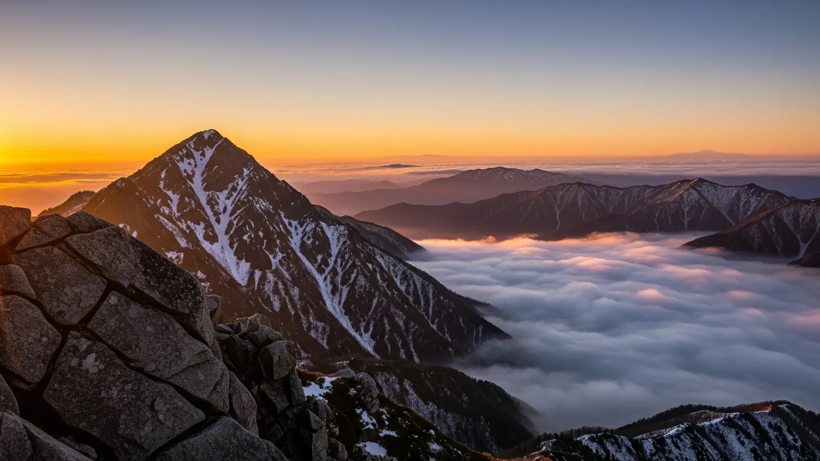
Around dawn, a valley can disappear beneath a white layer, leaving the peaks above it like islands. That happens when fog or low cloud spreads below a viewpoint. Knowing how valley fog forms helps you decide where and when to go.
What a sea of clouds looks like
A sea of clouds is a broad layer of fog or low cloud seen from above. Visibility may be poor on the valley floor while peaks remain visible from a viewpoint above the cloud.
The view depends on whether fog forms and how high the viewpoint sits relative to its top. Even if fog is forecast, the lookout itself may be inside the cloud.
Four conditions that favour radiation fog in valleys
Seas of clouds form in different ways. Here we look at radiation fog, which forms in valleys and basins as the ground cools overnight.
1. A clear night lets the ground cool
On clear nights the ground loses heat by radiation. The air next to it cools too, and at the dew point water vapour condenses into droplets, forming fog.
2. The wind near the ground is light
Strong wind keeps mixing the air, making it harder for a cool, moist layer to persist. Check the wind in the valley separately from the wind at the viewpoint or ridge.
3. There is moisture near the ground
Moisture may linger after rain or near rivers and lakes. Consider whether the air will also cool to its dew point.
4. Cool air collects in a valley or basin
Air cooled on slopes can flow downhill and collect in a valley or basin. Fog can then spread along the contours. Look at a map to see whether your viewpoint overlooks the low ground where fog may form.
Consider overnight cloud cover, wind, temperature and moisture together with the terrain. If there’s a webcam or a local operator’s cloud forecast, check it before leaving.
These conditions apply to radiation fog. Low cloud can also form when moist air flows into an area.
When to look for a sea of clouds
Early mornings from autumn to early winter are a useful starting point for looking for radiation fog in inland valleys and basins, such as in Nagano. Timing varies by location, and roads or facilities may close in winter.
Radiation fog can spread overnight and thin as sunlight warms the ground. Check sunrise and opening times, and pick a time you can manage.
A sea of clouds can form in summer too. At Tomamu in Hokkaido, the operator describes clouds formed in the basin as well as clouds flowing in from the Pacific side.
How to choose a viewpoint above the cloud
A lookout overlooking a valley or an open spot near a mountain hut can rise above the low clouds, even without a summit climb.
Places to combine with a hike
- Northern Alps. On a trip using a ridge hut near Tsubakuro, Jōnen or Chō, look for a spot with a view down into the valleys.
- Yatsugatake. Ridges around Akadake and Iōdake offer views of the valleys at their feet.
- Around Mount Fuji. From mountains such as Kintoki and Mitsutōge, you can look towards Fuji and the low ground in front of it.
Lookouts for viewing a sea of clouds
- Takabocchi Highlands (Nagano). Overlooks the Suwa Basin. Check municipal road information for winter closures and access restrictions.
- Utsukushigahara (Nagano). Plateau lookouts overlook low ground. Check road access and the hours of any facilities you plan to use.
- Bitchū Matsuyama Castle (Okayama). To see the castle from a distance among the clouds, go to the cloud-sea lookout, which is separate from the castle entrance.
- Takeda Castle ruins (Hyōgo). Go to the ruins to look out over the clouds, or to Ritsuunkyō across the valley to see the ruins and the clouds together. Check opening times and parking information.
If you are staying in a hut, ask about open viewpoints nearby. If you need to walk before dawn, check that you know the route, that access is allowed in darkness and that footing and wind conditions are suitable.
Getting ready to watch and take photos
Temperature, wind and visibility change around dawn. Plan a safe journey there and back before working out when the cloud might be visible.
What to check before leaving and on site
- Check sunrise, opening times, parking arrangements and trail access.
- If you’ll walk in darkness, bring a headlamp and test it and its batteries.
- If fog, strong wind or ice make walking unsafe, shorten the outing or turn back.
- Set up tripods out of the way and stay on the permitted side of fences and ropes.
What to bring while you wait
- Warm clothing. Choose a windproof jacket, warm layers, a hat and gloves for the temperature and the time you’ll spend waiting.
- A hot drink. A flask keeps your drink warm on a cold morning.
- Backup power. Camera and phone batteries may run down faster in the cold. Keep spares dry and warm.
If fog hides the view, there’s no need to extend the outing in search of a higher spot. Leave while you can still get back safely and note the time and weather for next time.
Planning your next visit
A clear night, light wind, moist air and a valley or basin that collects cool air are clues for radiation fog. Whether the viewpoint will rise above the fog can change up to the day itself, so decide using forecasts and local information.
Start with one accessible place overlooking a valley and check when it is open. Comparing the forecast with what you see will help you learn when cloud tends to form there.
References and sources
- Japan Meteorological Agency: Fog and low cloud
- Meteorological Satellite Center: Fog monitoring
- Nagano Local Meteorological Office: Autumn weather
- Hoshino Resorts Tomamu: Unkai Terrace
- Shiojiri City: Seasonal reopening of the Takabocchi road
- Takahashi City: Bitchū Matsuyama Castle
- Asago City: Takeda Castle ruins opening hours
- Niigata Prefecture: Uonuma Skyline sea-of-clouds viewing map