
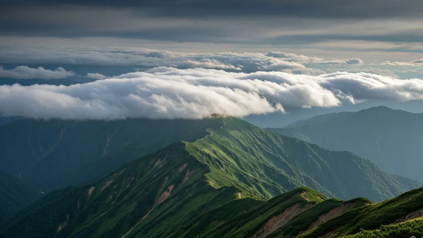
Clouds on a ridge can change while the wider forecast stays the same. Observing their height, shape and movement can help you notice declining visibility or a developing storm. Combine what you see with forecasts, warnings and your options for getting off exposed terrain.
The ten cloud genera and three height levels
The World Meteorological Organization groups clouds into ten genera. The International Cloud Atlas uses their appearance and structure to help identify them.
For hiking, begin with high, middle and low levels. The ranges below are approximate for temperate latitudes, and they overlap.
- High clouds, roughly 5–13 km: Cirrus, cirrocumulus and cirrostratus. Thin streaks or veils can appear before a change in weather.
- Middle clouds, roughly 2–7 km: Altocumulus, altostratus and nimbostratus commonly occur here. Nimbostratus can extend into the other levels and is associated with widespread, persistent precipitation.
- Low cloud bases, from the surface to about 2 km: Stratus and stratocumulus are common. Cumulus and cumulonimbus often have low bases, with tops that can extend into the middle or high levels.
The levels depend on latitude and conditions. Compare a forecast’s cloud base with the elevation of your route and check whether the provider gives heights above sea level or above the ground.
A cloud can appear dark because of its thickness and the lighting. Notice whether it is deepening, rising or spreading, and whether the wind, visibility or temperature is changing at the same time.
Three types of cloud worth noticing on a hike
These features give you things to watch before you enter an exposed section. The timing and conditions still need a forecast and local observation.
1. Cirrus: thin streaks high in the sky
Wispy high cloud can form ahead of a warm front. Cirrus can also occur in other situations, so its appearance alone cannot tell you whether rain will reach your route or when. Check how the clouds change and compare with the latest forecast.
2. Cumulonimbus: rapidly growing thunderclouds
A rapidly growing tower can develop into a cumulonimbus with lightning, heavy rain, gusts and sometimes hail. An anvil-shaped top is one sign of developed storm cloud. If you see a developing storm near the route, avoid entering exposed terrain. If you hear thunder, move promptly away from summits and ridges and seek a substantial enclosed building or hard-topped vehicle if safely reachable.
3. Lenticular clouds and summit cap clouds
A smooth lens-shaped cloud can reveal mountain waves in the air. A cap cloud over a summit can form when moist air flows over the mountain. Check the ridge wind, gusts and visibility in the forecast. The cloud shape alone does not give you a wind speed or tell you exactly where conditions will be strongest.
Read changes in clouds, wind and temperature together
Watch how the sky changes over time. Compare movement, growth and lowering cloud with wind and visibility, particularly when the route ahead is exposed.
A sequence from wispy cirrus to a thin veil of cirrostratus and then a thicker layer of altostratus can accompany an approaching warm front. A halo can appear through a thin high layer. Use the broader forecast to judge whether rain is likely and when conditions may change.
A sudden cool gust, darkening cloud or thunder can signal an approaching storm. A change in wind direction alone has several possible causes. If visibility falls or gusts affect your balance, stop in a stable spot and decide how to get to a safer place.
Use JMA forecasts, warnings and the rain and lightning nowcast when you have coverage. Clouds can develop quickly between updates. Keep track of where you can shorten the route or turn back without entering more exposed terrain.
Before setting out
Look up the forecast wind, cloud base, visibility and thunderstorm risk. Choose stopping points and retreat options before reaching the ridge. Reassess promptly if clouds build or descend, or if wind and visibility no longer suit the route.
Share observations and decisions with your group. After the hike, compare the conditions you saw with the forecast to learn which cues helped you decide.
References and sources
- World Meteorological Organization · Ten cloud genera
- World Meteorological Organization · Cloud levels and their approximate heights
- World Meteorological Organization · Clouds on the windward side of mountains
- Met Office · High clouds and warm fronts
- Met Office · Lenticular and other unusual cloud forms
- Japan Meteorological Agency · Signs of approaching cumulonimbus
- Japan Meteorological Agency · Lightning safety
- Japan Meteorological Agency · Rain and lightning nowcast
- Japan Meteorological Agency · Warnings and advisories