
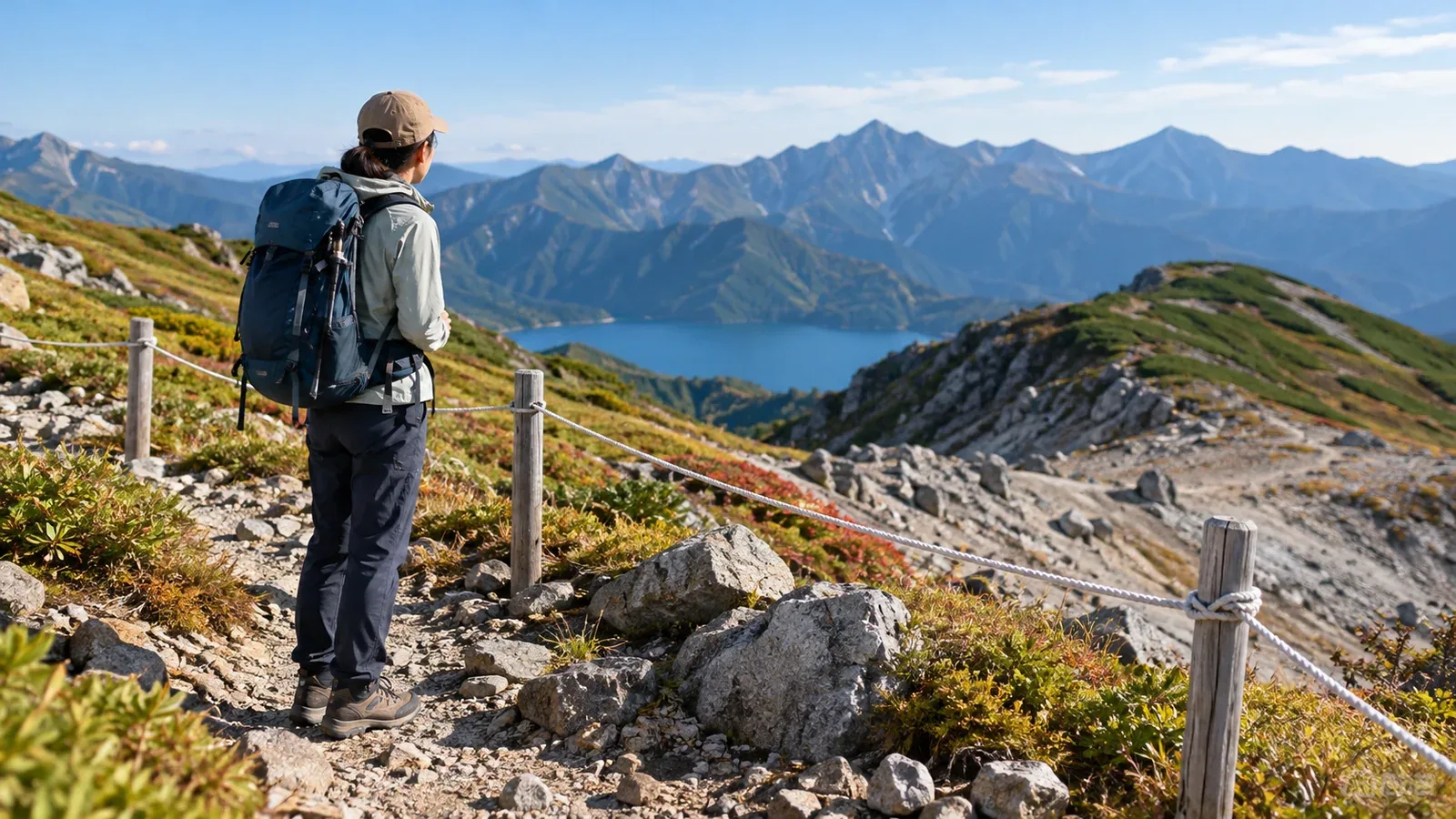
On a hiking trail, you may come across ropes stretched between posts or signs that say the area is closed. If a possible shortcut or scenic slope is roped off, stop and read the signs.
Behind the rope there may be recovering vegetation or a collapsed slope. Restricting access can keep hikers away from hazards and give plants space to recover.
Why ropes are installed
Rope barriers mark the area you can walk in. Some rocky sections also have ropes or chains installed to help hikers move through. Check signs and official route guidance to find out what a rope is for. Its position or angle alone gives you limited information.
Here are reasons you may see a rope barrier on a trail.
Protecting recovering vegetation. Stepping near alpine plants can damage stems or roots. At Sugatami Pond in Daisetsuzan National Park, rope fences on both sides of the path keep hikers off vegetated slopes.
Limiting erosion. Repeatedly walking on vegetated ground can expose the soil. Rain and snowmelt can wash it away on slopes. Ropes can help keep worn areas from spreading.
Keeping hikers away from hazards. Closures and barriers can mark sections damaged by a landslide or closed for work. On Mount Fugen in Unzen, the Ministry of the Environment directed hikers to another route after a landslide closed part of the trail.
How individual steps add up
When people step around mud or leave the path for a photo, they can create tracks beyond the edge of the trail. The next person may mistake a worn track for part of the route.
At Daisetsuzan, ropes have been installed where paths widened or parallel tracks appeared. On Mount Gassan, the trail was rerouted after vegetation was damaged. The old ridge vegetation gradually recovered. In the lingering snow season, the old trail can emerge from the snow before the current one.
Footprints can lead onto an old trail or a closed section. Confirm the current route and read the signs before proceeding.
What to do if you’re unsure on site
Stop on secure footing and check the signs and map if you cannot tell what a rope is for. Stay on your side of it until you know which direction is open.
Look at the signs and the rope’s position
- A no-entry or closure sign. Stay outside the boundary and check which route is indicated.
- A rope stretched across the trail. Look for closure or detour notices before going any farther.
- A rope running beside the trail. Stay within the trail and off the adjoining slope or grass.
- A barrier near a cliff or collapsed slope. Follow the marked route and keep your weight off the barrier.
- A rope or chain on a rocky section. Check signs or the official route description to see whether it is there to help you pass.
Look at the condition of any aid rope or chain and at your footing before deciding whether you can cross safely. Avoid relying on equipment of uncertain purpose or condition. Turn back while you still can if the passage seems too difficult.
If you lose the trail
If fog or snow hides the trail, stop in a safe place and check your map and position. If you know the way back and can retrace it safely, return to the last point where you could confirm the trail. If you cannot return and need rescue in Japan, call the police emergency number 110, give your location as precisely as you can and follow instructions.
Types of restrictions and where to check
In national and quasi-national parks, entry to some areas designated under Japan’s Natural Parks Act may require a permit. Designated managed access areas may require an entry approval or permit depending on the zone and dates. Check the park’s official guidance for boundaries and procedures.
Restrictions can result from natural hazards or construction, vegetation recovery or requirements under the Natural Parks Act. Follow posted instructions and check with the manager if you are unsure whether a section is open.
Restricted sections and dates can change. Look up the latest information from the Ministry of the Environment, the municipality or park office. Huts and visitor centres may also have local updates.
What you can do from the trail
Take photos from the path or boardwalk and stop where you will not block others. Leaving the vegetation beside the trail undisturbed gives it space to recover.
If a rope breaks or a sign becomes unreadable, record the location if you can and let the park office know. Moving a rope can make the trail boundary unclear to the people who come after you.
Before your next hike
Check closures and official detours before you leave, and share them with your companions along with the map. If your planned route is closed when you arrive, follow the signs and take a confirmed detour or turn back safely.
Where to find information
- Closures and detours — official information from municipalities, park offices and visitor centres
- Area designations and entry procedures — the Ministry of the Environment and prefectural nature park offices
- Hiking safety and rescue requests — mountain safety information from prefectural police
References and sources
- Japan Ministry of the Environment — Rope barriers and trail maintenance in Daisetsuzan National Park
- Japan Ministry of the Environment — Shosenen Trail rules, Daisetsuzan National Park
- Tohoku Regional Environment Office — Mount Gassan’s former trail and vegetation recovery
- Japan Ministry of the Environment — Notice of partial trail closure on Mount Fugen, Unzen
- Japan Ministry of the Environment — Managed access areas in national and quasi-national parks
- Japan Ministry of the Environment — Activities requiring permits or notifications in national parks
- Nagano Prefectural Police — Hiking safety and requesting rescue