
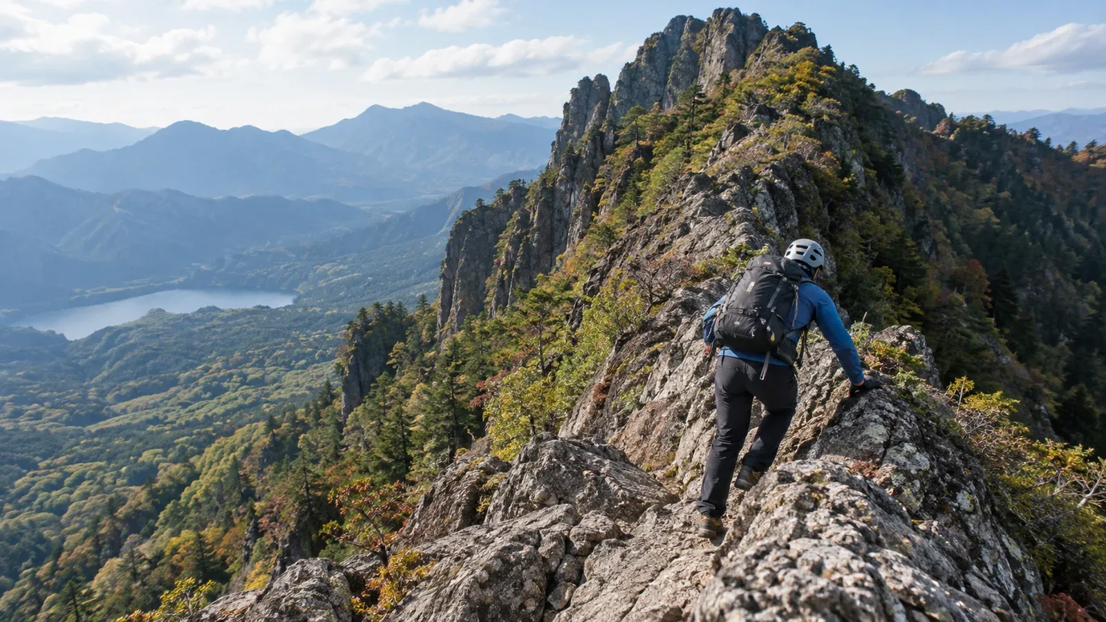
Mount Togakushi and Mount Myōgi both have exposed rocky routes that demand more than a few previous chain sections. The exact route matters at each mountain. Myōgi in particular has a mountainside trail as well as advanced ridge routes.
Compare the terrain and the skills each route requires. Use the local route map and current notices to check where you can turn back and how you will descend.
Mount Togakushi: the ridge to Happō-nirami
From Togakushi Shrine’s Okusha trailhead, the route climbs via Hyakken-nagaya to Ari-no-Towatari and Ken-no-Hawatari, then reaches Happō-nirami. The city warns of falls, slips and rockfall along this rocky approach. On the knife-edge ridge, steep drops on both sides and narrow footing make deliberate movement essential. Fixed chains help where provided, alongside stable handholds and footholds.
Skills to practise beforehand
- Secure contact: Confirm the next hold before shifting your weight. Practise controlled movement on less exposed terrain with experienced support.
- Managing exposure: Practise where you can stop and leave safely. If exposure makes it hard to move with control, choose another objective.
- Deciding when to turn back: Identify a safe turnaround point on the approach before entering the narrowest terrain. Check the map and current local guidance for any alternative.
Togakushi-specific considerations
Wet rock, snow or ice can make the exposed ridge unsafe. On a narrow section, reversing or passing can also be difficult. If another party is ahead, wait on stable ground away from rockfall paths and decide whether you still have time to continue.
The usual route described by the Togakushi Tourism Association ends at Togakushi Pasture after Ichifudō, away from the Okusha start. Nagano City warns that at Happō-nirami hikers bound for Togakushi’s summit can accidentally turn toward Nishi-dake. Confirm the junctions, descent and onward transport before setting out.
Mount Myōgi: Chūkan-michi and the Omote-Myōgi ridges
Chūkan-michi traverses the mountainside. It differs from the advanced Omote-Myōgi routes up Hakūn-zan and Kondō-san, where repeated chains, steep rock and exposed descents can be part of the route.
Gunma Prefecture advises beginners to stay off the advanced routes above Chūkan-michi and lists Kinkei-san as closed to entry. A marked trail can still require advanced skills. Check the precise route and notices before leaving.
What makes Myōgi’s ridge terrain difficult
Geological research identifies andesitic lava and volcanic fragmental rock in the Myōgi massif. At any hold, check for loose material and assess grip in the conditions in front of you. The type of rock alone does not tell you how secure a step is.
Steep chain descents can hide footholds from above. Locate the next secure foothold while keeping stable contact, and only move when you can do so in control. Avoid committing to a descent you cannot reverse without the skills and equipment it requires.
Choosing a Myōgi route
Chūkan-michi is a separate objective with its own rocky sections and access conditions. Gunma and Tomioka report that the wildfire closures affecting Chūkan-michi and the Hakūn-zan and Kondō-san trails were lifted on December 27, 2025. Tomioka also asks general hikers to stay off the advanced ridge routes after a fatal fall. Check for later notices, including any local restrictions, at the visitor centre or with the trail authority.
Comparing the two mountains
Start with the exact route you intend to walk and assess it against your group’s experience. These are the main differences to discuss.
- Key terrain: Togakushi has a narrow ridge with steep drops. Omote-Myōgi ridge routes have repeated chains and steep rocky descents.
- Reversing or passing: This can be difficult on Togakushi’s knife edge. On Myōgi, check each steep section and its approaches.
- Grip and rockfall: Assess moisture, loose rock and each hold on both mountains.
- Retreat: Choose a safe turnaround on Togakushi before the exposed ridge. On Myōgi, use only confirmed open and suitable mapped routes off the ridge.
Experience on comparable rock includes making controlled descents, using secure holds and staying able to assess conditions under exposure. A slope angle cannot show whether your party can manage the route. Practise on less exposed terrain and discuss an outing with a qualified local guide if needed.
Equipment and preparation
Check the condition and fit of footwear and choose gloves that protect your hands without impairing grip or dexterity. Test the equipment on stable ground. Carry clothing, navigation and emergency supplies suitable for the route.
Wear a well-fitted mountaineering helmet on exposed rock. Tomioka also recommends a helmet for Myōgi. Avoid knocking stones loose and give other parties space.
Allow time for queues at chains, slower descents, weather decisions and retreat. Plan to be off the mountain before dark and set a turnaround time that leaves a margin.
Where to check conditions
Check both mountains again before departure. Rain, snow, rockfall or works can change a route after you plan it.
- Weather: Japan Meteorological Agency forecasts and alerts for Nagano and Gunma.
- Trail status and restrictions: Nagano City and the Togakushi Tourism Association for Togakushi, and Gunma Prefecture and Tomioka for Myōgi.
- On-site checks: Trailhead signs, the park office and the Myōgi Visitor Centre.
Read the notices at the trailhead as well as those you found while planning. Leave room to change the route if the conditions differ from your plan.
Before setting out
Compare your experience with the hardest section and descent on the chosen route. Submit the required hiking plan for Togakushi and check Gunma Prefectural Police’s filing guidance for Myōgi. Ask a qualified guide about terrain or skills that remain uncertain. Use accounts from other hikers as additional context alongside official notices.
Further reading
- Japan Meteorological Agency forecasts and alerts
- National Police Agency mountain incident statistics
- Nagano City and Togakushi Tourism Association route guidance
- Gunma Prefecture and Tomioka trail maps and notices
References and sources
- Japan Meteorological Agency · Warnings and advisories
- National Police Agency · Mountain incident statistics
- Nagano City · Togakushi routes, hazards and hiking plan
- Togakushi Tourism Association · Mount Togakushi route
- Gunma Prefecture · Myōgi Park routes and restrictions
- Tomioka tourism website · Myōgi trail reopening notice
- Tomioka City · Mount Myōgi hiking map
- Gunma Prefectural Police · Mountain safety and hiking plan guidance
- Geological Collaboration Association of Japan · Geological study of the Myōgi massif