
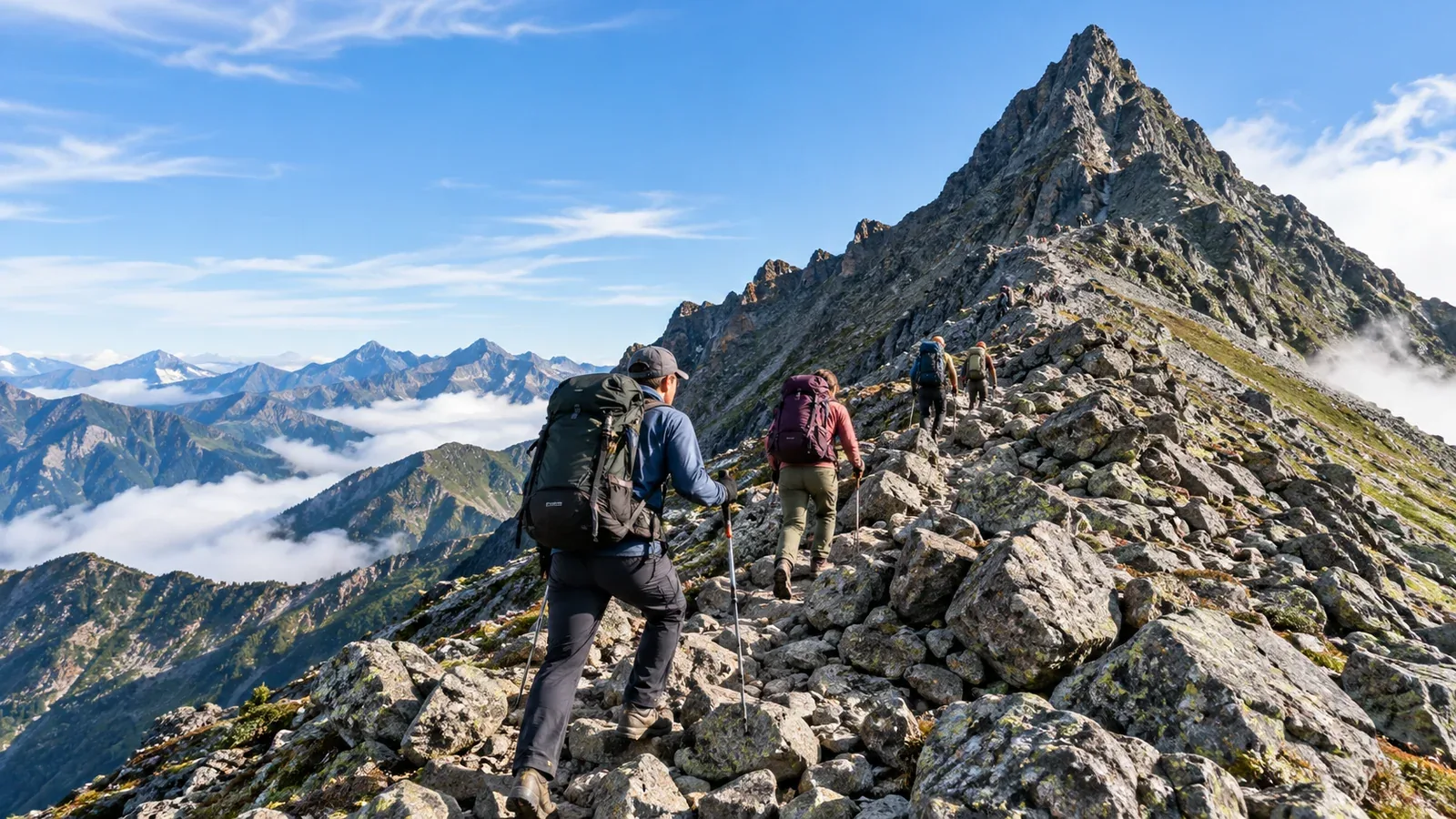
The route from Kamikochi to Mount Yari is one of the best-known walks in the Japanese Alps among visiting hikers. Kappa Bridge is famous for its view of the Hotaka Range. Farther up the valley, the Yarisawa route is a popular way to reach Mount Yari, often called Japan's Matterhorn.
Public transport reaches Kamikochi, and several mountain huts serve the route. The near-vertical climb to the summit is a taste of alpine terrain at the end of a long hike. Plan ahead for Japanese-language information, mountain weather, gear and hut reservations.
This guide uses the Kamikochi-to-Mount Yari route to show where information can be hard to find and how to prepare. It is intended both for visitors and for local companions helping with a trip.
The route and its hardest section
From Kamikochi, at about 1,500 m, the usual route follows the Azusa River to Yokoo Sanso, then climbs the Yarisawa valley to Yarigatake Sanso and Mount Yari's summit at about 3,180 m. As a rough itinerary, allow a day and a half to two days to go up and around one day to return. Stamina, weather and delays on the trail can make a large difference. Check individual stage times using the huts' route guidance and a topographic or hiking map.
The hardest section is the steep summit pinnacle above the hut. Climbers use both hands and feet on near-vertical rock with fixed chains and metal footholds. For someone unfamiliar with exposed scrambling, it can feel higher and take more energy than expected. Practice on suitable rocky terrain first. If you're unsure about the summit section, consider going with a certified guide.
Afternoon thunderstorms are possible even in summer. Near the ridges, temperatures can fall below 10°C even in August. Check current forecasts from the Japan Meteorological Agency and local updates from the huts each day.
Finding route information in Japan
The Kamikochi Visitor Center and major huts provide some information in English. The amount of support varies by facility, and detailed local advice or emergency communication may be in Japanese.
Check these sources before leaving.
- Matsumoto and Nagano Prefecture visitor information. Check private-car restrictions, seasonal access and how to file a hiking plan. Kamikochi's official visitor site and bus operators publish access information in English.
- Shobunsha's Yama to Kogen Chizu hiking maps. Even though the maps are in Japanese, the terrain, published walking times and hut locations are useful for planning.
- Official hut websites. Many use online reservations and some offer English instructions. Check the hut's current booking process.
Some signs on the main route use Japanese characters. Save a route map showing the Japanese names for Kamikochi, Yokoo, Yarisawa and Yarigatake alongside their romanizations, so you can match them to signs.
How reservations and hut stays work
Japanese mountain huts may operate differently from European refuges or North American backcountry cabins. Check what the hut you plan to use provides and expects.
Here are the main things to look up.
- Reservations. In Japan, booking ahead is common, particularly at busy times. Some regions abroad have huts that operate first come, first served.
- Bedding. Many Japanese huts provide bedding, so a sleeping bag may be unnecessary. In some regions, guests bring their own.
- Meals. Dinner and breakfast packages are common in Japan. Self-catering is more common in some hut systems abroad.
- Sleeping arrangements. Guests often share communal sleeping spaces in Japan. Private rooms and dorm layouts vary elsewhere.
Weekends from July to September can fill up at huts near Mount Yari, and walk-ins may be turned away. Contact the hut promptly if your plans change. Check its website for current rates, booking dates and cancellation rules.
Ask when you book whether you need a sleeping bag. A sleeping bag liner or cover can be useful, depending on the hut's rules.
Emergencies, rescue and filing a plan
Police and fire services respond to mountain emergencies in Japan. A private helicopter rescue can involve costs. Ask your travel or mountaineering insurer whether the policy covers this route and activity, including rescue.
Call 110 for police or 119 for fire and emergency medical services in Japan. Give your location and explain that you need mountain rescue. For advice on illness or injury, speak to hut staff if they're nearby and you can reach them safely. Call for help promptly in an emergency.
Nagano Prefecture requires a hiking plan on designated routes, including for visitors from abroad. Check whether your route is designated and how to file. The prefecture lists online options including Compass.
What to expect in autumn
When the Japanese article was written in October 2026, its seasonal guidance described fall colors around Mount Yari as past their peak in October, with snow and ice beginning on the ridges. Many huts close from mid- to late October, and the dates vary by hut and year. Check the huts' notices and current information from Matsumoto and Nagano Prefecture.
From autumn onward, snow or ice may call for crampons, an ice axe and the skills to use them. Conditions may make turning back difficult if you go up unprepared. Even in late September, ridge weather can change quickly. Carry warmer layers and more substantial weather protection than you'd normally bring in summer.
What to do next
Check the forecast and hut operating dates for your trip. File your plan in advance using Compass or another accepted method, and review your insurance before leaving. If you want help assessing conditions or the summit section, consider asking a certified local guide through Nordwand.
Further reading
- Japan Meteorological Agency, mountain weather information.
- Nagano Prefectural Police, filing hiking plans.
- Ministry of the Environment, Kamikochi visitor rules for Chubusangaku National Park.
- Matsumoto visitor information and Alpico's Kamikochi access guidance.
References and sources
- Yarigatake Sanso Group, Mount Yari and hut guidance (English)
- Yarigatake Sanso Group, route and summit FAQ
- Kamikochi official access information
- Nagano Prefecture, designated routes and filing a hiking plan
- Nagano Prefecture, English mountain safety and rescue guidance
- Ministry of the Environment, Chubusangaku National Park visitor rules