
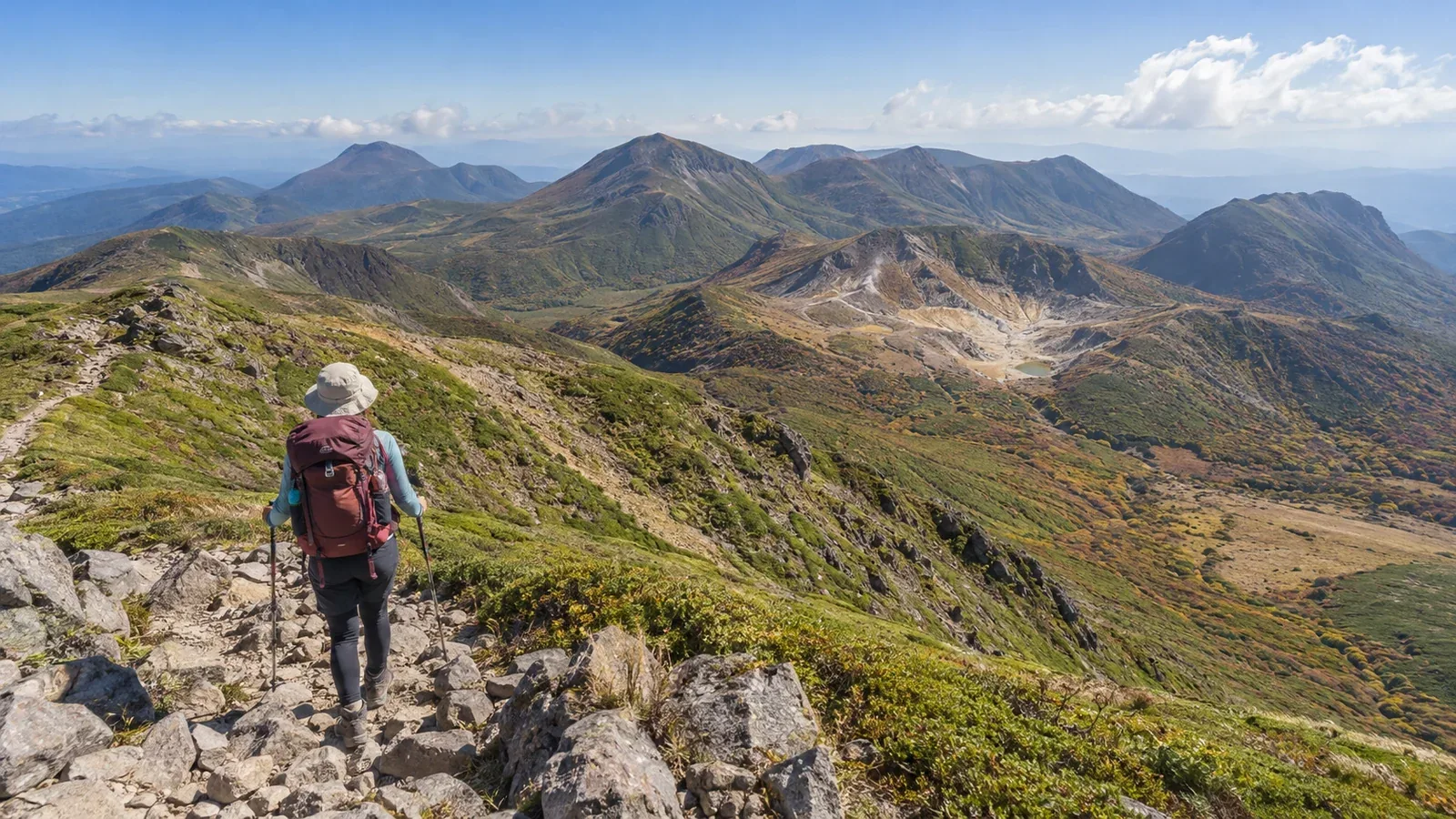
The Kuju Mountains are a group of volcanoes in western Ōita Prefecture. Nakadake (1,791 m), the highest peak on the main island of Kyushu, is one of several summits around 1,700 m, along with Mount Kuju, Hosshōzan and Mimatayama. Taisenzan and Hiijidake lie to the east. You can combine peaks in many ways, but the distance and elevation gain can quickly add up.
When planning a traverse, you want to know which trails link up, where to spend the night and how to prepare. This article looks at the terrain first, then route choices, overnight options and seasonal risks.
Get to know the terrain
Start by looking at the shape of the range on a map. Trails from Makinoto Pass, Chōjabaru, Ōmagari and other trailheads converge toward the center, where ridge paths connect the peaks.
Kuju-wakare is a key junction on the way from Makinoto Pass to Mount Kuju, Miike, Nakadake and Tengugajō. Adding Mimatayama to the north, or Taisenzan and Hiijidake east of Bōgatsuru, means more climbing after a descent. Wind and visibility can change quickly on the open ridges.
Much of the high terrain is open, with dwarf bamboo and volcanic rocks and scree. It is easy to lose your bearings in poor visibility. Practice checking your position with a topographic map and compass before heading out.
Main ways to link the peaks
Think in terms of a day hike, a hut stay or camping at a designated site.
Visit Nakadake and nearby peaks in a day. One option is an out-and-back from Makinoto Pass via Kuju-wakare and Miike. The Ministry of the Environment gives 11 km and 5 hours 15 minutes for the round trip. If you add Mount Kuju, Tengugajō or Hosshōzan, count the extra distance and climbing for each side trip. Choose the peaks according to the weather and your fitness.
Spend one night at a hut and include Taisenzan or Hiijidake. Hokkein Onsen Sansō, near Bōgatsuru, can be your base. Adding Mimatayama means another climb and descent, so check the stages separately. Consult the lodge’s information for opening and booking.
Camp and hike over two or three days. Use the designated Bōgatsuru campsite as a base for nearby peaks. Check conditions of use and facilities with the Chōjabaru Visitor Center or another official source. Keep tents out of the wetlands, trails and parking areas.
Taisenzan and Hiijidake lie east of Bōgatsuru. Adding either to a hike between Makinoto Pass and Nakadake adds distance, a descent and a climb back up. If the itinerary is too tight, set aside a separate day for the eastern peaks from Bōgatsuru.
Seasonal risks and preparation
Kuju is popular from spring through autumn, but each season brings different risks.
Spring to early summer (April to June). Miyama-kirishima azaleas begin flowering at lower elevations first. The usual best time to see them is from late May into June. Timing varies by location and year, so check the Chōjabaru Visitor Center’s bloom reports. Prepare for cold on the ridge and adjust equipment and plans if snow or ice is reported.
Summer (June to August). Check Japan Meteorological Agency forecasts, warnings and the lightning nowcast. Stay off exposed terrain when thunderstorms are possible. If you hear thunder or see lightning, leave ridges and summits and promptly seek a safe place such as a sturdy building.
Autumn (September to November). The days shorten and frost or ice can form in the morning and evening. Pack insulation and rain gear for the expected temperatures and wind. Parking fills up during the autumn colors, so allow extra time if driving. If taking a bus, check operating days and the last departure.
Winter and snow season (roughly December to March). Snow and ice may require crampons, an ice axe and the skills to use them. If you cannot cross snow or ice safely, postpone the trip until conditions improve. Check the forecast and local trail and road information again just before leaving.
Five checks before finalizing the route
Review these five points before building a detailed itinerary.
- File a hiking plan: Use an option listed by Ōita Prefectural Police, a submission box at a main trailhead, or the approved Compass or YAMAP service. On an overnight itinerary, include your expected finish date and time and potential exit routes.
- Locate water sources: Water is scarce on the ridges. Check whether water is available at Hokkein Onsen Sansō and Bōgatsuru, and carry enough plus a reserve to reach the next reliable supply.
- Identify escape routes: Mark open trails that lead from your route to Makinoto Pass, Chōjabaru, Ōmagari or another exit. Check closures and transport from the trailhead before you go.
- Check mobile coverage: Have a way to call for help where there is no signal. Consider a satellite communicator if needed, and verify whether any GPS device used for navigation can also send an emergency message.
- Check current restrictions and volcanic information: Consult Chōjabaru Visitor Center for trails and Ōita Prefecture for roads. Kuju is an active volcanic range. Check Japan Meteorological Agency volcanic warnings and local restrictions, and stay out of closed areas.
Making the traverse work
Kuju has several trailheads, but a way down is available only on certain ridges. Even where a ridge looks gentle, adding peaks increases the distance, climbing and time spent in exposed terrain.
Make sure you can reach the exit with time to spare before sunset or your last bus. For a trip with at least one night, plan a descent that skips peaks if the weather turns bad the following day.
Set a cutoff time at each junction. After that, head down instead of continuing to the next peak. Work backward from the time to the trailhead, breaks, sunset and the last bus. Shorten the route or turn back sooner if the weather deteriorates or someone feels unwell.
Where to start
Mark Kuju-wakare, the peaks and trailheads on a topographic map. Base your stages on the walking times and elevation gains you have handled comfortably before. Confirm your Hokkein Onsen Sansō booking or the Bōgatsuru campsite rules, and file your hiking plan as instructed by Ōita Prefectural Police.
References
- Ministry of the Environment and AIST (national park, Nakadake route and volcanic landforms)
- Chōjabaru Visitor Center and Kokonoe Town (trails, bloom reports and transport)
- Hokkein Onsen Sansō (accommodation and booking)
- Japan Meteorological Agency and Taketa City (weather, lightning and volcanic hazards)
- Ōita Prefectural Police and Geospatial Information Authority of Japan (hiking plans and topographic maps)
References and sources
- Ministry of the Environment | Aso-Kuju National Park
- Ministry of the Environment | Route from Makinoto Pass to Nakadake
- Geological Survey of Japan, AIST | Landforms of the Kuju volcanoes
- Chōjabaru Visitor Center | Hiking information and visitor rules
- Chōjabaru Visitor Center | Latest trail information
- Chōjabaru Visitor Center | Miyama-kirishima azalea bloom and autumn colors
- Kokonoe Town | Bus services to Chōjabaru and Makinoto Pass
- Hokkein Onsen Sansō | Accommodation and booking information
- Ōita Prefectural Police | Filing a hiking plan
- Japan Meteorological Agency | Forecasts, warnings and lightning nowcast
- Japan Meteorological Agency | Lightning safety
- Japan Meteorological Agency | Volcanic information for Kujusan
- Taketa City | Kuju volcano hazard map
- Geospatial Information Authority of Japan | GSI Maps