
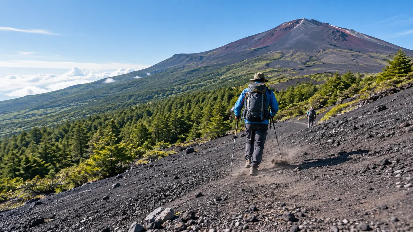
The Subashiri Trail begins in the forest at about 2,000 m. It continues onto open volcanic slopes, joins Yoshida at the Original 8th Station and has its own descent below the Shita-Edoya junction. Its lower descent includes a stretch of fine volcanic gravel called the Sunabashiri.
The switch from trees to exposed slopes changes how you manage wind, sun and pace. The descent calls for controlled steps and care around loose gravel. Here’s what to plan for on both halves of the route.
The climb through the forest
The path from the 5th Station to the Original 6th Station passes through woodland. Above the forested section, volcanic sand, gravel and rock become more prominent.
Take advantage of the lower section to settle into your pace and notice how conditions change as you gain altitude.
Shade: Trees can make the first stretch cooler. Drink as needed and keep water accessible for the open slopes above.
Less exposure to wind: The forest can shelter you from wind. At the treeline, expect more exposure and check the forecast and trail notices before departure.
Changing footing: In the woods, earth and roots are more common than loose volcanic gravel. Wet roots can still be slippery. Use the quieter opening to find a pace you can maintain higher up.
At a stable spot before the open slope, check your warm layers, sun protection and eyewear. If the weather or group condition has changed, decide whether to continue before leaving the shelter of the trees.
The Sunabashiri descent
The Sunabashiri is a long slope of loose volcanic gravel below the 7th Station, on the way to the Sunaharai 5th Station. Some patches are softer than others. Choose a controlled walking pace and leave room between hikers.
Dealing with grit and loose footing
Gravel can get into your footwear and cause rubbing or blisters. Gaiters that cover the opening of your boots can help. Check the fit and clear grit out at a safe stopping place before it becomes uncomfortable.
The surface can change from deep gravel to firm ground within a few steps. Take short steps, adjust to the surface and slow down if you lose balance. Leave enough space to avoid kicking stones or dust toward the person in front.
From the summit area, follow the signed descent shared with Yoshida. Near Shita-Edoya around the 8th Station, take the red Subashiri signs. The yellow signs lead to Yoshida and a different 5th Station. Regroup at the fork and check the map before descending.
Equipment for the forest and gravel
Start with rain protection, warm layers, suitable footwear, food, water and a headlamp. These additions can help with the route’s changing conditions.
In the forest
- Waterproof jacket and trousers: Leaves can keep dripping after the rain eases. Bring rainwear for the rest of the route too.
- Insect protection: Pack repellent if insects are likely to bother you in the lower section.
On the Sunabashiri
- Gaiters: Choose a length and fit that cover your boot openings and stay in place.
- Trekking poles if you use them: They may help balance on suitable ground. Plant them where they won’t slide and leave space around other hikers.
- Eyewear: Sunglasses or goggles can help keep windblown grit out of your eyes. A face covering may help in dusty conditions.
Time and energy for the whole route
The official guide gives 6.9 km and about 6 hours 25 minutes uphill, and 6.2 km and about 3 hours 20 minutes down, excluding breaks. Add time for your group, crowds, the junction and transport.
Begin at an easy pace in the forest and leave energy for the gravel, the steep rocks and the shared upper route. Stop ascending if symptoms of altitude sickness appear. Descend if they worsen or fail to improve and get urgent help for confusion, poor coordination or breathlessness at rest.
Allow for a slower descent if your legs are tired or the surface is loose or wet. When approaching the gravel slope, find a safe spot to check your equipment and regroup before carrying on.
In 2026 Subashiri’s climbing season ran from July 1 at 09:00 to September 10 at 17:00. Separate private-car restrictions on the Fuji-azami Line lasted until 18:00 on September 10, with transfers at Subashiri Multipurpose Plaza. The 2027 season is tentatively early July to early September, with exact dates and access rules to be announced. Check the trail, road, hut and last bus before booking.
Before you go
Verify Shizuoka’s entry procedure, the opening dates and the way back from Subashiri’s 5th Station. Download the route map and mark the red descent fork. Pack your warm layers and keep any gaiters and eye protection accessible. On Nordwand’s Base Camp you can ask hikers about their experience of the route.
Sources
- Official Mount Fuji climbing website: Subashiri trail and route map
- Japan Meteorological Agency: forecasts and warnings
- Shizuoka Prefecture: entry requirements and private-car restrictions
References and sources
- Official Mount Fuji climbing website — Trail comparison and access
- Official Mount Fuji climbing website — Current season outlook
- Official Mount Fuji climbing website — Trail openings and facilities
- Shizuoka Prefecture — Entry requirements
- Official Mount Fuji climbing website — Signs and junctions
- Japan Meteorological Agency — Weather forecasts
- Official Mount Fuji climbing website — Subashiri trail map
- Shizuoka Prefecture — Private-car restrictions
- CDC Yellow Book — Altitude illness