
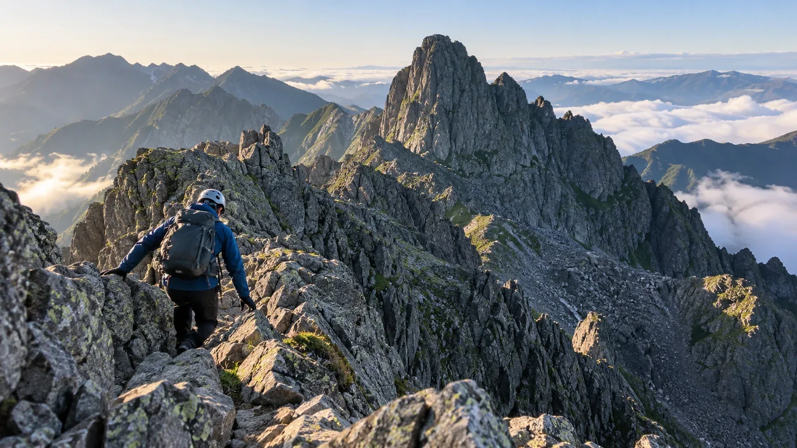
The Ōkiretto and the Gendarme are two well-known rocky sections of Japan’s Northern Alps. For either route, check the exposure, the descents, the approach and the few options for leaving the ridge. Chains describe only one part of the terrain.
This guide compares the two sections and the skills each requires. Use it alongside current route notices, a detailed map and local advice before deciding whether to go.
How the two routes differ
Consider the exposure, the time spent on steep rock and how you would retreat if conditions changed. Both routes are advanced objectives.
Ōkiretto is the deep notch between Minamidake and Kita-Hotaka. Steep rocky steps and narrow ledges continue through sections including Hasegawa Peak and Hidanaki. The Ministry of the Environment describes scree and steep, narrow ridges. The difficulty includes sustained, precise movement and the need to manage loose rock, exposure and fatigue.
The Gendarme is a rocky summit on the ridge between Oku-Hotaka and Nishi-Hotaka. Hotakadake Sanso describes the traverse as expert terrain and says there is no hut between Nishiho Sanso and Hotakadake Sanso. Some sections require independent route decisions and may call for rope protection by a party trained to use it. Check the directions and descents for the way you plan to travel.
On Ōkiretto, plan for repeated steep moves and sustained exposure. On the Gendarme traverse, also plan for more route-finding decisions and a long section with limited retreat.
Choosing a route that matches your experience
Neither traverse is an introductory exercise. Build experience on less exposed terrain with established retreat options and qualified guidance where needed.
A successful traverse on one ridge gives you experience to draw on. Assess the other route on its own terrain, weather, difficulty and escape options.
Before considering Ōkiretto
- Can you maintain secure contact and move with control on rock without chains?
- Can you descend exposed rocky steps deliberately, including after a long approach?
- Have you practised on similar terrain with experienced partners and understood where you could stop or turn back?
- Can the group respond to wind, wet rock or delays before committing to the notch?
Before considering the Oku-Hotaka–Nishi-Hotaka traverse
- Have you moved with a margin on comparable exposed ridges in a group?
- Can you identify the intended line where markings or fixed aids are sparse?
- Can you check holds for looseness while keeping secure supports?
- If any section calls for protection, does the party have the relevant training and compatible equipment?
- Can everyone manage the distance, exposure, descents and time without relying on a hut along the ridge?
Use those questions to review experience with your group. If several answers are uncertain, choose a more manageable route or discuss training and a supervised outing with a qualified guide.
Planning either route
Weather and time
Check Japan Meteorological Agency forecasts and warnings and the latest hut or trail notices. Rain, ice, thunder, wind and poor visibility can make the ridge unsafe. Set a point to turn back before the exposed section if conditions exceed the group’s skills.
Plan for delays and confirm hut dates and reservations. Minamidake Koya and Kita-Hotaka Koya sit on either side of Ōkiretto. Hotakadake Sanso and Nishiho Sanso serve the ends of the longer Gendarme traverse. In 2026, normal operations ended October 11 at Minamidake Koya and November 3 at Kita-Hotaka Koya and Hotakadake Sanso. Nishiho Sanso is listed as year-round, subject to its own conditions. Check each operator for the trip date and keep a separate retreat plan.
Equipment
Keep the pack compact and stable while carrying the route’s essential clothing, navigation, water and emergency equipment. A confirmed hut booking can change what shelter equipment you carry. Check what remains necessary if you are delayed or the plan changes.
Nagano Prefecture recommends helmets in the Yari–Hotaka rocky areas. Fit a mountaineering helmet before exposed terrain and avoid dislodging stones. Choose footwear and any gloves for the conditions, and make sure you can handle your equipment on secure ground.
Descent and retreat
Identify safe turnaround points before reaching either ridge. The Gendarme traverse has limited ways off the ridge. Hotakadake Sanso warns that the former escape route down from Tengu-no-Koru is impassable after major collapse. Do not plan to use it. Check whether a retreat you marked is actually maintained and available.
Season and timing
Snow or ice changes these routes substantially and can obscure the line and the holds. Winter and lingering snow require terrain-specific skills, equipment and current conditions from local sources. Do not infer safe conditions from the calendar or a hut opening.
Build extra time into the route for other parties, rockfall exposure, weather and retreat. On a narrow section, wait on stable ground out of the rockfall path and follow local signs. Turn back if the group loses the margin needed to descend safely.
Before choosing a date
Review your group’s experience on comparable terrain, check the operator’s latest trail and hut information, and confirm the weather and your descent. Submit the applicable hiking plan for designated routes. If you cannot identify a safe margin and retreat, choose a different objective or arrange qualified guidance.
Further reading
- Japan Meteorological Agency forecasts and warnings
- National Police Agency mountain incident reports
- Nagano and Gifu prefectural mountain safety information
- Route and operation information from the Northern Alps huts
References and sources
- Japan Meteorological Agency · Warnings and advisories
- National Police Agency · Mountain incident reports
- Nagano Prefecture · Shinshu route grading
- Gifu Prefectural Police · Hiking plan requirements
- Ministry of the Environment · Patrol across Ōkiretto
- Hotakadake Sanso · Route descriptions and Tengu-no-Koru closure
- Minamidake Koya · Hut information
- Kita-Hotaka Koya · Operation and reservations
- Hotakadake Sanso · Operating status
- Nagano Prefecture · Northern Alps huts and operating periods
- Nagano Prefecture · Seasonal Northern Alps safety information
- Nagano Prefecture · Areas where helmets are recommended