
Name, Origin, and Legal Standing
The Māori name Kā Roimata o Hine Hukatere means the tears of Hine Hukatere. As recounted by Lisa Tumahai in Te Rūnanga o Ngāi Tahu's Te Karaka in 2022, Hine Hukatere loved the mountains and persuaded her companion Wawe to climb with her. He fell, and her frozen tears formed the glacier. That story belongs to Ngāi Tahu oral tradition and culture. The Ngāi Tahu Claims Settlement Act 1998 made the dual name Franz Josef Glacier / Kā Roimata o Hine Hukatere the official legal name. Land Information New Zealand circulated a proposed orthographic revision of the Māori name for consultation in 2023 and 2024, considering changes to both English and Māori spellings. The minister rejected the proposed changes in 2024, leaving the official name as Franz Josef Glacier / Kā Roimata o Hine Hukatere.
The glacier is listed in the New Zealand Gazetteer under that dual name and is located within Westland Tai Poutini National Park. Its upper accumulation basin sits roughly between 1,900 and 2,400 metres, with the highest ice reaching around 2,900 metres according to a 2014 analysis by Purdie and colleagues.
Basin Geometry and Ice Movement
Snow accumulates in the wide upper basin through successive snowfall seasons. As layers compact under their own weight they transition to glacial ice, which drains toward a constriction where the terrain steepens sharply. That icefall marks the transition between the broad snowfield and the narrow valley glacier below. A 1956 field survey measured surface flow at a maximum of approximately 245 centimetres per day at the point where the snowfield enters the narrow upper valley above the icefall. That figure was the highest speed the team recorded and applies to that one location and that one campaign.
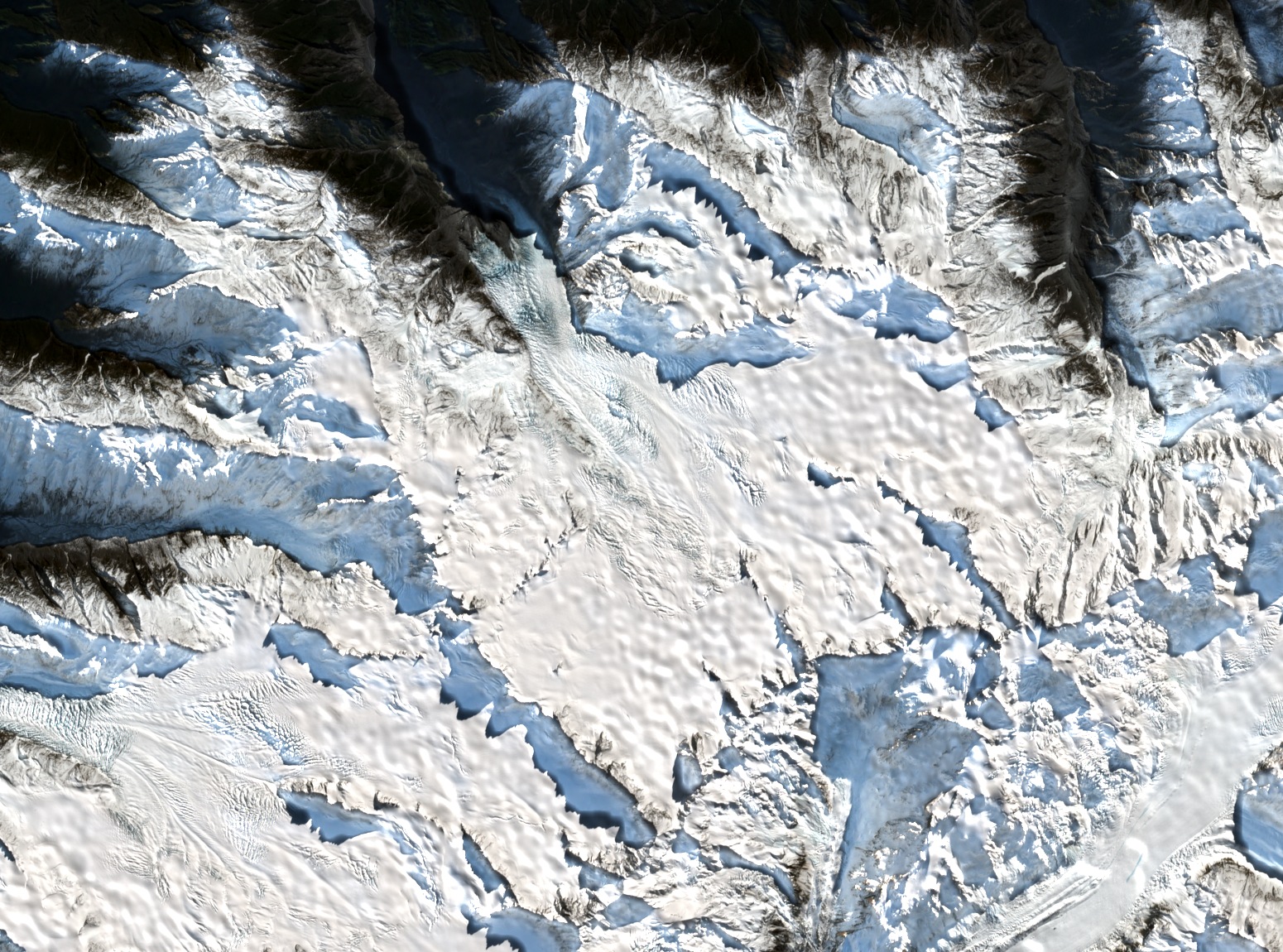
A Sentinel-2B natural-colour image acquired on 13 August 2026 shows the wide snow basin near the centre of the frame and its ice continuation running northwest. Not all snow visible in that image drains into Franz Josef Glacier / Kā Roimata o Hine Hukatere. The image provides a spatial view of the basin geometry.
Winter Accumulation Fieldwork
In 2008, Heather Purdie and colleagues conducted a winter snow field experiment placing flat snowboards and measurement poles on accumulation areas on both sides of the Main Divide, on the Franz Josef side and on the Tasman Glacier side. A snowboard is a flat reference surface left in place so that new snowfall depth above it can be measured. The 21-day study compared local accumulation against storm track and wind conditions at each site. The Franz Josef side site was located at approximately 43°30′S 170°14′E.
The two sites sit on opposite flanks of the Main Divide and do not respond identically to the same weather systems. The research team instrumented each site to record local wind speed and direction, humidity, and temperature alongside the snowboard accumulation measurements. That combination of instruments captured both how much snow fell and the atmospheric conditions driving each accumulation event.
Terminus Fluctuations and Long-Term Retreat
Purdie and colleagues published a reconstructed length record in 2014, drawing on historical records, photographs, and surveys. That record showed the Franz Josef terminus advancing approximately 1,420 metres between 1983 and 1999, then a further advance of about 280 metres between 2004 and 2008. The 2014 paper also noted that the greatest retreat rate in the record had recently been observed at that time, and that the multi-decade trend since the nineteenth century has been one of overall shortening.
Terminus measurements record movement at the lower end of the glacier, where ice melts, and upper-basin snowboard experiments record inputs at the top of the system. The two methods capture different parts of the glacier and different timescales. Short readvances of hundreds of metres over a period of years sit within a longer pattern of retreat spanning more than a century. Those short advances and the long-term retreat are products of different dynamics and operate at different scales.