
Landform and Setting
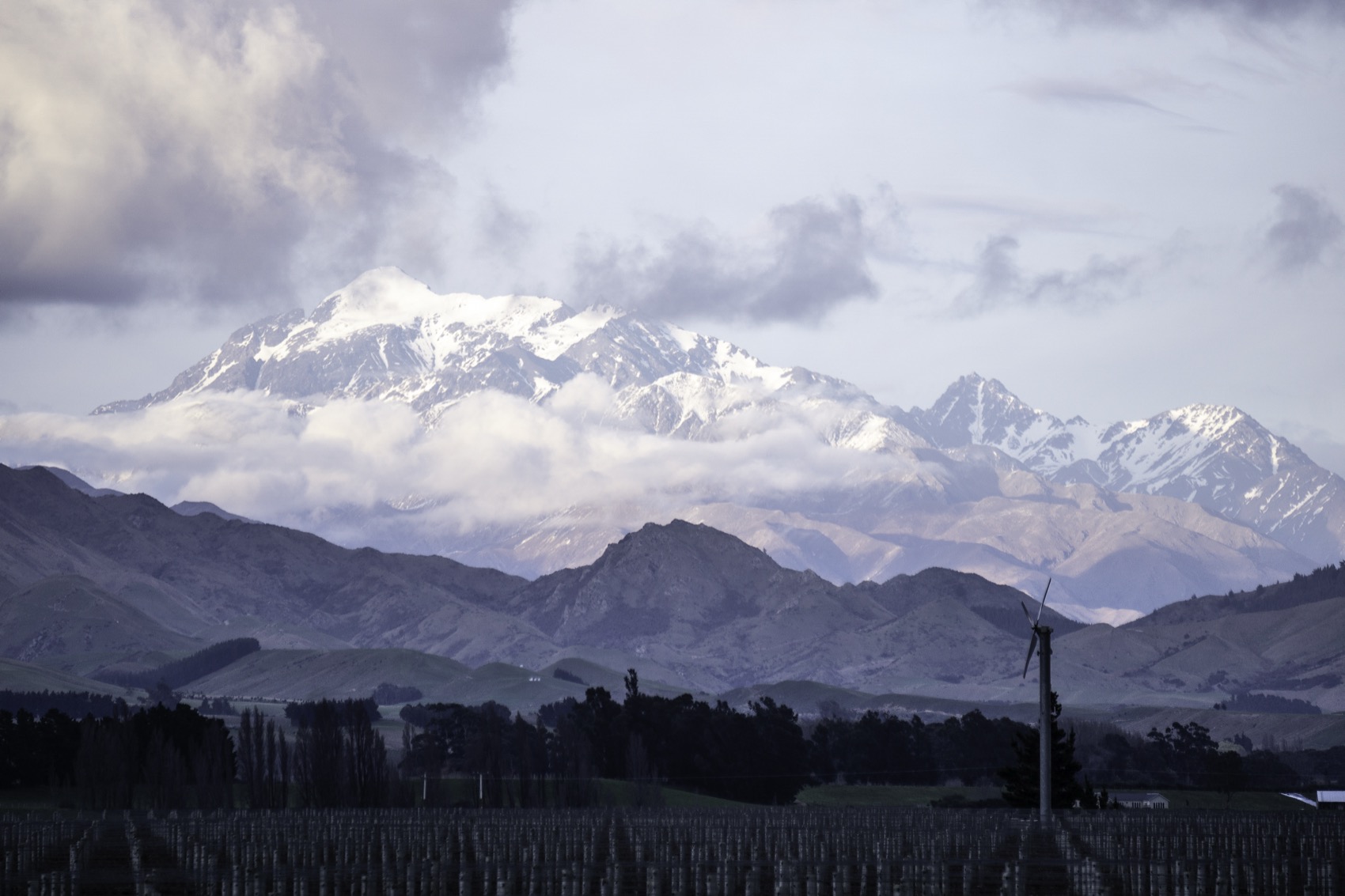
The mountain rises between the Awatere and Waiau Toa / Clarence valleys. The Department of Conservation identifies the beginnings of glacial hollows, or cirques, on the south side of the summit. It notes how few glacial landforms the Inland and Seaward Kaikōura ranges have compared with other high parts of the South Island. Rock slopes and eroded valleys give these mountains much of their shape.
The Inland Kaikōura Range is visible from the Marlborough coast. The 1988 New Zealand Gazette replaced the summit’s earlier mapped spelling, Tapuaenuku, with Tapuae-o-Uenuku. That is the name on the current national Topo50 map, while settlement documents use Tapuae o Uenuku.
Cultural and Legal Standing
Te Rūnanga o Kaikōura’s environmental management plan identifies Tapuae o Uenuku as an ancestral mountain of Ngāti Kuri. Schedule 90 of the Ngāi Tahu Claims Settlement Act 1998 records the Tōpuni, which recognises the cultural, spiritual, historical and traditional significance of this mountain to Ngāi Tahu.
The rūnanga’s plan explains that the term Tōpuni draws on the custom of extending protection by placing a cloak over a person or a place. Here the designation formally recognises Ngāi Tahu values within conservation management. The plan also records local priorities for protecting the Awatere headwaters and the mountain landscape.
Early Ascent Record
Te Ara records that in 1849 Wiremu Hoeta of Te Āti Awa fell during an attempt by a party of nine. His death is the earliest recorded in New Zealand mountaineering. The earliest documented successful ascent is usually dated to 1864 and credited to Nehemiah McRae and two companions. W. J. Weiss made the first recorded solo ascent in 1876. Annie and Florence Parsons became the first women known to reach the summit in 1890. A survey team erected a trig station on the summit in 1895.
Edmund Hillary climbed the mountain solo in 1944 while training with the Royal New Zealand Air Force in Marlborough. The Dictionary of New Zealand Biography records a 32-kilometre walk up the Awatere Valley before the approach by the Hodder River and a 14-hour climb. At the end of the weekend he returned down the same valleys.
The Mountain in View
A photograph taken on 8 September 2022 by Hughvannoorden from the Awatere Valley captures the mountain's characteristic profile looking southwest, with a vineyard in the foreground and the lower form of Mitre Peak visible to the right. The image illustrates the relationship between the range and the cultivated floor of the Awatere Valley — the same corridor Hillary followed for his 1944 approach — and conveys the scale at which the Inland Kaikōura peaks dominate the Marlborough interior.