
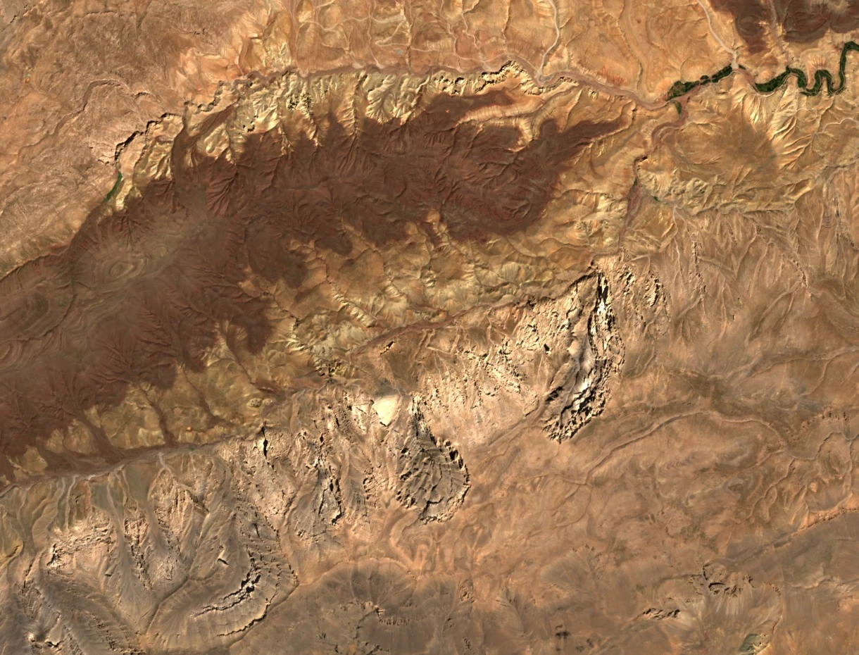
A hydrological network born at altitude
According to Dakki and Sehhar, the M'Goun network originates at around 3,000 metres altitude at the source of the Oulilimt. The Oulilimt then flows eastward for nearly eight kilometres along the foot of the northern slope of the massif before joining the Aflafal, a right-bank tributary. The diagnostic locates one of its permanent springs, Aïn Aflafal, at around 2,300 metres. The researchers also sampled the Aflafal at around 2,245 metres, just upstream of the confluence.
The Sentinel-2C image of 22 September 2026 reveals the morphology of the area: the deeply incised valley occupies most of the frame, while the cultivated valley floor extends beyond the confluence, in the upper right of the image.
From the 1987 map to the 2003 fieldwork
Issue 147 of the journal Pyrenaica (1987) publishes an account of a traverse of the M'Goun by Juan José Hidalgo, accompanied by a map by J. Gamarra on which the Assif-n-Oulilimt is clearly marked. This map attests to the place this valley held in the reading of itineraries of the period by Basque mountaineers active in the massif.
From 26 to 31 August 2003, the conservation project team surveyed the upper and middle course of the M'Goun on foot. They selected stations on either side of certain villages and near confluences. The researchers recorded water temperature and collected benthic invertebrates using a net, in order to compare habitats across the catchment.
Ramsar listing and biodiversity of cold springs
On 16 April 2019, Morocco listed 1,400 hectares of the Assif Mgoun on the list of wetlands of international importance under the Ramsar Convention (site 2376). The perimeter encompasses the permanent central channel, its intermittent upstream extension, and four small permanent tributaries. The site information sheet highlights the importance of cold springs and high-altitude streams, whose more stable regime compared to the main wadis plays a particular role for the biodiversity of the massif.