
High Point and Topography
The highest summit of the Babatag Range is Zarkosa, recorded at 2,290.4 metres on the Soviet topographic survey sheet J-42-77 (Ishnabad, 1965), where the name appears as Zorkossa. A Cabinet of Ministers decision dated 9 January 2026 — entry 85 of an official place-name register — standardises the Uzbek Latin spelling as Zarkosa, superseding the earlier form Zarkasa. The summit lies near the range's geographic centre, within the area that also contains the juniper stands described by the national news agency in coverage of the range.
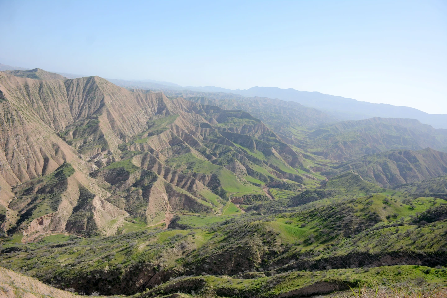
Annual precipitation across the range is approximately 170 to 400 millimetres. Seasonal ravines and streams on both flanks swell in winter and spring and run dry by summer, cutting deep gullies into the steeper eastern slopes while draining more broadly across the western side. These drainages feed into the Surkhandarya and Kofarnihon river valleys, both of which flow onward to the Amu Darya.
Vegetation Zones and Endemic Flora
Almonds, pistachios, barberries, and wild roses grow at approximately 800 to 900 metres, with juniper appearing at higher elevations, notably around the Besharcha and Zarkosa areas. A UNEP Convention on Migratory Species regional assessment characterises the shared border landscape as a mosaic of steppe, dry shrublands, and pistachio woodland.
A 2025 study in Ethnobotany Research and Applications documents Astragalus babatagi, a legume with a herbarium collection made by M. G. Popov in 1914 near Kel-Bulak on the Babatag Range. Populations occur in scattered patches on gypsum-bearing rocks, and a 2019 seed collection was made in pistachio woodland near Zarkamar at 1,700 metres.
Bobotog National Natural Park
Uzbekistan Cabinet of Ministers Resolution No. 93, signed 4 March 2022, established Bobotog National Natural Park in Uzun District at 12,064 hectares, divided into a reserved zone of 8,000 hectares, a recreational zone of 3,000 hectares, and an economic-use zone of 1,064 hectares. The park contains more than 300 plant species, of which 16 are listed in Uzbekistan's Red Book.
The Uzbekistan National News Agency reports extensive foothill pasture and irrigated farming in the Kofarnihon valley. Agency field photography shows eroded valley shapes and green spring growth within the park boundaries in Uzun District.
Names and Regional Context
The Getty Thesaurus of Geographic Names records the Uzbek form Bobotogʻ, the Tajik form Qatorkŭhi Bobotogh, and the transliterated cartographic variant Babatag, identifying the feature as a transboundary landform. The UNEP CMS transboundary assessment lists the Babatag as site 37, covering the eastern Surkhandarya and Khatlon portions of the range across both countries.