
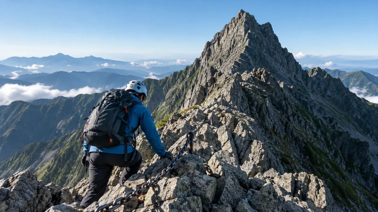
Mount Yari (3,180 m) is one of the best-known peaks in the Northern Japan Alps. Its sharp summit stands out from far away. The rocky section just below the top uses chains and ladders, so you need fitness, experience on rocky ridges and sound judgment.
This guide compares the main approaches, looks at the decisions you’ll make on the summit pinnacle and explains what to check when planning. Use it to decide whether the trip suits you.
Main approaches and how to choose
Starting points, trip lengths and difficulty vary. Choose a route that fits your experience and the time you have.
The Yarisawa route from Kamikochi is a common approach via Yokoo and Yarisawa Lodge to Yarigatake Sansō. Yarisawa Lodge estimates about 8–10 hours from Kamikochi to Yarigatake Sansō. For a first trip, consider three days with one night at the lodge and one at the upper hut. Snow lingers for different lengths of time each year. Snow or ice changes the skills and gear you need. Check the huts’ latest updates.
The Migimata route from Shinhotaka Onsen reaches Yarigatake Sansō via Hotakadaira Hut and Yaridaira Hut. The operator estimates about 8½ hours of ascent in total. Spending a night at Yaridaira breaks up the climb. Stream crossings such as Takidani Deai may become impassable after heavy rain. Check weather and trail updates and stay out of swollen streams.
The Omote Ginza traverse leads from Nakabusa Onsen past Mount Tsubakuro and the Mount Ōtenshō area to Mount Yari via Higashikama Ridge. The ridge offers long views and includes ladders, chains and exposed rock. You’ll need experience on consecutive days and the skills to move safely on rock.
Check access restrictions, hut opening dates and transport with the huts, Nagano and Gifu prefectures, local authorities and transport operators.
What to expect on the summit pinnacle
The pinnacle is the rocky section above Yarigatake Sansō leading to the 3,180 m summit. Chains and several metal ladders are in place, but the exposure can feel more serious than expected if you’re unfamiliar with rocky terrain.
Here’s what you’ll encounter.
- Near-vertical ladders. You need to be able to move calmly in both directions while checking each foothold and handhold.
- Ascent and descent signs. Follow the directions marked on site and leave room for those ahead.
- Queues. Waits grow on fine weekends and holidays. Set a time to skip the summit based on sunset, thunderstorm forecasts, the descent and hut times.
- Rockfall. Climbers can accidentally dislodge stones. Yarigatake Sansō recommends wearing a helmet on the pinnacle.
Decisions that matter on the pinnacle
Your decision depends on arrival time, crowds, weather and fatigue. Think through these situations while planning.
If you reach the hut late. Yarigatake Sansō estimates about 30 minutes each way to the summit in normal conditions, but at busy times a single leg can take more than two hours. Leave room to go the next day or skip the summit if the weather or queues warrant it.
If you have a large pack. A bulky pack makes it harder to move down ladders. Ask the hut where to leave it and put essential gear in a small pack. Leave poles behind so both hands are free.
If thunderstorms or bad weather are approaching. Check Japan Meteorological Agency warnings and local conditions before starting up the pinnacle. If you hear thunder or see lightning, leave the summit or ridge and take shelter inside a building such as a hut as soon as possible.
If footholds are hard to see on the way down. Check each foothold on steep ladders. Maintain three stable points of contact and move one hand or foot at a time. On rock, place your weight on stable footholds and avoid dislodging loose stones.
What to check when planning
The routes cross areas managed by different authorities, so plan for each section.
Hiking plan notification. Filing before the hike is mandatory on designated trails in Nagano and in areas covered by Gifu’s ordinance. Check where and how to submit for the sections you’ll use, and share the plan with someone who isn’t coming.
Hut bookings and opening dates. Yarigatake Sansō, Yarisawa Lodge, Yaridaira Hut and others have different seasons and booking procedures. Check the dates, meals, water and check-in time at each hut.
Weather. The day before and morning of the trip, check Japan Meteorological Agency forecasts and alerts, forecasts for ridge winds, rain and thunder, and local hut updates. Consider shortening or postponing the trip if bad weather is expected.
Gear. Take a helmet, warm layers, a rain jacket and trousers, a headlamp, map, trail food and water. Wind and rain can chill you quickly on the ridge. Lingering snow or ice may require different equipment and skills from a summer hike.
Experience to build before climbing
You’ll need to be comfortable using chains and ladders in both directions, even when tired. Check the following before committing.
- Rocky trails with chains and ladders. On a shorter route, practise climbing and descending calmly with a pack.
- Time to acclimatize. People react differently to altitude. If a headache or nausea could be altitude sickness, stop ascending. Descend if symptoms worsen. If there are severe symptoms such as breathlessness at rest or stumbling, call for rescue immediately and descend as quickly as you safely can.
- Reading weather and turning back. Practise making an early decision to turn around on a similar hike. It will be easier to change plans when it matters.
What to do next
Check hut opening dates and bookings, transport both ways and the total walking time. Decide when to turn back because of weather, delays or someone feeling unwell. You can also exchange information in Nordwand’s Base Camps with others planning Mount Yari or familiar with the area. If you’re unsure about the rock sections, consult a guide qualified for the route.
References
- Japan Meteorological Agency: weather warnings and lightning safety
- Geospatial Information Authority of Japan: elevation of Mount Yari
- Nagano and Gifu prefectures: hiking plan notifications
- National Mountaineering Training Centre and CDC: movement on rock and altitude illness
- Yarigatake Sansō Group: routes, summit and huts
References and sources
- Geospatial Information Authority of Japan | Elevations of Japan’s major mountains
- Yarisawa Lodge | Walking time from Kamikochi
- Yarigatake Sansō Group | From Shinhotaka Onsen to Yarigatake Sansō
- Yarigatake Sansō Group | Higashikama Ridge on the Omote Ginza
- Yarigatake Sansō Group | Summit advice and frequently asked questions
- Yarigatake Sansō Group | Trail conditions
- Japan Meteorological Agency | Weather warnings and advisories
- Japan Meteorological Agency | Staying safe in lightning
- Nagano Prefecture | Filing a hiking plan
- Gifu Prefecture | Mountain safety ordinance and hiking notifications
- National Mountaineering Training Centre | Basic climbing movement
- CDC | Travel to high altitudes