
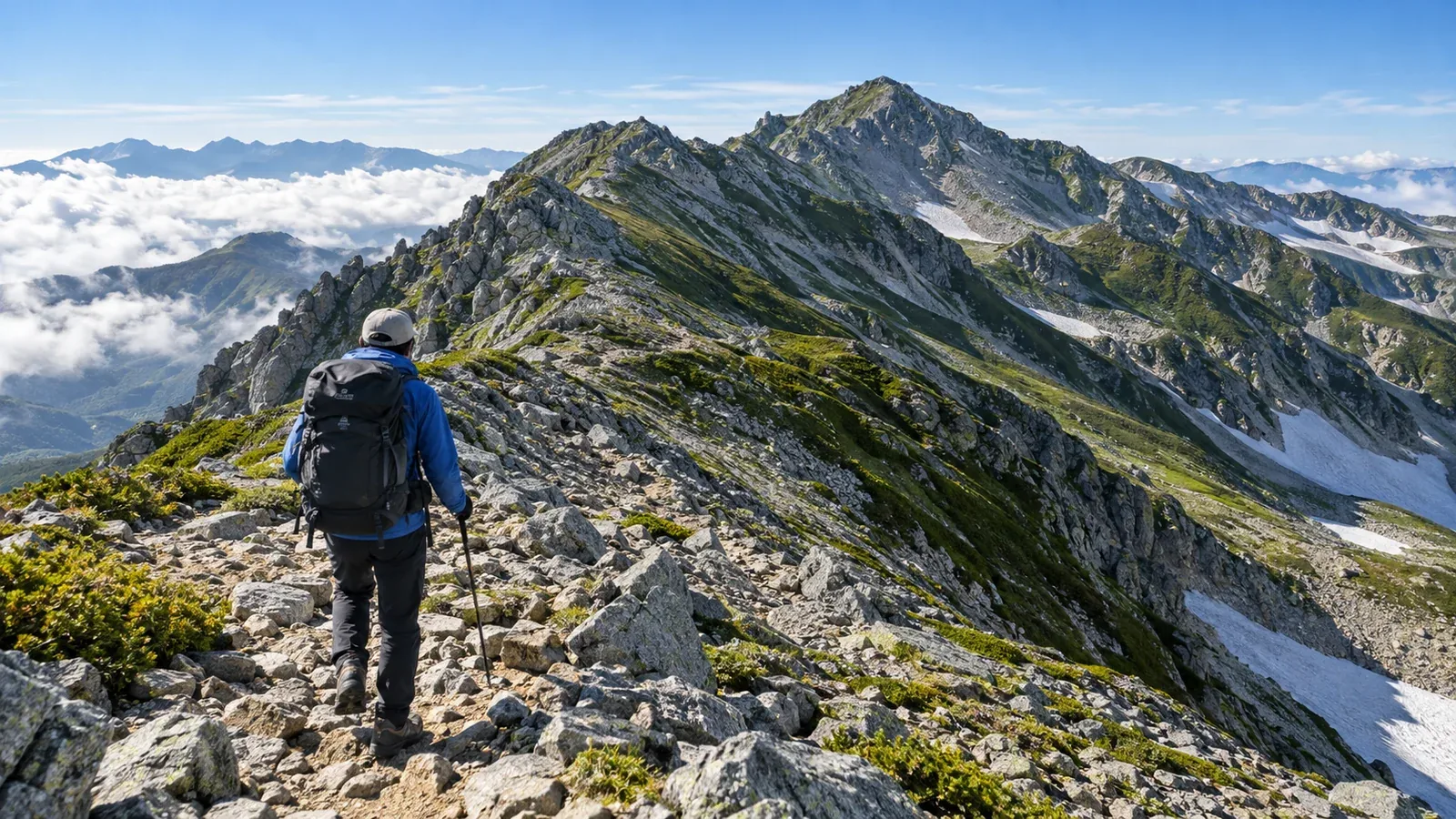
Tateyama Sanzan, or the three mountains of Tateyama, means Mount Jodo, Mount Oyama (Tateyama) and Mount Bessan. Oyama, Onanjiyama and Fuji-no-Oritate are the three summits of Tateyama itself. The loop linking the three mountains leaves Murodo via Mount Jodo and Ichinokoshi, then follows the Tateyama ridge to Mount Masago and Mount Bessan before returning via Raichozawa.
Murodo is at 2,450 m and the loop tops out at 3,015 m on Onanjiyama. The route has rocky ground and a long descent. Wind, lightning, snow and ice can change the conditions. This guide compares the full traverse with a loop that heads straight to Ichinokoshi without climbing Jodo and explains decisions to make along the way.
Route and walking times
The sections are outlined below. Walking times vary with the route and conditions. Plan with Toyama Prefecture’s segment maps, hut information and the Alpine Route timetable.
- Murodo → Mount Jodo → Ichinokoshi. This includes Mount Jodo (2,831 m) on the three-mountain loop. To skip it, follow the stone-paved trail straight from Murodo to Ichinokoshi.
- Ichinokoshi → Oyama (3,003 m). A steep climb on rock. Choose secure footholds to avoid dislodging loose stones.
- Oyama → Onanjiyama (3,015 m) → Fuji-no-Oritate. This connects Tateyama’s three summits. Onanjiyama is the highest point on the loop.
- Fuji-no-Oritate → Mount Masago → Mount Bessan (2,880 m). This stretch stays on an exposed ridge.
- Mount Bessan → Bessan Nokoshi → Raichozawa → Murodo. Descend to Raichozawa and pass near the campsite before climbing back to Murodo.
Toyama Prefecture’s Oyama-to-Bessan loop goes straight from Murodo to Ichinokoshi and skips Mount Jodo. It gives 7 hours of walking and 11.1 km. To add Jodo, use the segment maps to estimate the extra time and elevation change, then add breaks and delays. Check the last service and connections in your direction and work backwards from your arrival at Murodo.
Terrain and weather risks
Loose rocks and rockfall
There are loose rocks between Ichinokoshi and Oyama and around Fuji-no-Oritate. Test footholds before putting weight on them and leave space between hikers. If you dislodge a rock, shout “Raku!” (the local rockfall warning). Stow your poles where you need both hands.
Sudden changes and thunderstorms
Check Japan Meteorological Agency forecasts and alerts and local forecasts for ridge wind and thunderstorms the day before and the morning of the trip. If thunderstorms are forecast, reconsider a long loop even early in the day. Find escape routes and check in advance which buildings are open. If you hear thunder or see lightning, leave the summit or ridge and take shelter inside a building as soon as possible.
Early autumn snow and ice
Snow and ice can appear early in autumn at altitude. Even a dusting makes rock slippery. Check snow and ice reports from the Toyama Prefectural Police and the huts. Turn back or postpone if you lack the snow skills or equipment the conditions require.
Descending via Raichozawa
From Mount Bessan, descend to Raichozawa via Bessan Nokoshi. The long descent has steep slopes and loose stones. Fatigue and rain make it harder to find secure footing.
If you want to stay at Tsurugi Gozen Hut at Bessan Nokoshi, check opening dates, availability and check-in times before putting it in your plan. Decide early whether to shorten your trip. Leave enough energy and time for the final climb from Raichozawa to Murodo.
What to carry
Transport takes you as far as Murodo, but you still need gear for wind, rain and cold on the ridge. Pack for delays even on a day hike.
Start with safety essentials, then adjust what you carry for an overnight stay.
Pack these even for a day hike
- Rain jacket and trousers and gloves for wind and rain
- A warm layer such as fleece, chosen for the temperature and wind forecast
- Headlamp and spare batteries, map and compass, and emergency insulation
- Trail food and water. Check refill points and opening dates in advance.
What depends on your overnight stop
- Tent, sleeping bag and mat if camping. Check designated sites and conditions of use.
- Bedding and food for a hut stay. Find out what’s provided and what to bring when booking.
If there is snow or ice, summer day-hike gear may be insufficient. Check that you have the skills and equipment for your planned route.
Use the route to practise making decisions
At Ichinokoshi, check clouds and wind before going onto the ridge. Near Fuji-no-Oritate, look at the time and your pace. At Bessan Nokoshi, reassess whether you can manage the descent to Raichozawa and the final climb. Write down what you’ll check at each junction.
If you identify Kuranosuke Sansō or another hut as a possible retreat, check the trail from the junction and when the hut is open. A short distance to a hut can still be hard to cover in bad weather. Consider a shorter route, such as returning via Ichinokoshi, if conditions call for it.
What to do next
Check the Toyama Prefectural Police and Japan Meteorological Agency for weather and snow. Check hut opening dates and the Alpine Route’s operating dates and last services. Toyama Prefecture’s guidelines require an entry notification for designated parts of Murodo in April, May and November. Check current dates and boundaries. You can also talk to people who know Tateyama in Nordwand’s Base Camps.
References
- Toyama Prefecture: route segment maps and mountain entry notifications
- Tateyama Kurobe Alpine Route: hiking routes and timetable
- Japan Meteorological Agency: forecasts, alerts and lightning safety
- Toyama Prefectural Police and Japan Ministry of the Environment: mountain information and visitor restrictions
References and sources
- Japan Eco Track | Tateyama Sanzan: Jodo, Oyama and Bessan
- Toyama Prefecture | Tateyama trail segment maps
- Toyama Prefecture | Mountain route grades and distances, 2026
- Geospatial Information Authority of Japan | Elevations of Japan’s major mountains
- Tateyama Kurobe Alpine Route | Tateyama’s three summits and the trail to Oyama
- Tateyama Kurobe Alpine Route | Timetable
- Tateyama Town | Accommodation
- Toyama Prefectural Police | Mountain information
- Toyama Prefecture | Spring and late-autumn notifications for Murodo
- Japan Meteorological Agency | Weather warnings and advisories
- Japan Meteorological Agency | Staying safe in lightning
- Japan Ministry of the Environment | Chubusangaku National Park visitor rules