
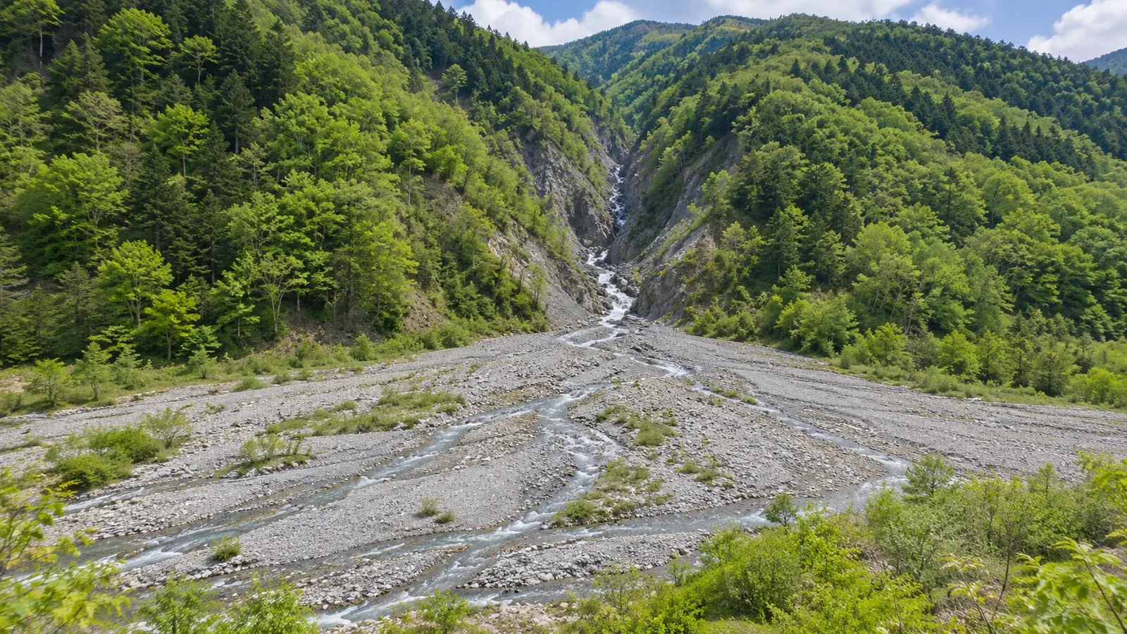
Read how the terrain opens out from the valley mouth toward the plain, then compare what you see with a landform classification map. Using the interpretation guide and map documentation from Japan’s Geospatial Information Authority (GSI) consulted on October 28, 2026, we look at what the contours can show and what to leave as a possibility. The note-taking exercise is our suggestion.
Look at how the valley opens onto the plain
As you trace a valley on the map, you may see gently sloping ground open out where the river leaves the mountains. To connect that landform with a possible alluvial fan, look at the direction it spreads in from the valley mouth. Wider gaps between contours are only one clue. This is an exercise to do on paper or screen before setting out. Check the safety of crossing on the day separately.
GSI’s interpretation guide describes an alluvial fan as a half-cone of sand and gravel deposited by a river, with its apex at the valley mouth and its broad edge opening toward the plain. Signs include a gentle slope at the outlet, traces of branching channels spreading outward and the overall fan-like outline. Look for the possible apex and the landform spreading below it together.
The guide also notes that some fans have irregular outlines and are hard to identify. A ragged outline does not rule out a fan, and one fan-like line does not establish one. Keep the shape marked as a candidate and compare it with the landform classification layer.
Match the contour arcs to the valley mouth
GSI’s guide to flood control landform maps describes roughly concentric contour arcs as a characteristic of an alluvial fan. Look for arcs opening toward the plain around the valley mouth as the apex. This lets you read the whole landform, beyond the first point where the ground flattens. An arc alone does not settle the classification.
The same guide shows the Sagae River building a broad alluvial fan where it leaves the valley for the plain. The point nearest the mouth is the fan apex, followed by the middle of the fan and the fan toe at the outer edge. In your notes, specify which part you are looking at. The area near the outlet and the broad edge toward the plain are different places to check.
For our map exercise, use one scale to show the possible valley mouth, the contour arcs spreading onto the plain, and the mountain slopes around them. Lightly mark the possible apex and the direction the landform opens, leaving the original lines legible. Counting contours inside a circle is a different exercise. If the valley bends, follow its shape instead of drawing a straight centerline.
Similar shapes can belong to different landform classes
The guide to flood control landform maps also describes debris-flow cones that resemble alluvial fans. On that map they may be grouped as footslope deposits or alluvial fans, based on surface slope, the area the landform covers and other factors. Consult the definitions for the map you are using before grouping features by their outline.
The Land Condition Map guide describes footslope deposits as slopes made of debris left by processes including debris flows and rockfalls. They occur below slopes, on valley floors in the mountains, or at valley mouths. The group includes talus cones, colluvial slopes, debris-flow deposits and debris-flow cones. An alluvial fan, by contrast, is a fan-shaped deposit of mostly sand and gravel where a river moves from the mountains onto a plain.
Footslope deposits need not lie immediately upstream of a fan, and a valley mouth need not be part of a fan. Compare the landform name and source definition with the area in view. If the feature you marked on the topographic map and the classification differ, check where you placed the boundary and what the layer covers. Leave it open if you cannot reconcile them.
A classification overlay leaves the outlet and safe access to be checked
GSI Maps Help explains that the landform classification layer identifies features such as alluvial fans and floodplains and gives information on their formation and associated hazards. It presents Land Condition Maps and Flood Control Landform Classification Maps as separate products. The latter shows features and levees along Japan’s Class A rivers. Check the product name and legend before comparing the colors or classes across layers.
Record the layer name, location, date of your check and classification. The classification you read applies to the displayed area. If nothing is shown at a location, check the coverage and whether data are available. The blank area tells you little about the landform or its hazards.
Even if your possible outlet overlaps the mapped fan, the overlay alone does not confirm that precise point. Review where the terrain opens from the mouth, how the contours curve and where the classification begins and ends. If the boundary remains unclear, write “fan extent mapped, outlet location tentative.” The shaded area may not show the finer boundaries you would see on the ground.
GSI explains that landform classes give clues to the kinds of hazards an area may be prone to. It lists footslope deposits and alluvial fans among landforms susceptible to debris-flow and slope-failure damage. The classification supplies no timing or rainfall threshold for safe passage. Flat-looking ground or a mapped class alone is insufficient to decide where to stop or whether to continue in rain.
If your route passes a valley mouth, check the latest weather and restrictions from local authorities or land managers as well as making the terrain notes. The shape of the landform gives you no rainfall cutoff for calling off the hike. Leave enough room to change plans before entering a hazardous stretch. Check the map from a stable place on the trail without going down to the valley mouth or gravel bars to investigate.
Read the possible outlet and the landform beyond it together
To connect a valley mouth with an alluvial fan, compare the shape spreading toward the plain, the contour arcs and the extent of the classified area. Alluvial fans can have irregular outlines, and debris-flow cones can look similar. Use several clues before assigning a name.
Keep a record of the mapped classification and extent, the possible outlet, and any boundary you could not identify. A match between the topographic and classification maps gives you a feature to check. The exact outlet and whether the route is safe on the day require separate information.