
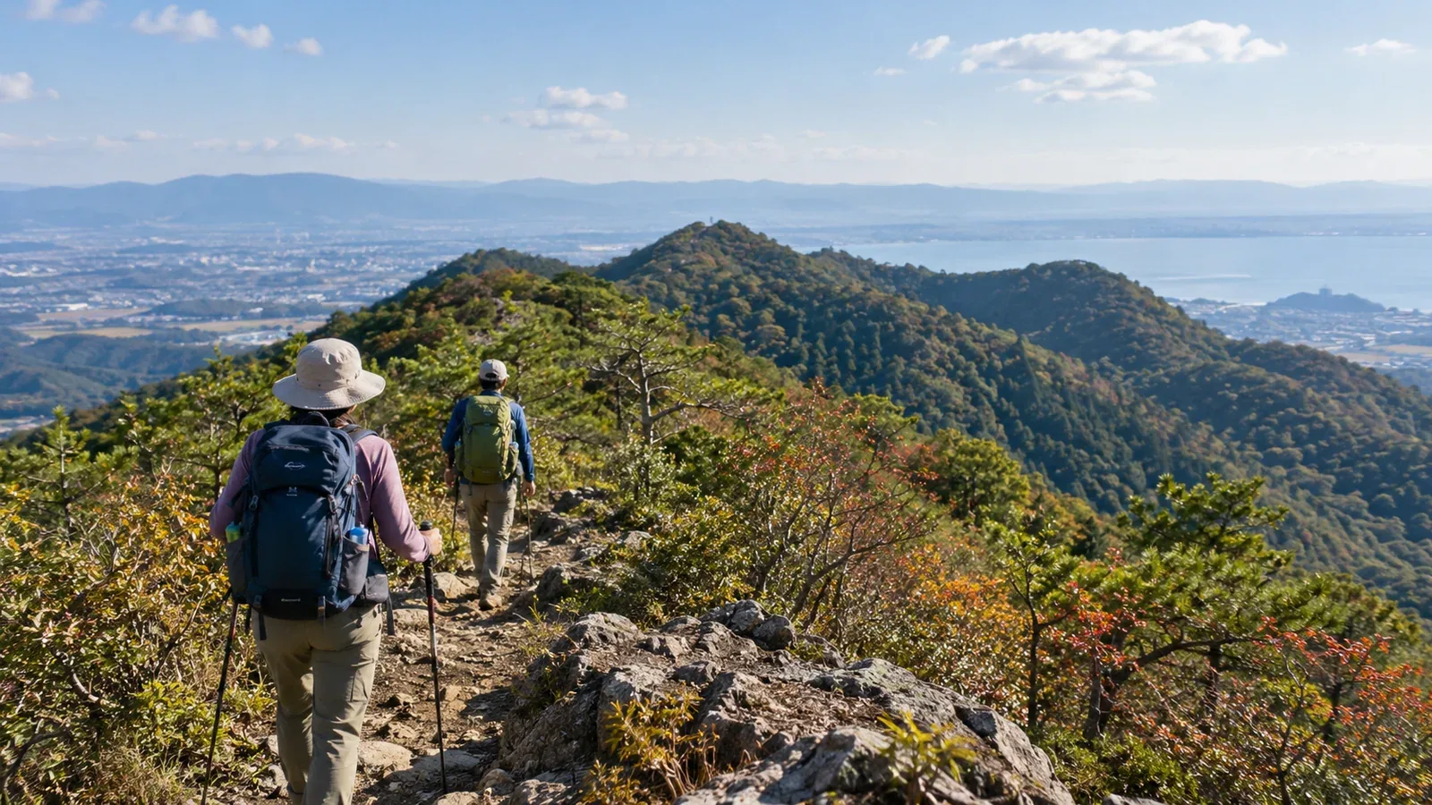
Once you’re comfortable going up and back down one hill, try linking two or three summits in the satoyama, the wooded hills around rural settlements in Japan. Even on a short trip, you get to read the ridge, watch the views change and keep enough energy for the final descent.
Even on low hills, every descent and climb back up takes time and energy. Look at how long you’ll be walking, how much strength you want to save for the descent and where you could cut the route short. That helps define what you can do in a day.
Here’s what to decide before leaving and when to change the plan on the trail.
Traverses, out-and-back hikes and loops
An out-and-back hike returns the way you came. A loop takes a different trail back to the start. A traverse links several peaks or sections, often along a ridge. A loop can include a traverse. Here we’ll look at point-to-point day hikes with different start and finish locations.
If you’re driving, decide how you’ll get back to your parked car from the finish. If you’re taking public transport, check departure times and how long it takes to walk to the stop. If your group leaves a car at each end, check that both places allow parking.
Four things to check when choosing a traverse
1. Look at the total ascent and descent
Along with the highest elevation, look at the total metres climbed and the total metres descended separately. A series of low hills can still be tiring if the trail repeatedly drops into a saddle and climbs back out. Use a topographic map or an elevation profile, and compare the distance and climbing with walks you’ve finished comfortably.
2. Check walking time and ways off the ridge
Start with the published hiking time, then allow for your own pace, breaks and map checks at junctions. Count the sections between summits and the road walk to the station or bus stop after you leave the trail.
Look for a path around the midpoint that descends to a village or road. A line on the map may be closed or in poor condition. Choose a route you can shorten if someone feels unwell, the weather changes or daylight runs short.
3. Check signs and trail conditions
Satoyama trails can have many junctions, and fallen leaves may hide the path. Check the municipality or land manager’s closure notices and use recent trip reports for extra detail. Download an offline map and get comfortable using a map and compass before you go.
4. Carry water and snacks
If you can’t identify a hut or water stop, start with enough drinking water for the conditions and time on the trail. Bring snacks that are easy to eat and check around halfway that your water, food and energy will last for the remaining distance.
Three checks while you’re hiking
Match the time and your location at summits and junctions
Check the time and your position on the map at summits and major junctions. If you fall behind early, recalculate how much time you need. Decide whether you can finish well before dark and take a way off the ridge if necessary.
Check whether you’ll catch the bus or train
Even if there’s a stop near the finish, there may be few departures. Check the operator’s latest timetable and leave time to walk to the stop and absorb delays. If you’re likely to miss your ride, switch to a shorter route before going farther.
File your hiking plan and agree how you’ll check in
Whether you go alone or with a group, share your route and expected finish time with someone you know. Agree what they should do if they don’t hear from you and file your hike plan as directed by the local police or authority. Let your contact know you’ve finished safely.
What to carry for a day traverse
Choose your day-hike gear for the time out, the weather and the trail conditions.
- Pack. Choose one you can carry easily when it’s loaded with water, food, rain gear, a warm layer and first aid.
- Map and compass. Bring a paper map and compass. If you use an app, bring an offline map and backup power as well.
- Headlamp. Carry one in case you’re delayed or lose the trail. Check that it works and that the batteries have enough charge.
- Rain gear. Keep a jacket and trousers that protect you from rain and wind within easy reach.
Choose footwear that fits and gives you the grip, protection and comfort you need on wet ground and steep descents. Try it on a short walk before the main trip.
What makes a traverse enjoyable
The next summit may look steeper close up than it did from the first, and a saddle can bring a sudden change of scenery. Remember your favourite stretch of the ridge as well as the summits.
Some satoyama ridges still carry old routes linking villages or paths that pilgrims once followed. Looking up the place names or a trail’s history can give you a sense of where the ridge used to lead.
Plan a route for your next day off
Pick two or three nearby hills and look for paths linking them. Check where you can cut the route short and how you’ll get home. Plan to finish with plenty of daylight left. You can look for people interested in the same area through the Nordwand community.