
Elevation and Position
The Nepal government register and the Himalayan Database give the western summit as 7,350 m. The Department of Tourism's 2025 Facts and Figures lists the same peak at 7,351 m. The Japanese Alpine Club expedition map, based on a 1996 Nepal Survey Department and Finland map, gives 7,350 m and shows a separate 7,321 m summit eastward toward Cho Oyu and Chamar at 7,287 m.
The guide uses the summit point visible in annotated photographs and topographic data. The Nepal Department of Tourism's published longitude falls approximately 270 m farther east. Copernicus terrain data provides an independent check of the location.
Names and Commemoration
The mountain was historically known as Jasemba or Jasamba, and earlier as Nangpai Gosum I or Nampai Gosum I. Nepal renamed the western 7,350 m summit to Pasang Lhamu Chuli in honor of Pasang Lhamu Sherpa, who reached the top of Everest on 22 April 1993 — the first Nepali woman to do so. She died during the descent. The Pasang Lhamu Mountaineering Foundation records the renaming alongside other commemorations: a monument in Kathmandu, a postage stamp, and the foundation's ongoing work supporting women in mountain communities.
Older sources used Nampai or Nangpai Gosum I for the peak now known as Pasang Lhamu Chuli. According to Kazuyoshi Kondo's 2007 firsthand account, after discussions with the Nepal Mountaineering Association president, his expedition proposed applying the name Nampai Gosum I to the separate 7,321 m summit immediately to the east, and the Nepal Tourist Board accepted the proposal. Kondo's 2006 joint Japanese-Nepali expedition reached that eastern peak's south summit at 7,240 m and turned back there. Jost Kobusch reached the eastern peak's main summit in 2017.
First Ascent and Early Climbs from Both Sides
The first documented ascent of Pasang Lhamu Chuli was made on 12 October 1986 by a Himalayan Association of Japan team approaching from the Tibet side via the northwest ridge. The Himalayan Database records four summiters: Katsushi Emura, Yukitoshi Endo, Katsuo Matsuki, and Yoshihiro Shikoda. Tamotsu Ohnishi's firsthand 1996 account acknowledges this prior climb and notes that expedition leaders at the time used differing names for the peak, with the earlier ascent confirmed by comparing terrain descriptions and expedition records.
On 18 October 1996 Michel Zalio's party reached the summit from the Nepal side, with Rémi Thivel, Arnaud Guillaume, Galsen Sherpa, Zangbu Sherpa, and Tsiring Dorje Sherpa at the top. On 19 October 1996 Tamotsu Ohnishi's Osaka Alpine Club party reached the summit from the Nepal side, with Mamoru Taniguchi and Toshiyuki Kitamura at the top. Accounts differ in the ordinal each assigns to these two ascents.
The Southeast Face and the View from Ngozumpa Tse
Simon Anthamatten's report, published in the American Alpine Journal in 2010, describes how Simon and Samuel Anthamatten and Michael Lerjen reached the summit on 29 October via a route called Hook or Crook on the southeast face, an alpine-style line through high rounded snow formations and rock bands. Hans Kammerlander and Karl Unterkircher made a separate ascent of the south ridge in 2007.
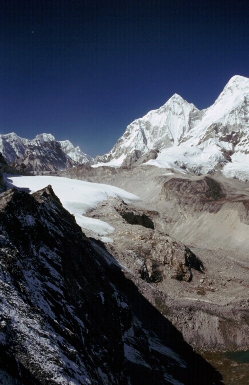
From Ngozumpa Tse to the southeast, Pasang Lhamu Chuli's pointed summit stands out to the right of center — the characteristic rocky, fluted top confirmed by Lindsey Nicholson's photograph taken from that vantage on 7 April 2006, and independently by an annotated panoramic view looking northwest from the same position. A lower shoulder at approximately 7,230 m appears to its right in that same panorama, with Cho Oyu further beyond the frame.