
Terrain and Setting
The Trus Madi Range runs northeast to southwest through interior Sabah, with deeply cut valleys and narrow ridges. The Tambunan–Keningau–Tenom plain separates it from the Crocker Range. Kaingaran lies east of Sinsing, which the 2024 Indogis map places at 2,586 m. The map marks ladders along the ridge between the two summits, where a waypoint drops to about 2,260 m. The Sabah Forestry Department describes lower montane forest at roughly 1,500 to 2,000 m and upper montane forest around 2,000 to 2,500 m across the wider reserve.
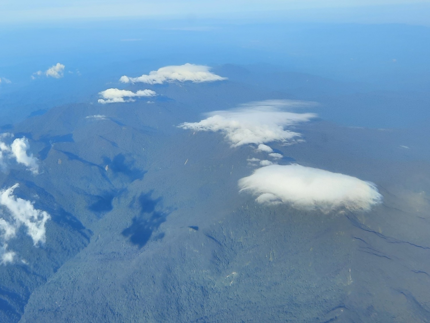
Negaraku photographed the range from the air on 27 July 2021. Forest covers the ridges and the deeply incised slopes below, while clouds gather over the higher ground. The photographer identifies Kaingaran and Sinsing in the frame, with the higher summit of Trus Madi partly obscured in the distance.
The 2018 Nupakan Expedition
A field party explored the Kaingaran–Sinsing route from 26 April to 4 May 2018. It included Nupakan residents Damasus Joannes and Jaulis Patrick Joannes, mountain guide Damasus Justin, whom the Sabah Forestry Department assigned to the trip, and botanist Ahmad Fuad Morad. Morad’s dated photographic record uses the spellings Kaingaron and Kaingaran.
Travellers describe moss covering roots and trunks, pitcher plants on the upper slopes and trees growing all the way to Kaingaran’s summit. These observations add detail to the broad forest zones mapped by the Sabah Forestry Department.
The Kaingaran Trail and the Trus Madi Corridor
Sabah Forestry Department officer Bonaventure Yampai documented another route with the same name. The Kaingaran Trail to Mount Trus Madi follows part of a migration corridor between Sinua and Mansiat on one side and Tambunan and Apin-Apin on the other. Yampai records the Iobuw people’s use of the corridor and improvements the Forestry Department made in 2009. Together with the Nupakan field record, his account shows two sets of journeys through the range and the communities associated with them.
Local Name and Oral Tradition
In a firsthand account for MySabah, Murphy records a local story in which Kaingaran was once called Gunung Gakou, after a person who hunted on the mountain. The story is one account of how the summit was remembered locally. The state atlas and the modern route map use Kaingaran.