
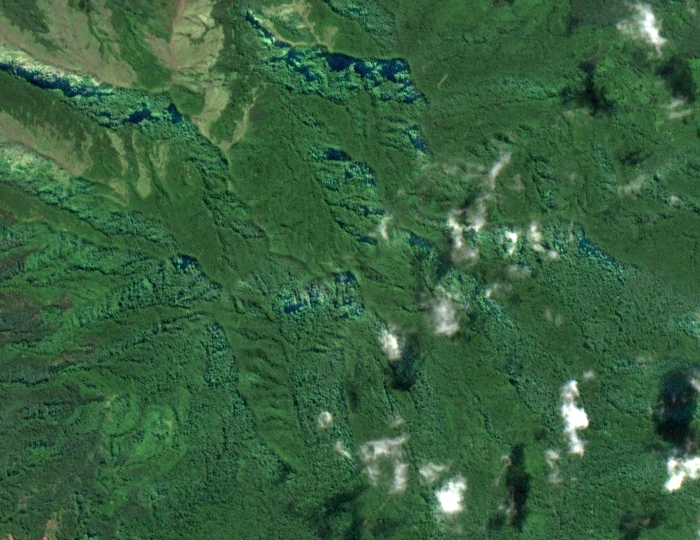
Two Summits, One Eroded Edifice
The Smithsonian Global Volcanism Program describes Aneityum as composed of two adjacent and overlapping Pleistocene volcanic edifices, predominantly basaltic in composition and so thoroughly dissected by erosion that large cirques have been carved into the flanks. The programme reports no known Holocene eruptions for Aneityum, placing the island's volcanic history firmly in the deep past. Inrerow Atamein — recorded by the Smithsonian as Inrerow Atamwan — forms the western cone of this structure. The GeoNames record, drawing on NGA names data, supports the name Inrerow Atamein, and the Smithsonian supplies an elevation of 852 metres for the summit; a specimen elevation of 850 metres has also been recorded on the upper slopes.
The GVP notes that an erosional cirque cuts the northwest face of Inrerow Atamwan, with a separate cirque cutting the southeast side of Nanawarez.
Highland Forest and Botanical Record
At 850 metres on the slopes of Inrerow Atamein, on 20 April 2016, botanical collectors Plunkett and colleagues recorded specimen number 3265 — a flowering example of Spiraeanthemum macgillivrayi subsp. macgillivrayi, a member of the family Cunoniaceae. The collection is documented in a 2023 revision of the genus published in Kew Bulletin by Pillon and colleagues, which treats specimens from Vanuatu and the Solomon archipelago. The revision notes that growth form in Spiraeanthemum can vary with altitude and exposure, with shorter stature recorded on exposed ridges. The subspecies appears at other sites across Vanuatu and is not restricted to this summit, but the Inrerow Atamein specimen establishes the mountain as part of its documented range.
Vanuatu's National Biodiversity Strategy and Action Plan for the period 2018 to 2030, produced by the Department of Environmental Protection and Conservation, frames Aneityum's upland habitats within the country's broader commitment to conserving island ecosystems. The strategy recognises the particular vulnerability of small-island forest habitats and the importance of maintaining intact vegetation on elevated terrain where species assemblages may differ markedly from lowland zones. The 2016 botanical collection at 850 metres on Inrerow Atamein sits within this framework as a data point in an ongoing effort to characterise what grows — and where — across Vanuatu's most remote islands.
Name, Spelling, and Island Identity
Aneityum carries several accepted spellings in the literature and official record: Anatom and Aneiteum appear alongside the most common contemporary form. The summit name similarly shows variation — the Smithsonian's catalogue uses Inrerow Atamwan while GeoNames and the NGA record Inrerow Atamein — without any single authority having established a universal standard. Situated in southern Vanuatu, the island's Pleistocene geology, its cirque-carved ridges, and its documented botanical collections define the character of its high point.