
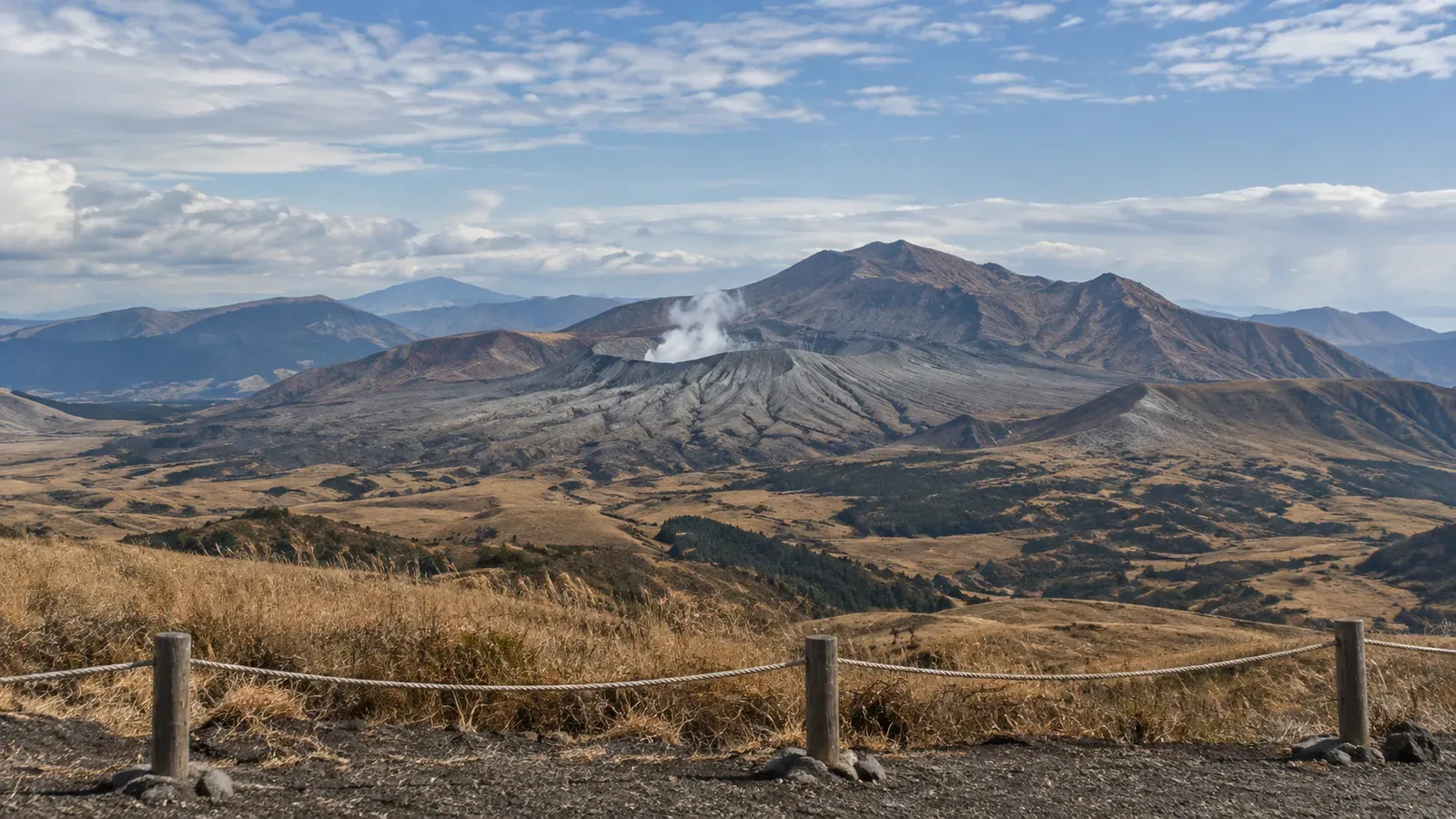
Level 3 calls for restrictions on mountain access. The affected area varies by volcano. Mount Aso went from level 2 to level 3 on August 14, 2026, then returned to level 2 on September 1. When planning a hike, check how the alert and local restrictions apply to your exact route.
Mount Aso Went from Level 2 to 3 and Back
At 3:45 p.m. on August 14, 2026, the Fukuoka Regional Headquarters of the Japan Meteorological Agency (JMA) raised Mount Aso from level 2, restricting the crater area, to level 3, restricting access to the mountain. The local council announced a restricted area extending approximately 2 km from Nakadake Crater No. 1. The JMA warned about large ballistic rocks and pyroclastic flows in that area. It cited larger volcanic tremors starting around 7 p.m. on August 12 and sulfur dioxide emissions rising from 1,200 tonnes per day on August 6 to more than 2,000 tonnes per day on August 14. The criteria depend on the volcano and what it is doing.
At 4 p.m. on September 1, the JMA lowered the alert to level 2. Sulfur dioxide emissions were no longer changing sharply and volcanic tremors had generally stayed small. The agency assessed a lower likelihood of an eruption affecting an area more than 1 km from the crater. After a local safety check, the Aso Volcano Disaster Prevention Council moved to its first-stage restriction, approximately 1 km around the crater, at 9 a.m. on September 2.
An alert can go up or down. Check it again before leaving, even if you looked it up two weeks ago. A plan made in July for a hike in August may need to change once the agency issues a new bulletin.
Check the Area Covered by the Alert
Level 3 calls for restrictions on access to the mountain, with the boundaries set for the volcano and situation. At Aso, the local restriction after the September downgrade covered approximately 1 km around Nakadake. Trails can also close for reasons unrelated to volcanic activity. Use the latest maps and notices from the Aso Mountaintop Visitor Center and the local authorities to check your route.
Japan’s five volcanic alert levels indicate the area where people should be alert and the steps they should take. Check the published boundaries and local instructions. Keep out of closed areas and stay aware of volcanic hazards even at level 1.
The JMA explains that eruptions can occur without detected warning signs. The published level may also skip one or more steps when it changes. Plan around the latest bulletin and local instructions.
Check Both the JMA Alert and Local Access Rules
The JMA issues the alert. Local authorities decide when access restrictions and gates change. At Aso, the alert fell to level 2 at 4 p.m. on September 1, and the council eased the local restriction the following morning after checking the area. The council’s crater access page gives seasonal gate hours. In the published summer schedule the site hours are 8:30 a.m. to 6 p.m., but the gate closes at 5:30 p.m., or 5 p.m. for bicycles. People on foot are asked to start at least an hour before the gate closes. Confirm the hours and restrictions for your date and route.
Level 1 still calls for attention to volcanic activity and local restrictions. The JMA lowered Mount Asama from level 2 to 1 on May 22, 2026. Access to Mount Maekake resumed the following day on designated trails. Komoro’s rules restrict access in the designated area within 4 km of the crater under Japan’s Basic Act on Disaster Management, with designated trails permitted according to the alert level. The JMA still identified the possibility of a very small eruption affecting the area within about 500 m of the summit crater. Follow the posted route boundaries.
The crash of a sightseeing helicopter in Nakadake Crater No. 1 in January 2026 showed the hazards inside it. Aso City’s January 23 notice described steep inner crater slopes, unstable footing, subfreezing winds and sulfur dioxide. These conditions made operations difficult. Keep outside the restricted area.
Three Checks Before You Leave
Start with the current alert, then check the local boundaries and your trail. Use all three sources before deciding whether to go.
- Japan Meteorological Agency, volcano information for hikers. Find the alert, forecasts and recent activity reports for the volcano you plan to visit.
- Local authorities or the volcano disaster prevention council. Look up the actual restriction boundary and gate hours. Use the Aso council’s crater access page or the relevant prefectural page.
- Local visitor center or mountain hut. Find notices for the exact trail, including closures unrelated to the alert. The Aso Mountaintop Visitor Center lists routes by name.
Check filing requirements too. In Gifu, the mountain safety ordinance requires a hiking plan in designated areas, including areas of Mount Ontake and Mount Yake. Hiking in a covered area without filing can carry an administrative fine of up to ¥50,000. Nagano has required a plan for designated trails since July 1, 2016 under its Mountain Hiking Safety Ordinance. When a route crosses a prefectural boundary, check which rules apply to the entry point and the sections you intend to walk.
Use the Alert Together with Route Restrictions
Decide whether to hike using the latest bulletin and the restrictions for each trail section. Local access can change because of weather or trail conditions even when the alert level stays the same.
In September 2026, Mount Aso was at level 2 with a restricted area of about 1 km around Nakadake. That is an example from a specific date. Check the current alert, council notice and exact trail before heading out.
Share the latest official links with the people you plan to hike with. On Nordwand you can also exchange local observations, and use the agencies’ current notices for your route decision.
References and sources
- Japan Meteorological Agency, Mount Aso raised to alert level 3, August 14, 2026
- Japan Meteorological Agency, Mount Aso lowered to alert level 2, September 1, 2026
- Japan Meteorological Agency, explanation of volcanic alert levels
- Japan Meteorological Agency, volcano information for hikers
- Aso Volcano Disaster Prevention Council, crater access restrictions
- Aso Mountaintop Visitor Center, trail information
- Aso City, January 23, 2026 notice on the sightseeing helicopter crash in the crater
- Japan Meteorological Agency, Mount Asama lowered to alert level 1, May 22, 2026
- Komoro City, hiking Mount Asama
- Gifu Prefecture, ordinance on mountain incidents in the Northern Japanese Alps and active volcanic areas
- Nagano Prefecture, Mountain Hiking Safety Ordinance
- Nagano Prefecture, volcano activity updates
- Japan Meteorological Agency, current Mount Aso activity
- Aso Volcano Disaster Prevention Council, current access and gate hours
- Komoro City, designated trails and restrictions on Mount Asama