
Names and Survey Record
Burrard and Heron's 1933 Survey of India index lists the pass as Singri La, also written Singala, at 33°58′ N and 76°54′ E. The 1987 Ladakh map by Baume uses Singi La. Geological maps by Buckman and colleagues and Simon Fraser's firsthand account use Singe La.
Baume's 1987 Ladakh sheet gives 5,060 m. The University of Southampton 1977 expedition map gives 16,600 ft. OpenStreetMap places the saddle at 4,955 m. The Copernicus GLO-30 surface measurement at that point is about 4,952 m.
Geological Setting
Buckman and colleagues mapped Singe La and Singe Kangri as separate features in their 2018 field map. That map also depicts the Spongtang Klippe, an ophiolite body consisting of pieces of ancient oceanic crust and upper mantle. A geological panorama published in the Oxford Research Archive marks the Singe-la Formation, the Lamayuru Complex and the Photoksar Thrust.
The Association of Petroleum Geologists India made a field traverse on 22 August 2018 from Wanla via Photoksar to Singe La. The team studied sedimentary layers and thrust faults around the Spongtang Klippe.
Expedition Crossings
In July 1977 Simon Fraser and University of Southampton teammates crossed Zanskar from south to north and camped on the pass. They made an attempt on a nearby rocky peak to the west, turning back on 1 August due to loose rock at around 5,750 m. The 1987 Baume Ladakh route map shows the foot route from Nerak via Yelchang and Singi La to Photaksar.
Villages of the Trans-Singe La Region
Jonathan Demenge's fieldwork from June to August 2004 describes Lingshed, Dibling, Skiumpata, Yulchang, Nierak and Photoksar as part of a region known locally as Trans-Singe La. At that time the villages were several days walk from the main road network and relied on livestock to carry loads and provide manure.
Ladakh administration met residents about road alignment in the Singay Lalok region in 2021. In 2025 its medical mobile unit began a seven-day visit with a camp at Photoksar.
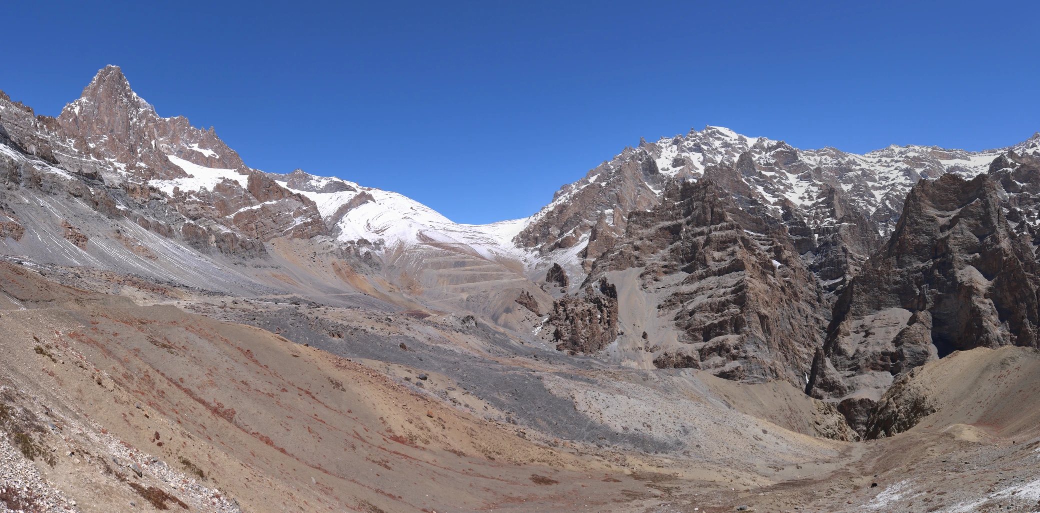
Singe La from the south
The snow-dusted saddle sits at the centre of the frame between rocky slopes. A winding track is visible climbing toward it from below.